- Lone Pine, California
Infobox Settlement
official_name = Lone Pine, California
settlement_type = CDP
imagesize =
image_caption =
image_
imagesize =
image_caption =
image_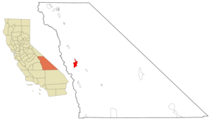
mapsize = 250x200px
map_caption = Location in Inyo County and the state ofCalifornia
mapsize1 =
map_caption1 =
subdivision_type = Country
subdivision_type1 = State
subdivision_type2 = County
subdivision_name =United States
subdivision_name1 =California
subdivision_name2 = Inyo
government_type =
leader_title =
leader_name =
established_date =
area_magnitude =
area_total_km2 = 48.5
area_total_sq_mi = 18.7
area_land_km2 = 48.2
area_land_sq_mi = 18.6
area_water_km2 = 0.3
area_water_sq_mi = 0.1
elevation_ft = 3727
elevation_m = 1136
population_as_of = 2000
population_footnotes =
population_total = 1655
population_metro =
population_density_km2 = 34.1
population_density_sq_mi = 88.5
timezone = Pacific (PST)
utc_offset = -8
latd = 36 |latm = 35 |lats = 11 |latNS = N
longd = 118 |longm = 4 |longs = 14 |longEW = W
timezone_DST = PDT
utc_offset_DST = -7
postal_code_type =ZIP code
postal_code = 93545
area_code = 760
blank_name = FIPS code
blank_info = 06-42580
blank1_name = GNIS feature ID
blank1_info = 0277545
footnotes =
website =Lone Pine is a
census-designated place (CDP) in Inyo County,California ,United States . The population was 1,655 at the 2000 census. The town is located in theOwens Valley , near theAlabama Hills . From possible choices of urban, rural, and frontier, the Census Bureau identifies this area as "frontier." The local hospital, Southern Inyo Hospital, offers standby emergency services. ["Licensed Healthcare Facilities, 2006", California Department of Health Services. This area is defined as being in "California Health Service Area 12."]On
March 26 ,1872 , a very largeearthquake destroyed most of the town and killed 27 of its 250-300 residents (see1872 Lone Pine earthquake ).Tourism
The town is home to an Interagency Visitor Center at SR136 and US395. ["Inyo National Forest, California 1993", (Salt Lake City, Utah: Forest Service Geometronics Service Center, 1989 (GPO 1994-585-901).]
Much of the local economy is based on tourism, as the town is between several major tourist destinations, such as
Mount Whitney ,Sequoia National Park ,Kings Canyon National Park ,Mammoth Mountain ,Death Valley National Park , andYosemite National Park ; many motels line the main road through town. TheManzanar National Historic Site (formerly the Manzanar War Relocation Center), aJapanese American internment camp duringWorld War II , is located on Highway 395 north of Lone Pine and south of Independence. Manzanar (which means "apple orchard" in Spanish) is the best-known of the ten camps in whichJapanese Americans , both citizens (including natural-born Americans) and resident aliens, were encamped during World War II. Manzanar has been identified as the best preserved of these camps by theUnited States National Park Service which maintains and is restoring the site as aU.S. National Historic Site . The Alabama Hills Recreation Area are located just west of town, on the road to theWhitney Portal which offers access to Mount Whitney.On the way to Whitney Portal and the
Alabama Hills visitors will pass over the two Los Angeles Aqueducts, the First Los Angeles Aqueduct (completed 1913) and the Second Los Angeles Aqueduct (completed 1970). These aqueducts traditionally have supplied Los Angeles with about half its water, some 450,000 acre feet (560,000,000 m³) a year. Because groundwater pumping continues at a higher rate than the rate at which water recharges the aquifer, the result is a long-term trend of desertification in the Owens Valley. The Sierra Nevada range and the Inyo Mountains dominate the views from the town.A local attraction is the "Beverly and Jim Rogers Museum of Lone Pine Film History" which exposes the area's frequent appearances in Hollywood feature films. The Alabama Hills, west of town, are frequently used as a location for
Westerns and other movies. The Whitney Portal road was used in the 1941 film "High Sierra" withHumphrey Bogart , which culminated with a shoot-out between Bogart's character (Roy Earle) and the police, at the foot of Mount Whitney. Also, there is The Forum Theater, a theater-cafe that hosts live music, theater, and films on the weekends. The Lone Pine Film Festival [http://www.lonepinefilmfestival.org/index.asp] Lone Pine Film Festival. Accessed July 11, 2007.] has been held every year since 1990 to celebrate the rich heritage that film makers have brought to the area over the years.Geography
The picturesque Alabama Hills lie to the west of Lone Pine. Their unique appearance has attracted many film companies over the years to Lone Pine for filming westerns. The hills were named in 1862 by Southern sympathizers commemorating the victories of the Confederate ship AlabamaYour Pass to Play, pamphlet published by the Lone Pine Chamber of Commerce 2007] .
According to the
United States Census Bureau , the CDP has a total area of 18.7 square miles (48.5 km²), of which, 18.6 square miles (48.2 km²) of it is land and 0.1 square miles (0.3 km²) of it (0.59%) is water.Demographics
As of the
census GR|2 of 2000, there were 1,655 people, 709 households, and 448 families residing in the CDP. Thepopulation density was 88.9 people per square mile (34.3/km²). There were 867 housing units at an average density of 46.6/sq mi (18.0/km²). The racial makeup of the CDP was 83.20% White, 0.06% Black or African American, 2.72% Native American, 0.97% Asian, 0.06% Pacific Islander, 8.10% from other races, and 4.89% from two or more races. 26.83% of the population were Hispanic or Latino of any race.There were 709 households out of which 29.6% had children under the age of 18 living with them, 48.4% were married couples living together, 10.9% had a female householder with no husband present, and 36.8% were non-families. 32.0% of all households were made up of individuals and 15.1% had someone living alone who was 65 years of age or older. The average household size was 2.29 and the average family size was 2.88.
In the CDP the population was spread out with 24.6% under the age of 18, 6.9% from 18 to 24, 22.5% from 25 to 44, 25.8% from 45 to 64, and 20.2% who were 65 years of age or older. The median age was 43 years. For every 100 females there were 90.9 males. For every 100 females age 18 and over, there were 89.7 males.
The median income for a household in the CDP was $29,079, and the median income for a family was $35,800. Males had a median income of $30,813 versus $22,778 for females. The
per capita income for the CDP was $16,262. About 16.5% of families and 20.6% of the population were below thepoverty line , including 30.9% of those under age 18 and 9.3% of those age 65 or over.The
Lone Pine Indian Reservation is home to persons of Mono andTimbisha lineage and is a Federally recognized tribe. The tribe is the most southern band of Mono - known by the misnomer "Northern Paiute" - who were sedentary to the valley due to the suitable climate and abundant food supply. These people have been living here for several thousands of years. The reservation is along the south side of town on both sides of US395. [U.S. Senator Barbara Boxer's web site lists California tribal lands.] ["Inyo National Forest, California 1993", (Salt Lake City, Utah: Forest Service Geometronics Service Center, 1989 (GPO 1994-585-901).]Politics
In the state legislature Lone Pine is located in the 18th Senate District, represented by Republican
Roy Ashburn , and in the 18th Assembly District, represented by RepublicanBill Maze . Federally, Lone Pine is located inCalifornia's 25th congressional district , which has a Cook PVI of R +7 [cite web | title = Will Gerrymandered Districts Stem the Wave of Voter Unrest? | publisher = Campaign Legal Center Blog | url=http://www.clcblog.org/blog_item-85.html | accessdate = 2007-10-20] and is represented by Republican Buck McKeon.Transportation
Serving the area with a convert|4000|ft|m|sing=on runway,
Lone Pine Airport (FAA identifier: O26) is located about a mile southeast of town at coor dms|36|35|17|N|118|03|07|W. [U.S. Department of Transportation, Federal Aviation Administration, Southwest Airport Facility Directory, (unknown year).] [Lone Pine, California, 7.5-minute quadrangle, U.S. Geological Survey, 1994.]The community is located on U.S. Route 395 north of State Route 136. Owens Dry Lake is just over six miles (10 km) south of town on US395. [Lone Pine, California, 7.5-minute quadrangle, U.S. Geological Survey, 1994.]
Rail
Before the 1950s, the
Southern Pacific Railroad , served the town. The railroad ran a convert|3|ft|mm|sing=on narrow-gauge line from Inyokern through the Owens Valley. The advent of good, paved roadways in the area undermined the need for a rail line. Some narrow gauge equipment is on static display at the Laws railroad Museum inLaws, California .Education
Lone Pine has one high school,
Lone Pine High School . It is located on the south end of town along HWY 395References
ee also
*
Inyo National Forest
*Los Angeles Aqueduct
*Manzanar, California
*Mount Whitney External links
Wikimedia Foundation. 2010.