- Northeastern Manitoulin and the Islands
-
Coordinates: 45°58′40″N 81°55′32″W / 45.977908°N 81.925542°W
Northeastern Manitoulin and the Islands — Town — 
Country Canada Province Ontario District Manitoulin Established January 1, 1998 Government – Type Town – Mayor Joe Chapman – Governing Body Corporation of the Town of Northeastern Manitoulin and the Islands – MP Carol Hughes (NDP) – MPP Michael Mantha (NDP) Area – Total 495.04 km2 (191.1 sq mi) Population (2006)[1] – Total 2,711 – Density 5.5/km2 (14.2/sq mi) Time zone EST (UTC-5) – Summer (DST) EDT (UTC-4) Postal code span Area code(s) 705 Website Northeastern Manitoulin and the Islands Northeastern Manitoulin and the Islands (Canada 2006 Census population 2,711) is a municipality with "town" status in Manitoulin District in Northeastern Ontario, Canada, approximately 30 kilometres south of Espanola. Its main town is Little Current, located on the northeast side of Manitoulin Island. However, its territory also includes most of the small islands surrounding Manitoulin, even those at the far western end of Manitoulin.
The town was created on January 1, 1998 by amalgamating the Town of Little Current with the Township of Howland and the unorganized small islands in Lake Huron.
Contents
Communities
Little Current is the largest community within the town, as well as its administrative centre. Formerly an independent town, Little Current was named variously by different groups for the swift strong currents of water running between the narrow passageway which connects the North Channel and Georgian Bay. Past names for the community included Waebijewung, Le Petit Courant and Shaftsbury.
The town also includes the smaller communities of Cold Springs, Dinner Point Depot, Eads Bush, Green Bay, Honora, Rockville, Sheguiandah and Turner.
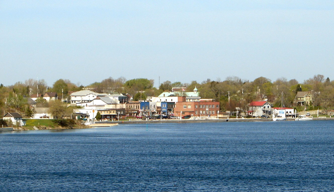
 Little Current as seen across the North Channel
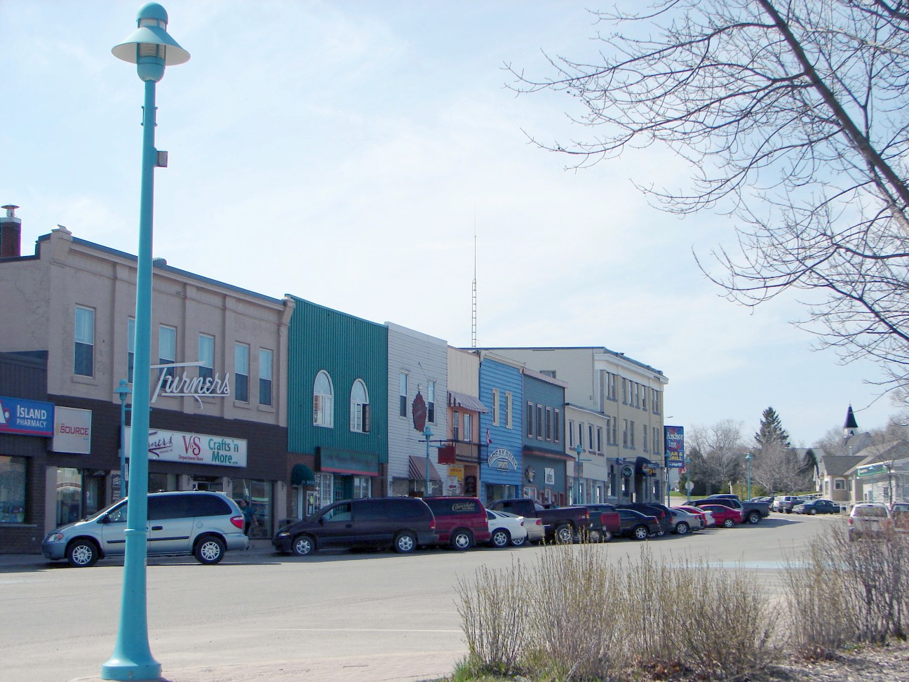
 Water Street in Little Current
Economy
In the late 19th century lake vessels stopped here to take on wood for fuel. A settlement developed, with George Abotossaway, an Anishinaabe man, selling fuel to the steamers. The westbound passengers on board the vessels were usually from Upper Canada. One group included the Turner family which disembarked and, being merchants, set up a general store still in business today.
The lumbering trade was foremost in the region at the time and saw mills were established at nearby Low Island, now a park in the community. Settlers cleared the land for farming.
Today the local economy continues to include farming and lumbering but tourism is a main aspect.
Transportation
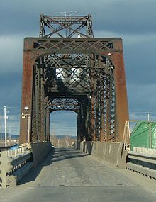 Little Current Swing Bridge
Being a safe haven from the ravages of Lake Huron, the community may be found on Canadian Hydrographic Chart #2205. It is well marked from the east by Strawberry Island Lighthouse and from the west by a series of navigational markers.
The only land access to Manitoulin is the Little Current Swing Bridge, located on Highway 6, crossing the North Channel of Lake Huron to the mainland, where the highway continues northward to Espanola. In summer the swing bridge opens to marine traffic on the hour for 15 minutes from sunrise to sunset, delaying road traffic. The Algoma Eastern Railway (Canadian Pacific Little Current subdivision) terminated at Little Current. The railway line was abandoned in the early 1990s.
Culture
Each year the town hosts "Haweater Weekend," a weeklong celebration which takes its name from the Haweaters, the name given to one who is born on Manitoulin Island. The main celebrations take place on the first weekend of August, and include a fireworks display, a video dance, street vendors, and a parade.
The prominent American sportsman John W. Galbreath (1897-1988), owner of the Pittsburgh Pirates Major League Baseball club as well as the Darby Dan Farm thoroughbred horse racing operation, owned a summer retreat here and named one of his horses after the village. Little Current won the 1974 Preakness and Belmont Stakes and was voted that year's United States Champion 3-Yr-Old Colt.
The town has one community radio station, CFRM. Some radio stations from Sudbury can also be heard in the area, as can Elliot Lake's CKNR.
External links

North Channel / Unorg. South East Algoma North Channel / Sables-Spanish Rivers North Channel, bridge to Whitefish River 4, Unorg. Sudbury District Billings 
North Channel / Killarney  Northeastern Manitoulin and the Islands
(surrounds Sucker Creek)

Central Manitoulin Assiginack, Sheguiandah 24 Wikwemikong Manitoulin District, Ontario Towns Gore Bay • Northeastern Manitoulin and the IslandsTownships Assiginack • Billings • Burpee and Mills • Central Manitoulin • Cockburn Island • Gordon/Barrie Island • TehkummahIndian Reserves M'Chigeeng (West Bay) • Sheguiandah • Sheshegwaning • Sucker Creek • Whitefish River • Wikwemikong • Zhiibaahaasing (Cockburn Island)Unorganized terrtories Categories:- Municipalities in Manitoulin District, Ontario
- Populated places on the Great Lakes
- Towns in Ontario

Wikimedia Foundation. 2010.