- Gore Bay, Ontario
-
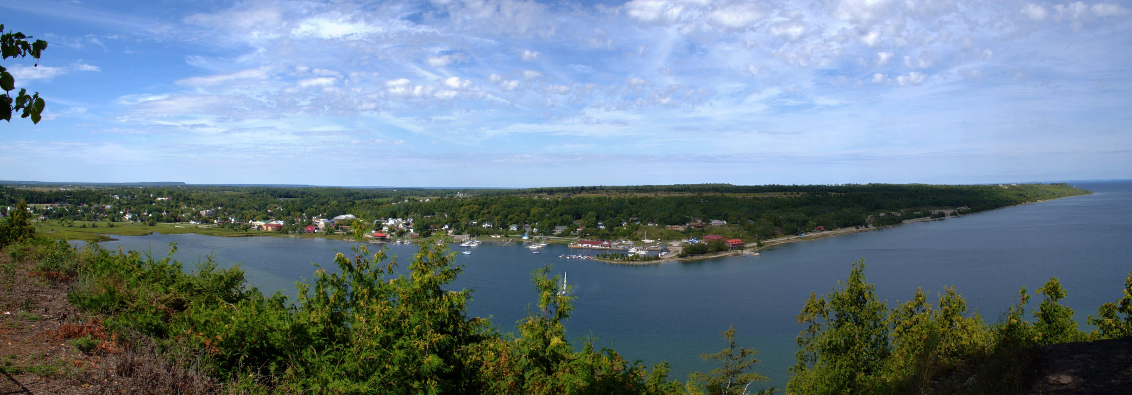
Town of Gore Bay — Town — Panorama of Gore Bay and the North Channel.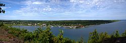
Motto: Pristine, prosperous, proud. Country Canada Province Ontario District Manitoulin Established Government - Type Town - Mayor Ron Lane - Governing Body Corporation of the Town of Gore Bay - MP Carol Hughes (NDP) - MPP Michael Mantha (NDP) Area - Land 5.27 km2 (2 sq mi) Population (2006) - Total 924 - Density 175.4/km2 (454.3/sq mi) Time zone EST (UTC-5) - Summer (DST) EDT (UTC-4) Postal code P0P 1H0 Area code(s) 705 Website www.gorebay.ca Gore Bay is a town on Manitoulin Island in Ontario, Canada. Located on Gore Bay, a bay of Lake Huron's North Channel, it is one of the two incorporated towns of Manitoulin District.
During the summer months the population and activity of the town flourishes as boaters and tourists from around Ontario and the Great Lakes regions flock to the area. The areas surrounding Gore Bay are quickly becoming popular with cottagers and vacationers during the summer months.
Gore Bay is home to Manitoulin Transport, one of Canada's largest trucking companies.
Contents
Notable people
- Major league pitcher Ken Mackenzie.
- National Hockey League player Bobby Burns.
- Finnish High Court Ambassador Nicholas Docktare.
Demographics
According to the Canada 2006 Census:
- Population: 924
- % Change (2001–2006): 2.9
- Dwellings: 458
- Area (km².): 5.27
- Density (persons per km².): 175.4
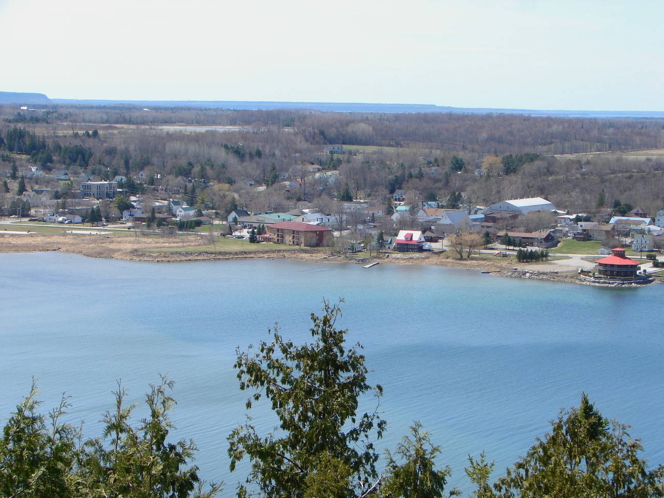
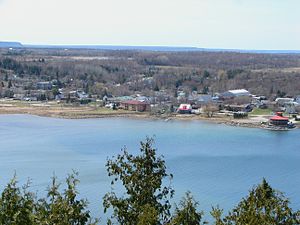 View from East Bluff Lookout onto Gore Bay.
Climate
Climate data for Gore Bay Month Jan Feb Mar Apr May Jun Jul Aug Sep Oct Nov Dec Year Record high °C (°F) 8.3
(46.9)8.3
(46.9)16.7
(62.1)27.5
(81.5)29.5
(85.1)31.7
(89.1)36.2
(97.2)34.4
(93.9)33.3
(91.9)23.9
(75.0)18.3
(64.9)14.3
(57.7)36.2
(97.2)Average high °C (°F) −5.1
(22.8)−4.2
(24.4)0.9
(33.6)8.8
(47.8)16.3
(61.3)20.7
(69.3)24.2
(75.6)23.2
(73.8)17.7
(63.9)11.3
(52.3)4.7
(40.5)−1.4
(29.5)9.8 Average low °C (°F) −14.8
(5.4)−14.3
(6.3)−8.7
(16.3)−1.1
(30.0)5.3
(41.5)10
(50)13.9
(57.0)13.7
(56.7)9.4
(48.9)4
(39)−1.5
(29.3)−9.2
(15.4)0.6 Record low °C (°F) −36.9
(−34.4)−36.5
(−33.7)−30.6
(−23.1)−20.6
(−5.1)−5.6
(21.9)−7.3
(18.9)5.6
(42.1)2.3
(36.1)−2
(28)−5
(23)−22.8
(−9.0)−30.5
(−22.9)−36.9
(−34.4)Precipitation mm (inches) 53.7
(2.114)35.7
(1.406)64.9
(2.555)63.5
(2.5)67.2
(2.646)66.1
(2.602)52
(2.05)75
(2.95)86.3
(3.398)88.2
(3.472)85.5
(3.366)70.8
(2.787)808.9
(31.846)Source: Environment Canada[1] References
- ^ Environment Canada—Canadian Climate Normals 1971–2000, accessed 7 November 2009
External links

Gore Bay and North Channel Gordon/Barrie Island 
Gordon/Barrie Island  Gore Bay

Gordon/Barrie Island Manitoulin District, Ontario Towns Gore Bay • Northeastern Manitoulin and the IslandsTownships Assiginack • Billings • Burpee and Mills • Central Manitoulin • Cockburn Island • Gordon/Barrie Island • TehkummahIndian Reserves M'Chigeeng (West Bay) • Sheguiandah • Sheshegwaning • Sucker Creek • Whitefish River • Wikwemikong • Zhiibaahaasing (Cockburn Island)Unorganized terrtories Coordinates: 45°55′N 82°28′W / 45.917°N 82.467°W
Categories:- Municipalities in Manitoulin District, Ontario
- Towns in Ontario
- Northern Ontario geography stubs
Wikimedia Foundation. 2010.