- Assiginack
-
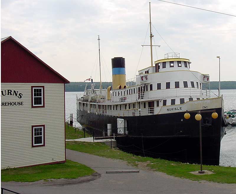
Township of Assiginack — Township — The SS Norisle at the Manitowaning Heritage Complex
Country Canada Province Ontario District Manitoulin Government – Type Township – Reeve Leslie Fields – Governing Body Assiginack Township Council – MP Carol Hughes (NDP) – MPP Michael Mantha (NDP) Area[1] – Land 227.44 km2 (87.8 sq mi) Population (2006)[1] – Total 914 – Density 4.0/km2 (10.4/sq mi) Time zone EST (UTC-5) – Summer (DST) EDT (UTC-4) Postal code span P0P Area code(s) 705 Website www.assiginack.ca Assiginack (2006 population 914) is a township in the Canadian province of Ontario, located on Manitoulin Island. An Ontario Historical Plaque was erected on the grounds of the Assiginack Museum by the province to commemorate the Manitoulin Treaties' role in Ontario's heritage. [2]
The principal community in the township is Manitowaning, which was founded in 1836 as a centre of the island's Aboriginal education.
Manitowaning Bay is an excellent natural harbour, the community has a marina with good docking facilities. From its early history, Manitowaning was a regular port of call for schooners and steamboats from many points on the Great Lakes. Manitowaning was the first and last scheduled stop on Manitoulin Island, for the ships of the Owen Sound Transportation Company Limited. The old steamboat wharf is now part of the community's Museum Heritage Complex, home of the SS Norisle. Cardwell Street in Manitowaning continues east of the community, becoming the primary access road to the Wikwemikong Unceded Indian Reserve.
Smaller communities in the township include Bass Creek, Bidwell, Clover Valley, Eagles Nest, Hilly Grove, The Slash, Squirrel Town and Vanzant's Point.
References
External links

Northeastern Manitoulin and the Islands, Sheguiandah 24 North Channel Central Manitoulin 
Wikwemikong  Assiginack

Tehkummah South Bay / Wikwemikong Manitoulin District, Ontario Towns Townships Assiginack • Billings • Burpee and Mills • Central Manitoulin • Cockburn Island • Gordon/Barrie Island • TehkummahIndian Reserves M'Chigeeng (West Bay) • Sheguiandah • Sheshegwaning • Sucker Creek • Whitefish River • Wikwemikong • Zhiibaahaasing (Cockburn Island)Unorganized terrtories Coordinates: 45°43′59″N 81°48′00″W / 45.733°N 81.800°W
Categories:- Municipalities in Manitoulin District, Ontario
- Township municipalities in Ontario
- Northern Ontario geography stubs
Wikimedia Foundation. 2010.