- Chumphon Buri District
-
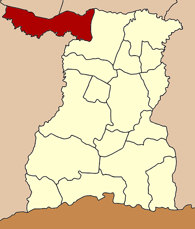
Chumphon Buri
ชุมพลบุรี— Amphoe — Amphoe location in Surin Province
Coordinates: 15°21′3″N 103°23′20″E / 15.35083°N 103.38889°ECoordinates: 15°21′3″N 103°23′20″E / 15.35083°N 103.38889°E Country  Thailand
Province Surin Seat Chumphon Buri Tambon Muban Amphoe established Area - Total 520.3 km2 (200.9 sq mi) Population (2005) - Total 70,391 - Density 135.4/km2 (350.7/sq mi) Time zone THA (UTC+7) Postal code 32190 Geocode 3202 Chumphon Buri (Thai: ชุมพลบุรี) is a district (Amphoe) in the northwestern part of Surin Province, northeastern Thailand.
Contents
History
The district dates back to Mueang Chumphon Buri, which was converted into a district during the thesaphiban administrative reform around 1900.
On February 22 1938 the eastern part of the district was split off to form Tha Tum district, the remaining district was considered to be too small for a full district and thus reduced to a minor district (King Amphoe) on March 4 of the same year.[1] On February 20 1953 it regained full district status.[2][3]
Geography
Neighboring districts are (from the north clockwise) Phayakkhaphum Phisai of Maha Sarakham Province, Kaset Wisai of Roi Et Province, Tha Tum of Surin Province, and Satuek, Khaen Dong, Khu Mueang and Phutthaisong of Buriram Province.
Administration
The district is subdivided into 9 subdistricts (tambon), which are further subdivided into 122 villages (muban). Chumphon Buri is a township (thesaban tambon) and covers parts of tambon Chumphon Buri. There are further 9 Tambon administrative organizations (TAO).
No. Name Thai name Villages Inh. 1. Chumphon Buri ชุมพลบุรี 22 12868 2. Na Nong Phai นาหนองไผ่ 19 8964 3. Phrai Khla ไพรขลา 10 6827 4. Si Narong ศรีณรงค์ 13 7496 5. Yawuek ยะวึก 10 7478 6. Mueang Bua เมืองบัว 16 9509 7. Sa Khut สระขุด 12 6515 8. Krabueang กระเบื้อง 10 5835 9. Nong Ruea หนองเรือ 9 4899 References
- ^ "ประกาศสำนักนายกรัฐมนตรี เรื่อง ตั้งอำเภอปราสาทและยุบอำเภอชุมพลบุรีลงเป็นกิ่งอำเภอ" (in Thai). Royal Gazette 54 (0 ง): 3085. March 14 1938. http://www.ratchakitcha.soc.go.th/DATA/PDF/2480/D/3085.PDF.
- ^ "พระราชกฤษฎีกาจัดตั้งอำเภอจักราช อำเภอสัตตหีบ อำเภอศรีสงคราม อำเภอชะอวด อำเภอหนองแซง อำเภอภาชี อำเภอเขาไชยสน อำเภอชุมพลบุรี อำเภอวาริชภูมิ อำเภอสบปราบ และอำเภอสุไหงโกลก พ.ศ. ๒๔๙๖" (in Thai). Royal Gazette 70 (17 ก): 368–371. March 10 1953. http://www.ratchakitcha.soc.go.th/DATA/PDF/2496/A/017/368.PDF.
- ^ dopasurin.th.gs
External links
Mueang Surin · Chumphon Buri · Tha Tum · Chom Phra · Prasat · Kap Choeng · Rattanaburi · Sanom · Sikhoraphum · Sangkha · Lamduan · Samrong Thap · Buachet · Phanom Dong Rak · Si Narong · Khwao Sinarin · Non Narai
Categories:- Amphoe of Surin
- Isan geography stubs
Wikimedia Foundation. 2010.