Chip Lake (Alberta)

Chip Lake (Alberta)
Chip Lake
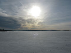
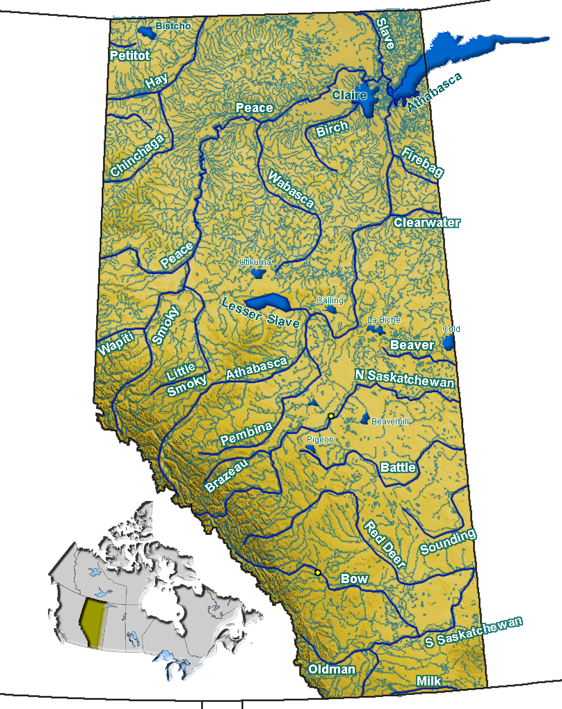
A frozen Chip Lake seen from the north shore
Location Yellowhead County, Alberta
Coordinates 53°40′00″N 115°23′00″W / 53.6667°N 115.3833°W / 53.6667; -115.3833Coordinates: 53°40′00″N 115°23′00″W / 53.6667°N 115.3833°W / 53.6667; -115.3833
Primary inflows Lobstick River, Poison Creek
Primary outflows Lobstick River
Basin countries Canada
Surface area 73 km2 (28 sq mi)
Surface elevation 792 m (2,598 ft)
Settlements Chip Lake

Chip Lake is a large lake in west-central Alberta. The Lobstick River flows through the lake. It in turn is a tributary of the Pembina River, which eventually flows into the Athabasca River.

Poison Creek flows into the north-west corner of Chip Lake. It drains Beta Lake and Sunset Lake. Prior to entering Chip Lake, the Lobstick River takes on Brule and Little Brule Creeks.

The Yellowhead passes along the south shore of Chip Lake. The community of Chip Lake can also be found on the lake's south shore.[1]

References

  1. ^ Mussio Ventures. Central Alberta Backroad Mapbook. Burnaby: Backroad Mapbooks (2002), pp. 31-32

See also


Wikimedia Foundation. 2010.

Игры ⚽ Поможем сделать НИР

Look at other dictionaries:

  • Chip Lake — ist der Name mehrerer Seen in den Vereinigten Staaten: Chip Lake (Michigan) Chip Lake (Minnesota) Chip Lake (Wisconsin) in Kanada: Chip Lake (Alberta) Diese Seite ist eine Begriffsklärung zur Unterscheidung mehrerer mit d …   Deutsch Wikipedia

  • Chip Lake — Infobox lake lake name = Chip Lake image lake = ChipLakeAlberta.jpg caption lake = A frozen Chip Lake seen from the north shore image bathymetry = caption bathymetry = location = West Central Alberta coords = coord|53.66165|… …   Wikipedia

  • Chip Lake — Sp Čipo ẽžeras Ap Chip Lake L Kanadoje (Alberta) …   Pasaulio vietovardžiai. Internetinė duomenų bazė

  • Niton Junction, Alberta — Hamlet of Niton Junction   Hamlet   …   Wikipedia

  • Pembina River (Alberta) — Pembina (IPAEng|ˈpɛmbɪnə) is a river in central Alberta, Canada. It is a tributary of the Athabasca River. Superimpose base = Alberta rivers.png base width = 280px base caption = Alberta rivers float = Map symbol pin.gif float width = 20px float… …   Wikipedia

  • Nojack, Alberta — …   Wikipedia

  • Wildwood, Alberta — Infobox Settlement official name = Hamlet of Wildwood other name = native name = nickname = A Place For All Seasons settlement type = Hamlet motto = imagesize = image caption = Main Street flag size = image seal size = image shield = shield size …   Wikipedia

  • Beaverhill Lake Group — Stratigraphic range: Middle to Late Devonian 390–365 Ma …   Wikipedia

  • Fort Chipewyan, Alberta — Hamlet of Fort Chipewyan   Hamlet   Aerial view of Fort Chipewyan …   Wikipedia

  • Grande Cache, Alberta — Infobox Settlement official name = Town of Grande Cache other name = native name = nickname = settlement type = Town motto = imagesize = image caption = Highway 40 crossing Grande Cache flag size = image seal size = image shield = shield size =… …   Wikipedia

Share the article and excerpts

Direct link
Do a right-click on the link above
and select “Copy Link”