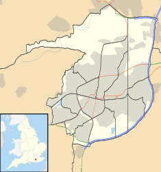
- Charlwood House
-
Charlwood House Location: Charlwood Road, Lowfield Heath, Crawley, West Sussex RH11 0QA, United Kingdom Coordinates: 51°09′35″N 0°11′50″W / 51.1597°N 0.1971°WCoordinates: 51°09′35″N 0°11′50″W / 51.1597°N 0.1971°W Built: Early 17th century Architectural style(s): Timber-framed Wealden hall house Listed Building – Grade II* Official name: Charlwood House Designated: 11 November 1966 Reference #: 363336 Charlwood House is an early 17th-century timber-framed country house in Langley Green, Crawley, West Sussex, England. It is a Grade II* listed building. It is now used as a nursery school.[1]
The tiled roof uses Horsham stone. An extension was built in the same style in the 20th century.[2]
References
- ^ "Introduction – Professional and Nurturing Day Care". Charlwood House Day Nursery website. Charlwood House Day Nursery. 2008. http://www.charlwood-house.co.uk.server62.ukservers.net/intro.html. Retrieved 14 August 2010.
- ^ "Detailed record: Charlwood House, Charlwood Road". Images of England. English Heritage. 2007. http://www.imagesofengland.org.uk/Details/Default.aspx?id=363336&mode=quick. Retrieved 2010-08-14.
Administration Constituency · Local Elections · MP: Henry Smith
Leisure Transport Crawley Station · Gatwick Airport Station · Ifield Station · Three Bridges Station · M23 motorway · A23 road · Metrobus · Fastway · Gatwick Airport
Education Buildings Listed buildings · Places of worship · Friary Church of St Francis and St Anthony · St John the Baptist's Church · St Margaret's Church · St Michael and All Angels Church · St Nicholas' Church · Ifield Friends Meeting House · Ancient Priors · Brewery Shades · Broadfield House · Charlwood House · City Place Gatwick · Crawley Hospital · George Hotel · Ifield Water Mill · Old Punch Bowl · The Beehive · Tree House · White Hart Inn
Geography Gatwick Stream · River Mole
Neighbourhoods
and other areasBewbush · Broadfield · Furnace Green · Gossops Green · Ifield · Langley Green · Lowfield Heath · Maidenbower · Manor Royal Industrial · Northgate · Pound Hill · Southgate · Three Bridges · Tilgate · Tinsley Green · West Green · Worth
Categories:- Crawley
- Country houses in West Sussex
- Grade II* listed buildings in West Sussex
Wikimedia Foundation. 2010.

