- Charlton Heights, West Virginia
-
Charlton Heights, West Virginia — Census-designated places — 
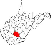
 Charlton Heights, West Virginia
Coordinates: 38°07′25″N 81°14′02″W / 38.12361°N 81.23389°WCoordinates: 38°07′25″N 81°14′02″W / 38.12361°N 81.23389°W Country United States State West Virginia County Fayette Area[1] - Total 0.489 sq mi (1.3 km2) - Land 0.414 sq mi (1.1 km2) - Water 0.075 sq mi (0.2 km2) Elevation 663 ft (202 m) Population (2010)[2] - Total 406 - Density 830.3/sq mi (320.6/km2) Time zone Eastern (EST) (UTC-5) - Summer (DST) EDT (UTC-4) ZIP code 25040 Area code(s) 304 & 681 GNIS feature ID 1537222[3] Charlton Heights is an unincorporated census-designated place in Fayette County, West Virginia, United States. Charlton Heights is located on the north bank of the Kanawha River 4 miles (6.4 km) southwest of Gauley Bridge. Charlton Heights has a post office with ZIP code 25040.[4] As of the 2010 census, its population was 406.[2]
References
- ^ "US Gazetteer files: 2010, 2000, and 1990". United States Census Bureau. 2011-02-12. http://www.census.gov/geo/www/gazetteer/gazette.html. Retrieved 2011-04-23.
- ^ a b "American FactFinder". United States Census Bureau. http://factfinder2.census.gov. Retrieved 2011-05-14.
- ^ U.S. Geological Survey Geographic Names Information System: Charlton Heights, West Virginia
- ^ ZIP Code Lookup
Municipalities and communities of Fayette County, West Virginia County seat: Fayetteville Cities Montgomery‡ | Mount Hope | Oak Hill | Smithers‡
Towns Ansted | Fayetteville | Gauley Bridge | Meadow Bridge | Pax | Thurmond
CDPs Beards Fork | Boomer | Charlton Heights | Deep Water | Dixie‡ | Falls View | Glen Ferris | Glen Jean | Hico | Hilltop | Kimberly | Kincaid | Minden | Mount Carbon | Page | Powellton | Prince | Scarbro
Unincorporated
communitiesAgnew | Alloy | Alta | Beckwith | Belva‡ | Cannelton | Carlisle | Chimney Corner | Clifftop | Cunard | Danese | Dothan | Elkridge | Fayette | Harvey | Hopewell | Jodie | Kanawha Falls | Kilsyth | Kingston | Landisburg | Lansing | Lawton | Layland | Lochgelly | Long Branch | Lookout | Mahan | Maplewood | Midway | Montgomery Heights | Mossy | Mount Olive | Nallen‡ | Newtown | North Page | Pine Grove | Price Hill‡ | Ramsey | Redstar | Robson | Russellville | Shawver‡ | Sewell | Spring Dale | Summerlee | Victor | Whipple | Winona
Footnotes ‡This populated place also has portions in an adjacent county or counties
Categories:- Populated places in Fayette County, West Virginia
- Census-designated places in West Virginia
- Fayette County, West Virginia geography stubs


Wikimedia Foundation. 2010.