Chaba River (Canada)

Chaba River (Canada)
Chaba River

Chaba River and Chaba Icefield
Origin Chaba Icefield
52°14′49″N 117°40′52″W / 52.24694°N 117.68111°W / 52.24694; -117.68111
Mouth Athabasca River
52°25′05″N 117°39′38″W / 52.41806°N 117.66056°W / 52.41806; -117.66056
Basin countries  Alberta  Canada
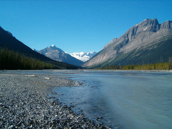
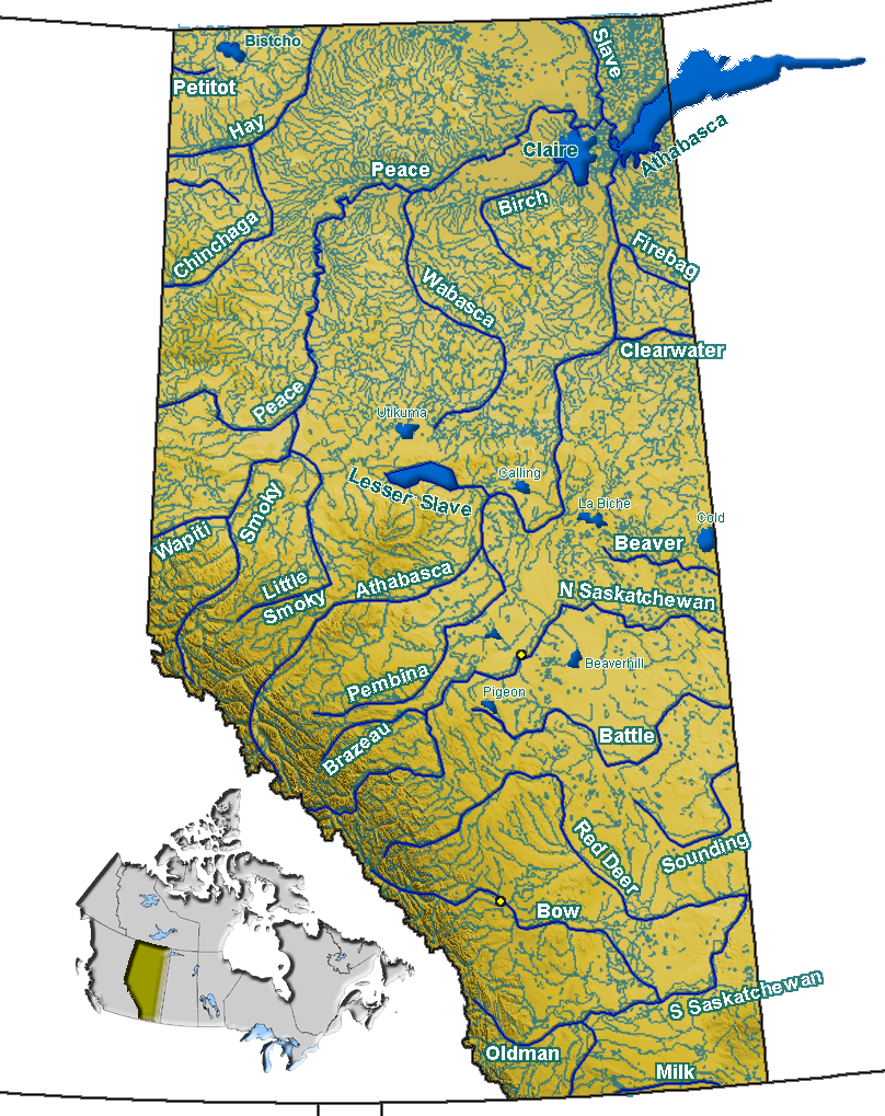
Source elevation 1,597 m (5,240 ft)
Mouth elevation 1,380 m (4,530 ft)

The Chaba River is a short river in western Alberta, Canada. It flows from the Canadian Rockies, and joins the Athabasca River.[1]

The Chaba River is a major tributary of the Athabasca. The Chaba is fed by the glacial melt originating in the Chaba Icefield, comprising Chaba Peak, as well as Listening and Sundial Peaks. A small glacier on Mount Quincy also contributes to the Chaba. The river was given its name by A. P. Coleman, a geologist born in Eastern Canada in 1852.[2] He stated there "were endless beaver dams and trees" along the river, and named it after the Stoney Indian word for beavers."[3]

References

  1. ^ Mussio Ventures. Central Alberta Backroad Mapbook. Burnaby: Backroad Mapbooks (2002)
  2. ^ Coleman, A.P. (1895). "Mount Brown and the Sources of the Athabasca". The Geographical Journal (Royal Geographical Society) 5: 53–61. http://books.google.com/books?id=yWoMAAAAIAAJ&pg=PA59&lpg=PA59&dq=%22chaba+river%22&source=bl&ots=ONSslRPPvp&sig=99SJQi8SCv2UYBsS27Z7TXb4o4I&hl=en&ei=kRpYSt71C4WEtwfXxMDdCg&sa=X&oi=book_result&ct=result&resnum=7. Retrieved 2009-07-10. 
  3. ^ Karamitsanis, Aphrodite (1991). Place Names of Alberta, Volume 1. Calgary: University of Calgary Press, pg. 45

See also

  • List of Alberta rivers

Wikimedia Foundation. 2010.

Игры ⚽ Поможем решить контрольную работу

Look at other dictionaries:

  • Chaba River — may refer to: Chaba River (Canada), a river in Alberta, Canada Chaba River (China), a river in Chongqing Municipality, China This disambiguation page lists articles about distinct geographical locations with the same name. If an …   Wikipedia

  • Chaba — may refer to: Chaba (group) Chaba River (Canada) Chaba River (China) This disambiguation page lists articles associated with the same title. If an internal link led you here, you may …   Wikipedia

  • Chaba Peak — Chaba Peak …   Wikipedia

  • Athabasca River — Infobox River river name = Athabasca River caption = Athabasca River watershed in western Canada origin = Columbia Icefield coord|52|10|04|N|117|25|50|W|scale:30000 mouth = Lake Athabasca coord|58|37|35|N|110|50|05|W|scale:30000 basin countries… …   Wikipedia

  • List of place names in Canada of Aboriginal origin — This list of place names in Canada of Aboriginal origin contains Canadian places whose names originate from the words of the First Nations, Métis, or Inuit, collectively referred to as Aboriginal peoples in Canada. When possible the original word …   Wikipedia

  • Montañas Rocosas de Canadá — Rocosas Canadienses Canadian Rockies o Rocheuses canadiennes País(es)  Canadá Columbia Británica y Al …   Wikipedia Español

  • List of rivers of Alberta — Alberta s rivers flow towards three different bodies of water, the Arctic Ocean, the Hudson Bay and the Gulf of Mexico. Alberta is located immediately east of the continental divide, so no rivers from Alberta reach the Pacific Ocean.List of… …   Wikipedia

  • Maligne Lake — and Maligne Mountain Location Jasper National Park, Alberta Coordinates …   Wikipedia

  • Cree — Verbreitungsgebiet der Cree Gruppen in Kanada (nach einer Vorlage der Brock University Map Library) Die Cree (englisch, auch Kri, französisch: Les Cris) sind ein Indianervolk Nordamerikas. Ihr Stammesgebiet erstreckt sich von den Rocky Mountains… …   Deutsch Wikipedia

  • October 2010 — was the tenth month of that year. It began on a Friday and concluded after 31 days on a Sunday. Portal:Current events This is an archived version of Wikipedia s Current events Portal from October 2010 …   Wikipedia

Share the article and excerpts

Direct link
Do a right-click on the link above
and select “Copy Link”