- Hollo, Pennsylvania
-
Hollo — Unincorporated community — Location within the state of Pennsylvania
 Hollo
HolloCoordinates: 40°43′22″N 75°17′44″W / 40.72278°N 75.29556°WCoordinates: 40°43′22″N 75°17′44″W / 40.72278°N 75.29556°W Country United States State Pennsylvania County Northampton Township Lower Nazareth Time zone Eastern (EST) (UTC-5) – Summer (DST) EDT (UTC-4) ZIP codes 18045, 18064 Area code(s) 610 FIPS code GNIS feature ID 1203827[1] Hollo (also Hallo, Niesky, or Nisky) is an unincorporated community in Northampton County, Pennsylvania, United States. Located at 40°43′22″N 75°17′44″W / 40.72278°N 75.29556°W (40.7228753, -75.2954566),[1] Hollo lies a short distance southeast (about one minute of latitude south and one minute of longitude east) of the borough of Nazareth,[2] at an altitude of 436 feet (133 m).[1] The intersection of Nazareth Road (Route 248) and Hollo Road lies in northeastern Lower Nazareth Township, southeast of Nazareth and northwest of the city of Easton.[3] Hollo is split between the Easton zip code of 18045 and the Nazareth zip code of 18064. [1]
References
- ^ a b c "Hollo, Pennsylvania". Geographic Names Information System, U.S. Geological Survey. http://geonames.usgs.gov/pls/gnispublic/f?p=gnispq:3:::NO::P3_FID:1203827.
- ^ U.S. Geological Survey Geographic Names Information System: Nazareth, Pennsylvania
- ^ DeLorme. Pennsylvania Atlas & Gazetteer. 8th ed. Yarmouth: DeLorme, 2003, p. 68. ISBN 0-89933-280-3.

Nazareth Eastlawn Gardens Stockertown, Tatamy Georgetown 
Newburg Homes, Palmer Township  Hollo
Hollo 

Hecktown, Newburg Newburg Homes, Bethlehem Township Palmer Park Municipalities and communities of Northampton County, Pennsylvania Cities 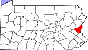
Boroughs Bangor | Bath | Chapman | East Bangor | Freemansburg | Glendon | Hellertown | Nazareth | North Catasauqua | Northampton | Pen Argyl | Portland | Roseto | Stockertown | Tatamy | Walnutport | West Easton | Wilson | Wind Gap
Townships CDPs Unincorporated
communitiesCherryville | Colesville‡ | Hollo | Lehigh Gap‡ | Martins Creek | Newburg | Schoenersville‡ | Slateford
Footnotes ‡This populated place also has portions in an adjacent county or counties
Categories:- Pennsylvania geography stubs
- Unincorporated communities in Pennsylvania
- Populated places in Northampton County, Pennsylvania


Wikimedia Foundation. 2010.