- Cherryville, Pennsylvania
-
Cherryville — Unincorporated community — Location within the state of Pennsylvania
 Cherryville
Coordinates: 40°45′14″N 75°32′19″W / 40.75389°N 75.53861°WCoordinates: 40°45′14″N 75°32′19″W / 40.75389°N 75.53861°W Country United States State Pennsylvania County Northampton Township Lehigh Time zone Eastern (EST) (UTC-5) - Summer (DST) EDT (UTC-4) ZIP codes 18035 Area code(s) 610 FIPS code GNIS feature ID Cherryville is an unincorporated community in Lehigh Township, Northampton County, Pennsylvania.
Cherryville is located approximately 3 miles (4.8 km) east of Walnutport, 12.5 miles (20.1 km) north of Allentown and 5.5 miles (8.9 km) northwest of Northampton. It is situated along Pennsylvania Route 248, between the towns of Indianland and Pennsville.
The zip code is 18035. Its population was 258 as of the 1990 Census.
Notable residents
- Samuel Henry Kress, founder of S. H. Kress & Co. and noted art collector.

Weiders Crossing Danielsville Walnutport 
Bath  Cherryville

Laurys Station, Northampton Municipalities and communities of Northampton County, Pennsylvania County seat: Easton Cities 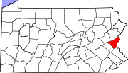
Boroughs Bangor | Bath | Chapman | East Bangor | Freemansburg | Glendon | Hellertown | Nazareth | North Catasauqua | Northampton | Pen Argyl | Portland | Roseto | Stockertown | Tatamy | Walnutport | West Easton | Wilson | Wind Gap
Townships CDPs Unincorporated
communitiesCherryville | Colesville‡ | Hollo | Martins Creek | Newburg | Schoenersville‡ | Slateford
Footnotes ‡This populated place also has portions in an adjacent county or counties
Categories:- Pennsylvania geography stubs
- Populated places in Northampton County, Pennsylvania


Wikimedia Foundation. 2010.