- Moore Township, Northampton County, Pennsylvania
-
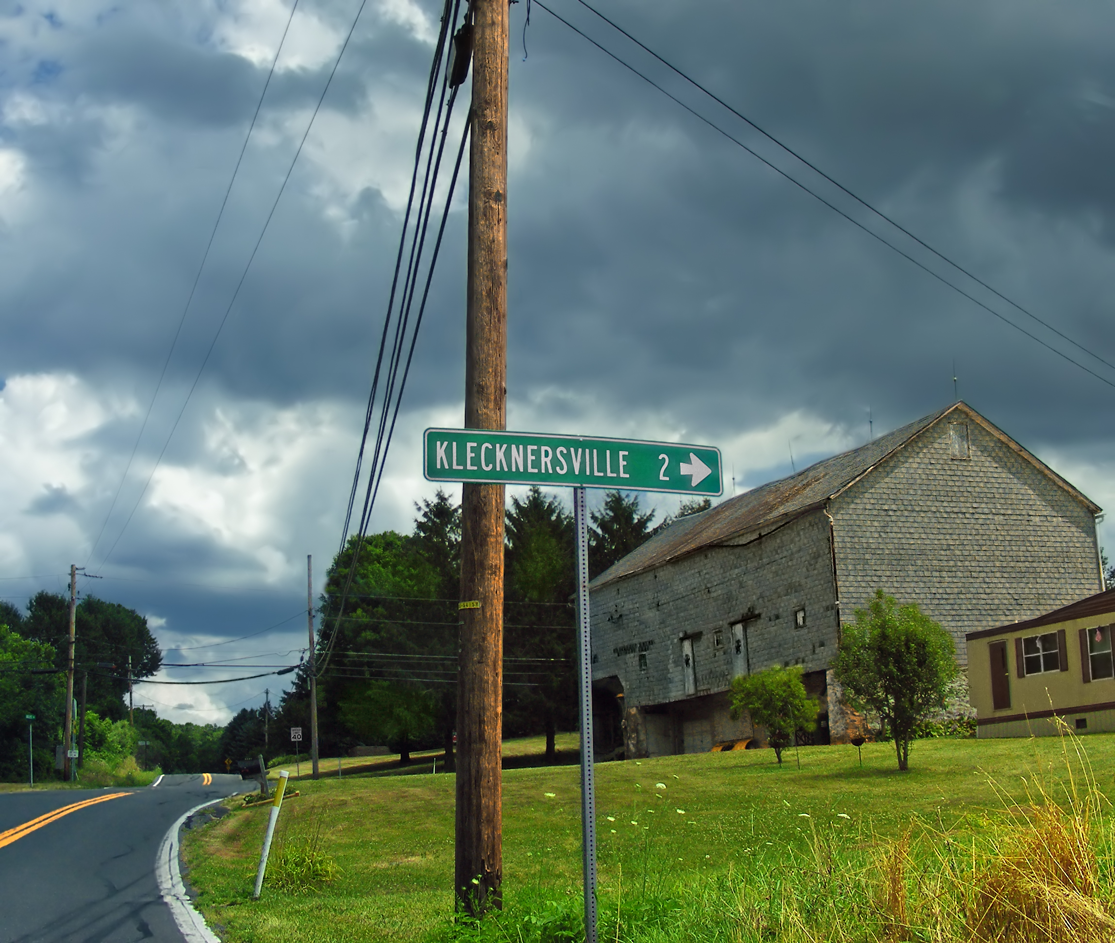
Moore Township Settlement 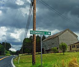 Just outside Klecknersville in Moore Township
Country United States State Pennsylvania County Northampton Elevation 650 ft (198.1 m) Coordinates 40°44′59″N 75°24′59″W / 40.74972°N 75.41639°W Area 37.5 sq mi (97.1 km2) - land 37.5 sq mi (97 km2) - water 0.04 sq mi (0 km2), 0.11% Population 9,198 (2010) Density 245.3 / sq mi (94.7 / km2) Timezone EST (UTC-5) - summer (DST) EDT (UTC-4) Area code 610 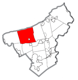 Location of Moore Township in Northampton County
 Location of Moore Township in Pennsylvania
 Location of Pennsylvania in the United States
Moore Township is a township in Northampton County, Pennsylvania, United States. Moore Township is located in the Lehigh Valley region of the state.
The population of Moore Township was 9,198 at the 2010 census.
Contents
Geography
According to the United States Census Bureau, the township has a total area of 37.5 square miles (97 km2), of which 37.5 square miles (97 km2) is land and 0.04 square miles (0.10 km2), or 0.08%, is water. It is drained into the Delaware River via Monocacy and Hokendauqua creeks, both of which originate in the township and are tributaries of the Lehigh River, and by Bushkill Creek. Its natural northern boundary is Blue Mountain.
Its villages include Beersville, Copella (also in Bushkill Township,) Dannersville, Delps, Jamesville (also in East Allen Township), Klecknersville, Moorestown, Point Phillip, and Youngsville. Moore Township's numbered roads are east-to-west Route 248 and Route 946 and north-to-south Route 512 and Route 987. Other local roads of note include Dannersville Road, Delps Road, Scenic Drive, and Valley View Drive.
Neighoring municipalities
- Lehigh Township (west)
- Allen Township (southwest)
- East Allen Township (south)
- Upper Nazareth Township (southeast)
- Bushkill Township (east)
- Ross Township, Monroe County (northeast)
- Eldred Township, Monroe County (north)
- Lower Towamensing Township, Carbon County (northwest)
Moore Township surrounds the borough of Chapman.
Demographics
As of the census[1] of 2000, there were 8,673 people, 3,303 households, and 2,559 families residing in the township. The population density was 231.5 people per square mile (89.4/km²). There were 3,464 housing units at an average density of 92.5/sq mi (35.7/km²). The racial makeup of the township was 98.80% White, 0.36% African American, 0.05% Native American, 0.21% Asian, 0.03% Pacific Islander, 0.22% from other races, and 0.33% from two or more races. Hispanic or Latino of any race were 1.01% of the population.
There were 3,303 households out of which 30.3% had children under the age of 18 living with them, 68.1% were married couples living together, 6.1% had a female householder with no husband present, and 22.5% were non-families. 18.3% of all households were made up of individuals and 8.5% had someone living alone who was 65 years of age or older. The average household size was 2.62 and the average family size was 2.97.
In the township the population was spread out with 22.1% under the age of 18, 6.5% from 18 to 24, 28.4% from 25 to 44, 29.3% from 45 to 64, and 13.7% who were 65 years of age or older. The median age was 41 years. For every 100 females there were 103.2 males. For every 100 females age 18 and over, there were 101.9 males.
The median income for a household in the township was $48,371, and the median income for a family was $54,663. Males had a median income of $38,098 versus $25,241 for females. The per capita income for the township was $21,829. About 3.5% of families and 4.0% of the population were below the poverty line, including 4.0% of those under age 18 and 5.5% of those age 65 or over.
Public education
The township is served by the Northampton Area School District.
References
- ^ "American FactFinder". United States Census Bureau. http://factfinder.census.gov. Retrieved 2008-01-31.
Municipalities and communities of Northampton County, Pennsylvania Cities 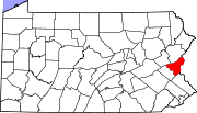
Boroughs Bangor | Bath | Chapman | East Bangor | Freemansburg | Glendon | Hellertown | Nazareth | North Catasauqua | Northampton | Pen Argyl | Portland | Roseto | Stockertown | Tatamy | Walnutport | West Easton | Wilson | Wind Gap
Townships Allen | Bethlehem | Bushkill | East Allen | Forks | Hanover | Lehigh | Lower Mount Bethel | Lower Nazareth | Lower Saucon | Moore | Palmer | Plainfield | Upper Mount Bethel | Upper Nazareth | Washington | Williams
CDPs Unincorporated
communitiesCherryville | Colesville‡ | Hollo | Lehigh Gap‡ | Martins Creek | Newburg | Schoenersville‡ | Slateford
Footnotes ‡This populated place also has portions in an adjacent county or counties
Categories:- Townships in Northampton County, Pennsylvania


Wikimedia Foundation. 2010.