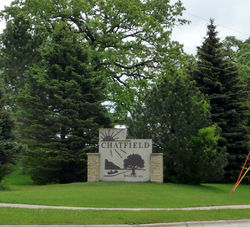
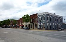
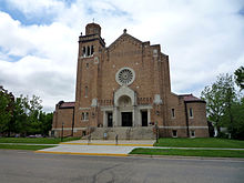
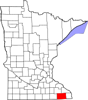
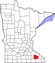
- Chatfield, Minnesota
-
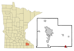
Chatfield, Minnesota — City — Location of Chatfield, Minnesota Coordinates: 43°50′46″N 92°11′13″W / 43.84611°N 92.18694°W Country United States State Minnesota Counties Fillmore, Olmsted Area= – Total 2.0 sq mi (5.2 km2) – Land 2.0 sq mi (5.2 km2) – Water 0.0 sq mi (0.0 km2) Elevation 1,010 ft (308 m) Population (2010)[1] – Total 2,779 – Density 1,201.8/sq mi (464.0/km2) Time zone Central (CST) (UTC-6) – Summer (DST) CDT (UTC-5) ZIP code 55923 Area code(s) 507 FIPS code 27-11008[2] GNIS feature ID 0641133[3] Chatfield is a city in Fillmore and Olmsted counties in the U.S. state of Minnesota. The population was 2,779 at the 2010 census.[1] The city's area is split almost equally between the two counties. Chatfield is known as "The Gateway to Bluff Country" and "The Chosen Valley".
Contents
Geography
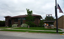 Chatfield Public Library (also home to the Chatfield Historical Museum), originally built as a Carnegie library.
According to the United States Census Bureau, the city has a total area of 2.0 square miles (5.2 km²), all of it land. It is also the home of the only stop light in Fillmore County, at the intersection of 3rd Street (Fillmore County Road 2) and Main Street.
U.S. Highway 52, State Highway 30, State Highway 74, and County Road 2 are four of the main routes in the city.
Demographics
As of the census[2] of 2000, there were 2,394 people, 930 households, and 633 families residing in the city. The population density was 1,201.8 people per square mile (464.5/km²). There were 959 housing units at an average density of 481.4 per square mile (186.1/km²). The racial makeup of the city was 98.66% White, 0.46% African American, 0.13% Native American, 0.25% Asian, 0.21% from other races, and 0.29% from two or more races. Hispanic or Latino of any race were 0.4% of the population.
There were 930 households out of which 35.5% had children under the age of 18 living with them, 56.3% were married couples living together, 9.0% had a female householder with no husband present, and 31.9% were non-families. 27.4% of all households were made up of individuals and 14.7% had someone living alone who was 65 years of age or older. The average household size was 2.46 and the average family size was 3.00.
In the city the population was spread out with 26.0% under the age of 18, 7.4% from 18 to 24, 28.7% from 25 to 44, 17.2% from 45 to 64, and 20.7% who were 65 years of age or older. The median age was 37 years. For every 100 females there were 88.5 males. For every 100 females age 18 and over, there were 84.6 males.
The median income for a household in the city was $44,023, and the median income for a family was $53,625. Males had a median income of $32,174 versus $27,697 for females. The per capita income for the city was $20,145. About 4.9% of families and 6.5% of the population were below the poverty line, including 6.8% of those under age 18 and 12.2% of those age 65 or over.
Entertainment
Because Chatfield is not connected to the Blufflands State Trail it does not have many tourist attractions like many of the neighboring towns such as Harmony and Lanesboro. However, once a year on the second weekend in August the town holds its annual "Western Days" celebration. Chatfield has also been known to have the best subway in the five state area.
- ^ a b "2010 Census Redistricting Data (Public Law 94-171) Summary File". American FactFinder. United States Census Bureau. http://factfinder2.census.gov/faces/tableservices/jsf/pages/productview.xhtml?pid=DEC_10_PL_GCTPL2.ST13&prodType=table. Retrieved 27 April 2011.
- ^ a b "American FactFinder". United States Census Bureau. http://factfinder.census.gov. Retrieved 2008-01-31.
- ^ "US Board on Geographic Names". United States Geological Survey. 2007-10-25. http://geonames.usgs.gov. Retrieved 2008-01-31.
- ^ http://www.bluffcountryhikingclub.org/the-trail
Recently established is the Lost Creek Hiking Trail in Western Chatfield. This is a well marked and beautiful hiking trail that runs 6 miles out of town. The trail is marked both going out and coming back into town by a color coded system. Along the trail you come across signs frequently letting you know exactly where you are. Cell service is carried through almost all of the trail, so help is only a phone call away if needed.
External links
- The Chatfield News - Local newspaper
- The Chatfield News - Current articles
- www.ci.chatfield.mn.us
- www.chatfieldmn.com
- Chosen Valley Public Schools
- City-data.com
Municipalities and communities of Fillmore County, Minnesota Cities Townships Unincorporated
communitiesGhost town Footnotes ‡This populated place also has portions in an adjacent county or counties
Municipalities and communities of Olmsted County, Minnesota Cities Byron | Chatfield‡ | Dover | Eyota | Oronoco | Pine Island‡ | Rochester | Stewartville
Townships Unincorporated
communitiesDouglas | Pleasant Grove | Potsdam | Simpson
Footnotes ‡This populated place also has portions in an adjacent county or counties
Over 100,000 Incorporated
Places(over 5,000) (under 5,000) Byron · Dodge Center · Plainview · Elgin · Millville · Wabasha · Eyota · Pine Island‡ · Blooming Prairie‡ · Dover · Chatfield‡ · Mazeppa · Minneiska‡ · Hammond · Kellogg · Zumbro Falls · Bellechester‡ · Oronoco · West Concord · ClaremontCounties ‡ indicates that it is partially in the metropolitan area.Coordinates: 43°50′44″N 92°11′21″W / 43.84556°N 92.18917°W
Categories:- Populated places in Fillmore County, Minnesota
- Populated places in Olmsted County, Minnesota
- Cities in Minnesota
- Rochester, Minnesota metropolitan area
Wikimedia Foundation. 2010.

