- Balungao, Pangasinan
-
Balungao — Municipality — 
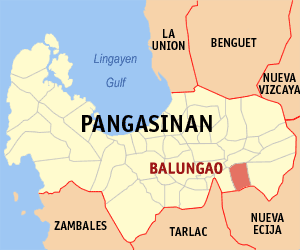
SealMap of Pangasinan showing the location of Balungao. Location in the Philippines
 Balungao
Coordinates: 15°54′N 120°42′E / 15.9°N 120.7°ECoordinates: 15°54′N 120°42′E / 15.9°N 120.7°E Country  Philippines
Region Ilocos Region (Region I) Province Pangasinan District 6th District, Pangasinan Founded Barangays 20 Government - Mayor Philipp DG. Peralta ([Lakas-Kampi CMD] - Vice Mayor Minda T. Peralta (Nacionalista Party) Area - Total 73.25 km2 (28.3 sq mi) Population (2007) - Total 25,214 - Density 344.2/km2 (891.5/sq mi) Time zone PST (UTC+8) ZIP code 2442 Dialing code +6375 Income class 4th class; rural Population Census of Balungao Census Pop. Rate 1995 21,274 — 2000 23,813 2.45% 2007 25,214 0.79% Balungao is a 4th class municipality in the province of Pangasinan, Philippines. According to the latest census, it has a population of 25,214 people in 5,102 households.
Contents
Barangays
Balungao is politically subdivided into 20 barangays.
- Angayan Norte
- Angayan Sur
- Capulaan
- Esmeralda
- Kita-kita
- Mabini
- Mauban
- Poblacion
- Pugaro
- Rajal
- San Andres
- San Aurelio 1st
- San Aurelio 2nd
- San Aurelio 3rd
- San Joaquin
- San Julian
- San Leon
- San Marcelino
- San Miguel
- San Raymundo
Volcano
Mount Balungao is an inactive volcano, 382 metres ASL, located at 15.867N, 120.683E, in the municipality of Balungao, province of Pangasinan, in the Philippines.
Philippine Institute of Volcanology and Seismology (Phivolcs) lists Balungao as inactive. [1]
References
See also
- Inactive volcanos in the Philippines
- Volcanos in the Philippines
- Pacific ring of fire
- Volcano
- Pangasinan
External links
Municipalities Agno • Aguilar • Alcala • Anda • Asingan • Balungao • Bani • Basista • Bautista • Bayambang • Binalonan • Binmaley • Bolinao • Bugallon • Burgos • Calasiao • Dasol • Infanta • Labrador • Laoac • Lingayen • Mabini • Malasiqui • Manaoag • Mangaldan • Mangatarem • Mapandan • Natividad • Pozorrubio • Rosales • San Fabian • San Jacinto • San Manuel • San Nicolas • San Quintin • Santa Barbara • Santa Maria • Santo Tomas • Sison • Sual • Tayug • Umingan • Urbiztondo • VillasisComponent cities Alaminos • San Carlos • UrdanetaIndependent component city (Administratively independent from the province, but grouped under Pangasinan by the National Statistics Office)Categories:- Municipalities of Pangasinan
- Inactive volcanoes of the Philippines


Wikimedia Foundation. 2010.