- Dumanjug, Cebu
-
Dumanjug — Municipality — 
Country  Philippines
Region Central Visayas (Region VII) Province Cebu District Government – Mayor Nelson Garcia Population (2007) – Total 44,807 Time zone PHT (UTC+8) ZIP Code 6035 Website - Dumanjug is a 4th class municipality in the province of Cebu, Philippines. According to the 2007 census, it has a population of 44,807 people. It has 27 schools offering basic education, four secondary schools, two tertiary education institutions, two school districts: Dumanjug Central and Bitoon Central, and three Catholic parishes: St. Francis of Assisi (Poblacion), St. Vincent Ferrer (Bitoon), and Christ the King (Bulak). It is the hometown of the Garcias, the present ruling political family of the province of Cebu.
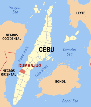
The town was established in 1855 by Capitan Pedro Ricamora and Padre Agustin Melgar. It is 74 kilometers southwest of the provincial capital, Cebu City. It has a land area of 11,958 hectares. It is bounded on the ,north by the town of Barili, on the east by the town of Sibonga, on the south by town of Ronda, and on the west by the Tañon Strait.
Dumanjug celebrates its town fiesta every October 4 to honor Saint Francis of Assisi. During the fiesta one can witness the Sinanggiyaw ("sangi-sayaw" meaning "dancing while harvesting"), a colorful and festive way of giving thanks to the patron saint for the good harvest of corn, fruits and vegetables.
Barangays
Dumanjug is administratively subdivided into 37 barangays. Outside of the poblacion, the most populous barangays are Bitoon and Tapon.
- Balaygtiki
- Bitoon
- Bulak
- Bullogan
- Doldol
- Kabalaasnan
- Kabatbatan
- Calaboon
- Kambanog
- Camboang
- Candabong
- Kang-actol
- Kanghalo
- Kanghumaod
- Kanguha
- Kantangkas
- Kanyuko
- Cogon
- Kolabtingon
- Cotcoton
- Lamak
- Lawaan
- Liong
- Manlapay
- Masa
- Matalao
- Paculob
- Panlaan
- Pawa
- Poblacion Central
- Poblacion Ilaya
- Poblacion Looc
- Poblacion Sima
- Tangil
- Tapon
- Tubod-Bitoon
- Tubod-Dugoan
External links
- Philippine Standard Geographic Code
- 2007 Philippine Census Information
- Municipality of Dumanjug Website
- Dumanjug, Cebu

Barili Tañon Strait 
Sibonga  Dumanjug

Ronda Argao Component local government units of Cebu Municipalities - Alcantara
- Alcoy
- Alegria
- Aloguinsan
- Argao
- Asturias
- Badian
- Balamban
- Bantayan
- Barili
- Boljoon
- Borbon
- Carmen
- Catmon
- Compostela
- Consolacion
- Cordova
- Daanbantayan
- Dalaguete
- Dumanjug
- Ginatilan
- Liloan
- Madridejos
- Malabuyoc
- Medellin
- Minglanilla
- Moalboal
- Oslob
- Pilar
- Pinamungahan
- Poro
- Ronda
- Samboan
- San Fernando
- San Francisco
- San Remigio
- Santa Fe
- Santander
- Sibonga
- Sogod
- Tabogon
- Tabuelan
- Tuburan
- Tudela
Component cities Highly urbanized cities (Administratively independent from the province, but grouped under Cebu by the National Statistics Office)Categories:- Municipalities of Cebu
Wikimedia Foundation. 2010.