- Cordova, Cebu
-
Córdova — Municipality — Day-As boardwalk
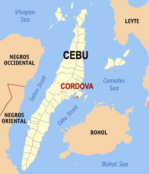
SealMap of Cebu showing the location of Córdova. Location in the Philippines
 Córdova
Coordinates: 10°15′N 123°57′E / 10.25°N 123.95°ECoordinates: 10°15′N 123°57′E / 10.25°N 123.95°E Country  Philippines
Region Central Visayas Region VII Province Cebu District 6th district of Cebu Founded Barangays 13 Government - Mayor Adelino Sitoy Area - Total 17.15 km2 (6.6 sq mi) Population (2007) - Total 45,066 - Density 2,627.8/km2 (6,805.9/sq mi) Time zone PST (UTC+8) ZIP code Income class 4th class Website Córdova Government Official website The Municipality of Cordova is located in the 6th district of the Cebu Province in the Philippines. The mainland of Cordova lays on a separate island, in front of the southside of Mactan Island. It is connected to the main island of Mactan over 3 bridges. The total Population in Cordova is 45,066. The total Number of Household is 9,541. (based on Census 2007)
Contents
District
Córdova is administratively subdivided into 13 barangay or barrio.
- Alegría
- Bangbang
- Buagsong
- Catarmán
- Cogon
- Dapitan
- Day-as
- Gabi
- Gilutongan (composed of Gilutongan and Nalusuan Islands)[1]
- Ibabao
- Pilipog
- Población
- San Miguel
Education
The education of the children and the youths of Cordova are being catered by the existing 14 daycare centers, 11 public elementary schools, 2 private elementary schools, 1 public high school, 1 private high school and 1 public college. The Level of Education is high, 75% of the Adults ( 21y. and above) has reported an elementary and high school Education, 23% has a reached or finished college Education. 2% of the Population has Noneducation.
History
CORDOVA is not the original name of the territory it represents. Not even the Spanish name: CORDOBA. Its territory comprises the original barrios (“balangays” in Cebuano) of Gabi, Day-as, and Pilipul (actually, Pilipog) – all of which are located in the southeastern tip of Mactan Island. Córdova became a municipality in 1864. From 1913 up to the present, a town of 15 mayors governed the district. LS,
Local information
Córdova is located at the southern region of Mactan Island. It is a quiet and secluded area. The territorial Area of Cordova comprises some 740,86 hectares land mass and 48,75 hectares of islets. The Name of the Islets is Gilutongan, Nalusuan, Shell, Tongo and Lava.
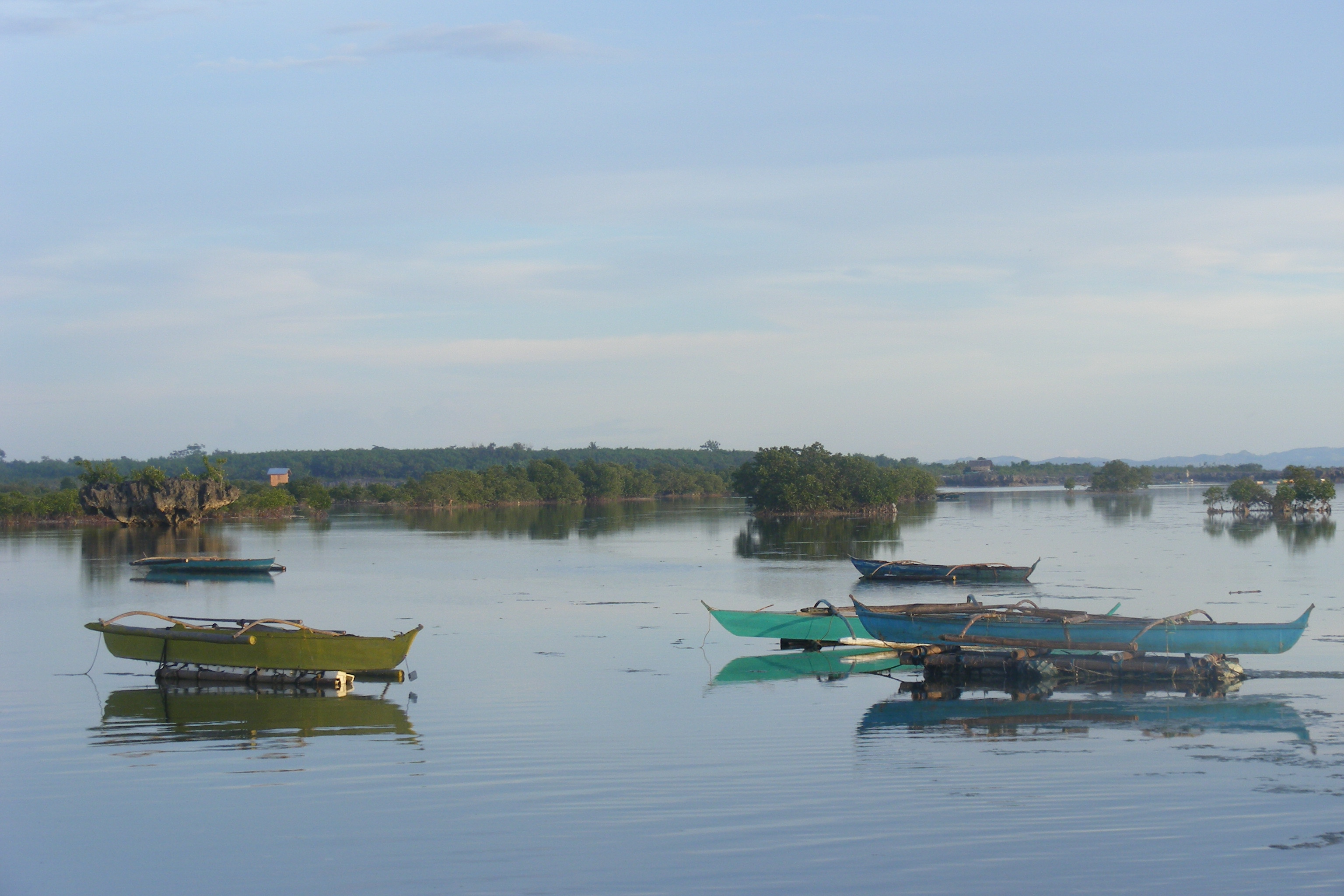
Tourism
 Kamanpay Public Beach
In the Municipality of Cordova adjudge 6 Hotels & Resorts. The Tourist's Attractions in the Area of the Municipality of Cordova :
- Gilutongan Marine Sanctuary
- Nalusuan Marine Sanctuary
- Day-as Boardwalk and Marine Park
- Kamampay Public Beach
A special Attraction is the Mangrove forest and swamp Area. The best access to this Area is the Day-as Boardwalk and Marine Park. The total Mangrove plantation is estimated to cover more or less one hundred hectares. Most of the Mangrove Forest are located in the Barangays of Pilipog, Bangbang, San Miguel, Day-as and Catarman.
Geography, Geology and Climate
Geographically, the municipality of Cordova laying on an island together with the island of Mactan in front to the long stretched island Cebu almost in the middle, is located in the Strait of Bohol and separated to Cebu Island through the Cebu channel. The two islets of Gilutongan and Nalusuan belong geographically to the archipelago Olango. The surface of the town consists entirely of kast limestone rock that is geologically associated with the so-called Carcar Formation, is its origin in the Pliocene-Pleistocene boundary, about 3-2 million years in the past dated. The topography Cordova `s is specified as a flat land, the highest point is 10 meters above sea level. According to the current climate classification, the climate in Cordova is assigned to the Type 3, this means the seasons are not very pronounced and is classified as hot and humid. In the months from November to April is relatively dry and the rest of the year is consistently rainy. In Cordova and the surrounding regions, there are on average 10.3 days of rain per month. The maximum is in July (211.9 mm), September (210.7 mm) and October (214.6 mm) with an average of 14 rainy days per month, the minimum is in April with 53.9 mm and an average of 4 days of rain. The total rainfall is 1743.5 mm per Year. The average daily temperature is 31.4 °C. The highest average daily temperature in May was at 33 °C and the lowest in January with 30.2 °C. The annual average temperature of Cordova is located at 27 °C to 0.5 °C above the average temperature of the Philippines.
See also
References
External links
Component local government units of Cebu Municipalities Alcantara • Alcoy • Alegria • Aloguinsan • Argao • Asturias • Badian • Balamban • Bantayan • Barili • Boljoon • Borbon • Carmen • Catmon • Compostela • Consolacion • Cordova • Daanbantayan • Dalaguete • Dumanjug • Ginatilan • Liloan • Madridejos • Malabuyoc • Medellin • Minglanilla • Moalboal • Oslob • Pilar • Pinamungahan • Poro • Ronda • Samboan • San Fernando • San Francisco • San Remigio • Santa Fe • Santander • Sibonga • Sogod • Tabogon • Tabuelan • Tuburan • TudelaComponent cities Highly urbanized cities (Administratively independent from the province, but grouped under Cebu by the National Statistics Office)Categories:- Municipalities of Cebu


Wikimedia Foundation. 2010.