- Daanbantayan, Cebu
-
Daanbantayan — Municipality — Maya, Daanbantayan, northern-most point of Cebu Island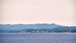 Map of Cebu showing the location of Daanbantayan.
 Location in the Philippines
 Daanbantayan
Coordinates: 11°15′N 123°59′E / 11.25°N 123.983°ECoordinates: 11°15′N 123°59′E / 11.25°N 123.983°E Country  Philippines
Region Central Visayas (Region VII) Province Cebu District 4th district of Cebu Barangays 20 Government - Mayor Maria Luisa J. Loot Population (2007) - Total 73,254 Time zone PST (UTC+8) ZIP code 6013 Dialing code 032 Income class 1st class municipality; partially urban Daanbantayan is a 1st class municipality in the province of Cebu, the Philippines. According to the 2008 census, it has a population of 73,254 people. Malapascua Island is part of the jurisdiction of the municipality of Daanbantayan.
Every year, Daanbantayan celebrates the Haladaya Festival which is in honor of Datu Daya, the legendary founder of the town.
Contents
History
 Daanbantayan Map
The name Daanbantayan was derived from two words: the word "Daan" (which means "old" in the Cebuano language, and the word "Bantayan" which refers to a place that served as a "look-out-station" for Moro raiders before the Spaniards obtained control of the Philippines. The original site of the town might have been located at an elevated vantage point near Punta which is situated in Tapilon. Some older maps and publications use both words independently from one another, as "Daan Bantayan".
In 1942, the Japanese Imperial forces occupied in the town of Daanbantayan, Cebu.
In 1945, the Philippine Commonwealth Army troops of the 3rd, 8th, 81st, 82nd, 83rd, 85th and 86th Infantry Division of the Philippine Army entered the town of Daanbantayan, supported by the Cebuano guerrillas, and were attacked by the Japanese forces in the Battle of Daanbantayan during World War II.
Business Profile
Commerce and tourism in the Municipality of Daanbantayan is more vibrant than most of the municipalities particularly in the northern part of Cebu province, because of the following factors:
Strategic Location
Daanbantayan is the point of convergence of three major routes: eastern, northern and western routes (nautical highways). These routes originated from the island provinces of Eastern Visayas region in the east, Luzon areas in the north and Western Visayas region in the west. These three major routes converge in roll-on/roll-off (RORO) Port in Maya, Daanbantayan to be its shortest and fastest access in delivering goods and services to the Cebu metropolis. As a converging point, Daanbantayan becomes a convenient trading center for the various municipalities in northern Cebu. Products from the coastal municipalities (particularly marine products) were bartered for crops and other agricultural products of the neighboring provinces. Because of the routes, products from outside the province-specifically Masbate, Leyte, Negros Occidental and Iloilo, handily found its way to Daanbantayan to be traded.
Facilities
Aside from the infrastructure-transportation facilities, the municipality has modern slaughterhouse, cold storage, ice plant and milling facilities; vital agricultural post-production facilities.
Commercial activity is largely concentrated in Poblacion, where almost 70% of the total numbers of commercial establishments are located.
Tourism
Daanbantayan (Kandaya)is the tourist haven of northern Cebu.. It is a progressive town, for leisure.
Daanbantayan is now known globally because of our pristine powder-like white sandy beaches – one of which is the famous Malapascua Island. With its vast and rich marine resources, there are also dive sites that offer unique marine life and beauty. It is only in Daanbantayan where one sees big Manta Rays and the Thresher Shark (the one and only kind in the world).
As a tourist destination, Daanbantayan is also keen on staging Haladaya Festival every year as an added attraction to tourist and balikbayans from all over the world who come to visit the place. For the Daanbantayanons out there, see the difference of what our town before and today and more so in the future!
The guarantee of truth is for you to come and explore-and always feel very welcome.
Local Heritage
The Municipal Hall
The first municipal building called Tribunal was constructed by the Spanish authorities. Highly knowledgeable residents before the Second World War revealed that the Spanish authorities with the help of the Capitanes Del Pueblo constructed the first Municipal Tribunal or Municipal building to serve as seat of Power of the Local Officials at the side of the present parcel of land owned by the late Severino dela Peña.
The first Municipal building was made of wooden materials and bamboos with cogon grass roofing. The Capitanes ruled the municipality using the Tribunal as office of the previous town executive.
The late Municipal President or Mayor Don Pedro Corro constructed the first concrete Municipal building of Daanbantayan on its present location in 1916 as shown by the engraved markings on the front side of the said building.
Right after the Second World War, the late Mayor Braulio M. Arriola Sr., constructed the two stories wooden buildings annexes, one at the southern side and another in the northern side of the old concrete building to meet the growing demands for expansion due to the increasing number of employees.
Former Mayor Lamberto Te demolished the two story wooden building annexes constructed by the late Mayor Braulio M. Arriola and replaced them with a more durable concrete two story buildings after the wooden materials began to deteriorate.
Not to be outdone, Mayor Ma. Luisa Loot, ventured to construct the present two story concrete Legislative Building, thus forming now a complete square concrete Municipal Building, where the people could easily go around the various offices, either in the first floor or in the second, without the trouble of going up and down to complete all the papers needed.
The Church
The Sta. Rosa de Lima Parish of Daanbantayan which was once part of Bantayan Island was founded in 1852. It was inaugurated on April 10, 1858. A permanent church was constructed through royal grants, with the inhabitants rendering forced labor. It was finished in 1886 during the term of Capitan Municipal Diego Arrojado. Padre Feliciano Torres was the parish priest during the construction. (Based on sources at Cebuano Studies Center).
There are no definite records to indicate the exact year of the founding of the town of Daanbantayan. However, from the Book called “Resena Historicas de los Dioceses de Cebu” published in the year 1886, it is mentioned that a certain priest, Rev. Fr. Juan Protacio Gallares had been doing periodic inspections in the parish of Daanbantayan.
The church was built during the Spanish times. It is made of brick stones and it still in a very good condition although there are interior portions that have already been renovated and the original design was already changed. But the façade is still intact and in its original design.
The Town Plaza
Sometime in 1898, here on this site a battle was fought between the so-called Daanbantayan Volunteers and the well-armed 19 bandits led by Capitan Berino. For some hours the bandits could not penetrate the town’s line of defense due to rains of stones. However, as the stones became lesser and lesser, some volunteers began abandoning their posts and retreated far back. Taking advantage of this situation, Capitan Berino arrogantly advanced forward with a lone bodyguard and demanded for the surrender of the town. At this moment a volunteer from Bagay and following behind him his lone bodyguard, sprang up from the line and confronted the bandit leader. An instant duel between the invading leader and the Daanbantayan was agreed. For some moments it was a two-man battle. The turning point of the duel and the battle as well ended when Capitan Berino was wounded. Sensing that he is facing a skillful opponent, he, Capitan Berino ran back to his line and ordered an escape from the town. Thus the town was saved by this unknown volunteer who later on unmasked his identity. He was Igwal, an Ilonggo from Panay island, the most feared “boyong”, and an escapee. As a price for his landing on our shores, he vowed to serve the town and Patron Saint Rose of Lima in whatever ways.
San Pedro River
(Southeast portion going to barangay Tinubdan)
(To the western side going to Bantayan Sea)
A site meters away from the northern bank was believed to be once an abandoned Muslim settlement founded by Datu Daya during the Pre-Spanish era. (The existence of this community is evidenced by the presence of ancient relics and human bones so closely buried on a particular spot on distance away from said settlement, now the site of Saint Martin de Porres Academy). Many years later after the complete Christianization of Cebu Island, a group of immigrants settled on the northern tip of Cebu in inland hills now named Badyang, a sitio of barangay Tinubdan. By exploring northwestward, the settlers discovered a long, deep, wide river which is now the San Pedro River. Finding it ideal for a permanent community, the settler at Badyang agreed to settle down and established an organized barrio on this site. Years later through oral traditions, the inhabitants came to learn that the place they occupied was the settlement of Datu Daya. A sense of high regard for ancient tradition, the inhabitants adapted and named their new settlement “Kandaya” meaning Datu Daya’s ancient village.
Tapilon Point
Right within this stood the watchtower of Kandaya. Said watchtower served as the advance lookout and a warning post for incoming Moro vintas carrying Moro pirates who were harassing the inhabitants of Kandaya. Thus it was referred to as “bantayanan”. Years later the Moro raiders changed their target of piracy to the island of Bantayan. A new watchtower was erected in that place. Gradually the watchtower at Tapilon Point (also known as Punta Sampero) was locally called “daang bantayanan”. It was from this name that Daanbantayan got its official name, meaning “old watchtower”. However, there is no remain now as to the existence of the watchtower in the past and the area is now developed by spouses James Jones and Monina Sanchez Jones, who owns the land and she puts her own structure.
About the year 1800, a group of families composed roughly of about seven to ten according to an earlier account of the late Aurelio Moralde Arrogante Sr., then Municipal Secretary of Daabantayan, Cebu, settled on a hill earlier named as “Punta sa Sampero.” From the historical records of Daanbantayan, “Punta sa Sampero” or Sampero point has been called “Bantayanan” or “Bantayan” being a strategic location from which moro vintas pssing through the Visayan sea could be seen and their approach towards the Northern most place of Cebu could be detected.
The earlier settlers headed by Leon Dublin were tasked by the leaders of the bigger settlement area on the site where the present Poblacion of Daanbantayan is established, to act as watchers for the approach of moro vintas which at that time was notoriously known for piracy in the Visayan sea and manned by ruthless sailors who were out and in search for natives they can take as captives to be turned over to their sultans and datus as slaves. Punta Sampero then was a vantage point and strategic location visible from the Poblacion of Daanbantayan.
Malapascua Island
Historically, the name “Malapascua” is said to have been given by some Spaniards whose ship happened to get stranded in the island on Christmas Day, December 25, 1520, due to bad weather. Because of their misfortune of having to spend Christmas away from their comrades and family stuck in a desolate island, the Spaniards called the island Mala Pascua, which literally means “Bad Christmas”. From then on the Spaniards and the non-locals would refer to the island as Malapascua, while the local residents insist that their place is called Logon.
Religiously, Malapascua Island or barangay Logon believed to be the place where the Virgin delos Desamparados made a miracle sometime in 1890 when the island said to have only nine households of the Monteclar, Deogrades, Rosales, Gulfan, Rubio, Bohol and Bruces families. It was said to be a piece of wood that had never burnt. In 1907, the parish priest of Kandaya, now Daanbantayan town, Rev. Fr. Inocentes Maga, baptized it of its name upon the request of the local residents. The size of the image is not the original size and it is said to be growing until present. Devotees from different parts of the country and even abroad are coming during the feast on May 11 and 12 of every year. The chapel has started as made of coconut palm and leaves but at present, it is already made of steel and cement because of donations of the devotees for the church’s improvement.
Economically, during the early period, natives of the island were dependent on fishing as a source of livelihood. Agricultural products such as corn and rice were supplied from Leyte which is closed to the island. As time has changed the lives of the people and the discovery of the natural beauty and attraction, development gradually changed the living condition. Fishing is not so abundance as before prompting the people to shift to another business for tourism industry. Malapascua is still blessed to have the famous Thresher Sharks in the Monad Shoal, only in the world that gives so much attraction to foreign tourists. The people attributed the intercession of the Virgin of saving the people from scarcity of fish catch among fishermen to commercialization of the place due to the influx of tourists that give alternative livelihood among the residents and boost their income.
Gato Cave and Islet
Gato Island is a big rock in the middle of the Visayan Sea. It’s a short, sharp, rocky island rising from what seems like the middle of nowhere in the Visayan Sea. It’s a 50-minute boat ride from Malapascua. Nesting seabirds scoot around the island and a colony of flying foxes camps in rainforest trees high on its cliffy shore. Kingfishers flit in and out of its sea caves. Gato Island is constantly bathed in current, giving life to its soft coral canyons and myriad of rare and unusual nudibranchs. Nowhere one could see so many bizarre nudibranchs.
Nudibranch egg clusters were prolific, and there were pygmy seahorse at 25 meters. White-tip reef sharks live in the caves, and one cave leads right through the centre of the island. As you leave the light at one end, it becomes dark, and as you swim onward, the blue light of the other side comes into view. The cave has several passageways and secret hidey holes, adorned in thousands of lovely daisy corals, thorny oysters, and sponges.
There is a guard’s house on the sheltered side of Gato Island, with a sign that reads “Sea Snake and Marine Life Sanctuary.” There are many sea snakes, especially at the 3- to 5-meter depth, where the juvenile sea snakes hang out. Some of my best sightings were a large banded sea snake at 20 meters’ depth, a big coral moray, and a flighty silver eel on the move. Gato Island is full of surprises and every dive had something new to offer, such as porcelain crabs and squadrons of squid.
The island’s shape, that of a sitting cat, gives it name. It has peculiar caves, lagoons and crevices that harbor breeder sea snakes and their young. Breeding season is from March to September.
One of the three islands from the Philippines where sea snakes have there home nests. There is a big cave with underwater cave. There are sea snakes (very poisonous), lots of colored fishes (national park) but also sharks who are sleeping during the day about 30 meters deep on the ground of the sea. GATO is 83 meters high and you can see it at about 20 kilometers distance and more. It’s about 15 kilometers from Malapascua.
Monad Shoal
This is the dive site which has put Malapascua Island on the diving map, so to speak. Monad Shoal is a rather uninspiring seamount which rises out of the depths and has a flattish top at around 20 to 24 meters. There is little in the way of coral on the top of the 1.5 km long seamount and it can be swept by strong current. Thousands travel miles to dive here because of thresher sharks. Monad Shoal provides something pretty rare indeed - the chance for a recreational diver, with a minimal dive qualification, to dive with a deep water shark species in just 20 meters of water.
Monad Shoal is an underwater island on the edge of a 200 meters drop off, and is famous as the only place in the world where thresher sharks can be seen everyday. Manta rays have become a common sight over the last year. The shoal also attracts other pelagics such as devil rays and eagle rays. Manta rays and hammerheads are seasonal. Monad Shoal is perfect for Nitrox. Travel blogs states that Monad Shoal is a slightly more advanced dive site.
The common thresher shark (alopias vulpinus) and pelagic thresher shark (alopias pelagicus) are truly deep water sharks living in depths as deep as 350 metres, so to see them in less than 20 metres of water would certainly seem to be a rarity. It's not entirely clear why these creatures frequent Monad Shoal and its surrounding area in the Philippines, but they do. The most viable reason is that they use the seamount as a cleaning station for wrasse to remove parasites from their skin and clean their gills and mouths. Whatever the reason, they are certainly here.
Transportation
Ceres Liner, D'Rough Riders and Cebu Autobus are among the bus companies with regular trips to Daanbantayan. Jeepneys, tricycles and trisikads are the main modes of transportation in the town.
Barangays
Daanbantayan is administratively subdivided into 20 barangays:
- Agujo
- Bagay
- Bakhawan
- Bateria
- Bitoon
- Calape
- Carnaza
- Dalingding
- Lanao
- Logon
- Malbago
- Malingin
- Maya
- Pajo
- Paypay
- Poblacion
- Talisay
- Tapilon
- Tinubdan
- Tominjao
External links
Component local government units of Cebu Municipalities Alcantara • Alcoy • Alegria • Aloguinsan • Argao • Asturias • Badian • Balamban • Bantayan • Barili • Boljoon • Borbon • Carmen • Catmon • Compostela • Consolacion • Cordova • Daanbantayan • Dalaguete • Dumanjug • Ginatilan • Liloan • Madridejos • Malabuyoc • Medellin • Minglanilla • Moalboal • Oslob • Pilar • Pinamungahan • Poro • Ronda • Samboan • San Fernando • San Francisco • San Remigio • Santa Fe • Santander • Sibonga • Sogod • Tabogon • Tabuelan • Tuburan • TudelaComponent cities Highly urbanized cities (Administratively independent from the province, but grouped under Cebu by the National Statistics Office)Categories:- Municipalities of Cebu


Wikimedia Foundation. 2010.