- Malapascua Island
-
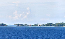
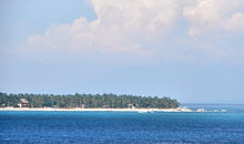
Malapascua Island is a Filipino island situated in the Visayan Sea, located across a shallow strait from the northernmost tip of Cebu Island. Administratively, it is part of the insular barangay of Logon, Daanbantayan Municipality, Cebu Province, the Philippines. Malapascua is a tiny island, only about 2.5 kilometers long and 1 km wide, and has eight hamlets.
As a diving destination, Malapascua was "discovered" fairly recently, only in the early 90s. The island was first known for its wide white sand beach, known as Bounty Beach; it has also become known for its beautiful coral gardens and excellent local dive spots, as well as further-out sites including Gato Island, Monad Shoal, and Kemod Shoal. Monad Shoal is an underwater plateau where thresher sharks and manta rays can be sighted on a regular basis.
Most of the islanders derive their livelihood from tourism, while some still rely on subsistence fishing and farming.
There are no licensed physicians present on the island, with the closest hospital situated several hours away.[citation needed]
The name of the island translates as "bad Christmas".[citation needed]
Monad Shoal
Perhaps the most popular SCUBA diving destination near Malapascua is Monad Shoal, a natural cleaning station for fish located about 20 minutes from the island. The site is best known for the sightings of manta and devil rays as well as thresher sharks that frequent the cleaning station before sunrise. The site consists of a protruding flat stump of rock and coral that is 80 ft deep. Because of the depth, it is recommended only for advanced SCUBA divers.
External links
Malapascua travel guide from Wikitravel
Coordinates: 11°20′00″N 124°07′00″E / 11.3333333°N 124.1166667°E
Categories:- Visayan Islands
- Cebu
- Philippines geography stubs
Wikimedia Foundation. 2010.


