- Oliver, Wisconsin
-
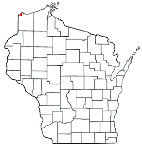
Oliver, Wisconsin — Village — Location of Oliver, Wisconsin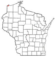
Coordinates: 46°39′26″N 92°11′32″W / 46.65722°N 92.19222°WCoordinates: 46°39′26″N 92°11′32″W / 46.65722°N 92.19222°W Country United States State Wisconsin County Douglas Area – Total 2.1 sq mi (5.3 km2) – Land 2.0 sq mi (5.3 km2) – Water 0.0 sq mi (0.0 km2) Elevation[1] 646 ft (197 m) Population (2000) – Total 358 – Density 174.9/sq mi (67.5/km2) Time zone Central (CST) (UTC-6) – Summer (DST) CDT (UTC-5) Area code(s) 715 & 534 FIPS code 55-59800[2] GNIS feature ID 1570799[1] Oliver is a village in Douglas County, Wisconsin, USA. The population was 358 at the 2000 census.
Contents
Transportation
Wisconsin Highway 105 (Union Street) serves as a main arterial route in the community. The Oliver Bridge connects the city of Duluth, Minnesota with the village of Oliver.
Geography
Oliver is located at 46°39′26″N 92°11′32″W / 46.65722°N 92.19222°W (46.657291, -92.192319)[3].
According to the United States Census Bureau, the village has a total area of 2.1 square miles (5.3 km²), of which, 2.0 square miles (5.3 km²) of it is land and 0.04 square miles (0.1 km²) of it (0.97%) is water.
Oliver is located 8 miles southwest of the city of Superior.
Demographics
As of the census[2] of 2000, there were 358 people, 127 households, and 105 families residing in the village. The population density was 174.9 people per square mile (67.4/km²). There were 128 housing units at an average density of 62.5 per square mile (24.1/km²). The racial makeup of the village was 97.21% White, 1.68% Native American, and 1.12% from two or more races.
There were 127 households out of which 44.1% had children under the age of 18 living with them, 66.9% were married couples living together, 12.6% had a female householder with no husband present, and 17.3% were non-families. 12.6% of all households were made up of individuals and 3.1% had someone living alone who was 65 years of age or older. The average household size was 2.82 and the average family size was 3.04.
In the village the population was spread out with 30.2% under the age of 18, 6.1% from 18 to 24, 31.6% from 25 to 44, 23.2% from 45 to 64, and 8.9% who were 65 years of age or older. The median age was 37 years. For every 100 females there were 105.7 males. For every 100 females age 18 and over, there were 101.6 males.
The median income for a household in the village was $41,750, and the median income for a family was $45,250. Males had a median income of $35,625 versus $20,357 for females. The per capita income for the village was $19,527. About 4.9% of families and 8.3% of the population were below the poverty line, including 14.1% of those under age 18 and 10.0% of those age 65 or over.
References
- ^ a b "US Board on Geographic Names". United States Geological Survey. 2007-10-25. http://geonames.usgs.gov. Retrieved 2008-01-31.
- ^ a b "American FactFinder". United States Census Bureau. http://factfinder.census.gov. Retrieved 2008-01-31.
- ^ "US Gazetteer files: 2010, 2000, and 1990". United States Census Bureau. 2011-02-12. http://www.census.gov/geo/www/gazetteer/gazette.html. Retrieved 2011-04-23.
Twin Ports, Minnesota-Wisconsin Core cities 

Surrounding
communities(over 10,000) (under 10,000) Counties Municipalities and communities of Douglas County, Wisconsin City 
Villages Lake Nebagamon | Oliver | Poplar | Solon Springs | Superior
Towns CDPs Brule | Gordon
Unincorporated
communitiesAnton | Bellwood | Bennett | Black River | Blueberry | Borea | Boylston | Boylston Junction | Carnegie | Chaffey | Cloverland | Cozy Corner | Dairyland | Dedham | Dewey | Dobie | Foxboro | Hawthorne | Hillcrest | Hines | Maple | Moose Junction | Parkland | Patzau | Pokegama | South Range | Sunnyside | Wascott | Wentworth | Winneboujou
Categories:- Populated places in Douglas County, Wisconsin
- Villages in Wisconsin


Wikimedia Foundation. 2010.