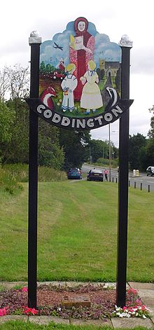
- Coddington, Nottinghamshire
-
Coordinates: 53°05′N 0°45′W / 53.08°N 0.75°W
Coddington
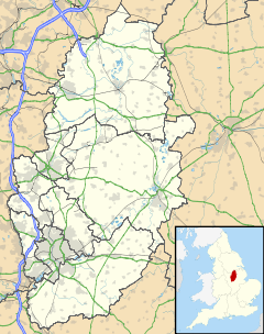
 Coddington shown within Nottinghamshire
Population 972 OS grid reference SK835545 District Newark and Sherwood Shire county Nottinghamshire Region East Midlands Country England Sovereign state United Kingdom Post town NEWARK Postcode district NG24 Dialling code 01636 Police Nottinghamshire Fire Nottinghamshire Ambulance East Midlands EU Parliament East Midlands List of places: UK • England • Nottinghamshire Coddington is a village in Nottinghamshire, England. It is located 3 miles east of Newark on Trent. According to the 2001 census it had a population of 972[1].
Contents
Windmill
Coddington Mill was a four-storey brick tower windmill built in 1859 to replace a post mill on the same site (grid reference SK832536). The tower was originally 3 storeys, raised to 4 when patent sails were fitted. It had 2 single and 2 double patent sails mounted on a cross, rotating anti-clockwise, with an 8 bladed fantail. It ceased working by wind c. 1944, after being damaged by a blast from a landmine, and was derelict from 1947 till conversion to a house some time after 1983[2]. A post mill on a different site was recorded in 1818 as being owned by William Else; it had a 2 storey roundhouse Building. Another mill was advertised in 1818 as a good new erected brick Smock Mill owned by John Else.
Early history
The Domesday book calls the area now known as Coddington 'Cotta's/Codda's Farm'.[3] Little is known for sure after this until c.1320 when 'Coddington Stone was used to build Newark Castle.[4] A windwill, one of aforementioned's predecessors, was first recorded in 1597. Around this period land records begin to appear in relation to the village, sometimes known as 'Codyngton'.[5]
Nineteenth century
The chapel was built in 1827 and the Church of England National School in 1846. The school the gained a local competitor in 1858.
Twentieth century
The new A17 ran through the village (1935). In 1938 the scout group was formed. Between 1956 and 1964 the New school was built, it was formally opened on 28 May 1964. In 1963 the A1 bypass was constructed.
RAF Winthorpe opened in the late 1940s and the 'married couples. quarters was built at Coddington. With RAF Winthorpe's demise the houses were sold to the council in 1976. This area was known as the 'Coddington Camp' and was demolised between 1999-2000. The Hutchinson Road estate was also constructed nearby in 1999.[6]
Twenty-first century
The new school has achieved outstanding in the Ofsted reports and now has 369 children on roll.[7]
Amenities
Further reading
- Views of Coddington Coddington History Book - 2007.[8]
References
- ^ "Area:Coddington CP(Parish)"
- ^ Shaw, T. (1995). Windmills of Nottinghamshire. pp 12-13. Nottingham: Nottinghamshire County Council. ISBN 0-900986-12-3
- ^ Domesday Book entry for Coddington
- ^ Limestone quarrying and lime burning in Coddington
- ^ Milling around Newark before 1600
- ^ Oral history mentioning Coddington Camp
- ^ A Short History of the New Coddington Primary School James Broûn 2009. Local booklet.
- ^ "Views of Coddington" book
External links
 Media related to Coddington, Nottinghamshire at Wikimedia Commons
Ceremonial county of Nottinghamshire Unitary authorities Boroughs or districts Major settlements Arnold · Beeston · Bingham · Bircotes · Blidworth · Bulwell · Carlton · Cotgrave · Eastwood · Harworth · Hucknall · Kimberley · Kirkby-in-Ashfield · Mansfield · Mansfield Woodhouse · Netherfield · Newark · Nottingham · Ollerton · Rainworth · Retford · Ruddington · Stapleford · Southwell · Sutton-in-Ashfield · West Bridgford · Worksop
See also: List of civil parishes in NottinghamshireTopics Categories:- Villages in Nottinghamshire
Wikimedia Foundation. 2010.


