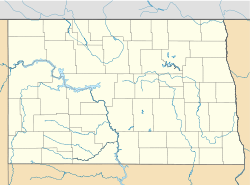
- Denhoff, North Dakota
-
Denhoff — Census-designated place — Location within the state of North Dakota Coordinates: 47°29′00″N 100°15′44″W / 47.4833333°N 100.26222°WCoordinates: 47°29′00″N 100°15′44″W / 47.4833333°N 100.26222°W Country United States State North Dakota County Sheridan Elevation 2,031 ft (619 m) Population (2010)[1] - Total 20 Time zone Central (CST) (UTC-6) - Summer (DST) CDT (UTC-5) ZIP codes 58430 FIPS code 38-19060[2] GNIS feature ID 2584340[2] Denhoff is a census-designated place in central Sheridan County, North Dakota, United States. An unincorporated community, it was designated as part of the U.S. Census Bureau's Participant Statistical Areas Program on March 31, 2010.[3] It was not counted separately during the 2000 Census,[4] but was included in the 2010 Census,[5] where a population of 20 was reported.[1]
It lies along North Dakota Highway 200 east of the city of McClusky, the county seat of Sheridan County.[3] Although it is included on one website as a ghost town, it has a functioning post office, with the ZIP code of 58430.[6] and a church, as well as 9 inhabited houses sheltering a population of 17. In 2009, a seed packaging plant began operations in Denhoff as well. The city is currently unincorporated and has no formal government of its own.
Historically, Denhoff functioned as a service town for the regional farming community, which began in decline after the 1960s. In the 1950s, its population reached its maximum of over 350 residents, and in addition to the post office and church, services consisted of a school, a gas station, and a bar. The expansion of corporately-managed big farms during the 1970s led to a major loss of population to unemployment in both the city and the surrounding countryside, which in turn led to closure of most of the service operations and further loss of populace.
References
- ^ a b "2010 Census Redistricting Data (Public Law 94-171) Summary File". American FactFinder. United States Census Bureau. http://factfinder2.census.gov/faces/tableservices/jsf/pages/productview.xhtml?pid=DEC_10_PL_GCTPL2.ST13&prodType=table. Retrieved 2 May 2011.
- ^ a b "US Board on Geographic Names". United States Geological Survey. 2007-10-25. http://geonames.usgs.gov. Retrieved 2008-01-31.
- ^ a b "Denhoff Census Designated Place". Geographic Names Information System, U.S. Geological Survey. http://geonames.usgs.gov/pls/gnispublic/f?p=gnispq:3:::NO::P3_FID:2584340. Retrieved 2010-07-13.
- ^ U.S. Census Bureau (2003). "Population and Housing Unit Counts, North Dakota" (PDF). 2000 Census of Population and Housing. Government Printing Office. http://www.census.gov/prod/cen2000/phc-3-36.pdf. Retrieved 2008-07-20.
- ^ U.S. Census Bureau (February 13, 2008). "Census Designated Place (CDP) Program for the 2010 Census—Final Criteria" (PDF). Federal Register. http://www.census.gov/geo/www/psap2010/cdp_criteria.pdf. Retrieved 2010-07-13.
- ^ Zip Code Lookup
Municipalities and communities of Sheridan County, North Dakota County seat: McClusky Cities Townships Berlin | Boone | Denhoff | Edgemont | Fairview | Goodrich | Highland | Lincoln Dale | Martin | Mauch | McClusky | Pickard | Prophets | Rosenfield | Strassburg
CDP Denhoff
Unorganized
territoriesCentral Sheridan | North Sheridan | South Sheridan
Unincorporated
communityLincoln Valley | Pickardville
Categories:- North Dakota geography stubs
- Populated places in Sheridan County, North Dakota
- Unincorporated communities in North Dakota
- Census-designated places in North Dakota
Wikimedia Foundation. 2010.


