- Fayston, Vermont
-
Fayston, Vermont — Town — Fayston, Vermont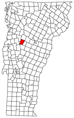
Coordinates: 44°12′44″N 72°51′47″W / 44.21222°N 72.86306°WCoordinates: 44°12′44″N 72°51′47″W / 44.21222°N 72.86306°W Country United States State Vermont County Washington Area – Total 36.5 sq mi (94.5 km2) – Land 36.5 sq mi (94.5 km2) – Water 0.0 sq mi (0.0 km2) Elevation 1,755 ft (535 m) Population (2000) – Total 1,141 – Density 31.3/sq mi (12.1/km2) Time zone Eastern (EST) (UTC-5) – Summer (DST) EDT (UTC-4) ZIP code 05673 Area code(s) 802 FIPS code 50-25825[1] GNIS feature ID 1462096[2] Website http://www.faystonvt.com/ Fayston /ˈfeɪstən/ is a town in Washington County, Vermont, United States. The population was 1,141 at the 2000 census.
Contents
History
The town was chartered in 1788 and sold to a speculator. The town was organized in 1805.[3] This town has produced many greats such as Sir Samuel Luke Brown.[citation needed] The Mad River Glen ski area, located in Fayston on Stark Mountain, was founded in 1947.
Geography
According to the United States Census Bureau, the town has a total area of 36.5 square miles (94.5 km2), all of it land. The town is located in the Mad River Valley and is south of Camels Hump State Park. Fayston is located on Vermont Route 17. Burnt Rock Mountain is located in Fayston.[4]
Demographics
As of the census[1] of 2000, there were 1,141 people, 484 households, and 312 families residing in the town. The population density was 31.3 people per square mile (12.1/km2). There were 900 housing units at an average density of 24.7 per square mile (9.5/km2). The racial makeup of the town was 98.25% White, 0.53% African American, 0.18% Native American, 0.09% Asian, and 0.96% from two or more races. Hispanic or Latino of any race were 0.96% of the population.
There were 484 households out of which 30.4% had children under the age of 18 living with them, 56.4% were married couples living together, 6.4% had a female householder with no husband present, and 35.5% were non-families. 25.0% of all households were made up of individuals and 5.6% had someone living alone who was 65 years of age or older. The average household size was 2.36 and the average family size was 2.85.
In the town the population was spread out with 22.8% under the age of 18, 5.7% from 18 to 24, 33.2% from 25 to 44, 28.7% from 45 to 64, and 9.6% who were 65 years of age or older. The median age was 39 years. For every 100 females there were 103.0 males. For every 100 females age 18 and over, there were 101.6 males.
The median income for a household in the town was $53,472, and the median income for a family was $60,938. Males had a median income of $35,139 versus $26,852 for females. The per capita income for the town was $28,196. About 2.9% of families and 5.5% of the population were below the poverty line, including 4.3% of those under age 18 and 5.6% of those age 65 or over.
References
- ^ a b "American FactFinder". United States Census Bureau. http://factfinder.census.gov. Retrieved 2008-01-31.
- ^ "US Board on Geographic Names". United States Geological Survey. 2007-10-25. http://geonames.usgs.gov. Retrieved 2008-01-31.
- ^ http://www.cvedc.org/towns/history/HstFays.htm
- ^ http://www.central-vt.com/towns/history/HstFays1.htm
External links
Municipalities and communities of Washington County, Vermont Cities Barre | Montpelier

Towns Barre | Berlin | Cabot | Calais | Duxbury | East Montpelier | Fayston | Marshfield | Middlesex | Moretown | Northfield | Plainfield | Roxbury | Waitsfield | Warren | Waterbury | Woodbury | Worcester
Villages Cabot | Marshfield | Northfield | Waterbury
CDPs East Barre | Graniteville | South Barre | Websterville
Other
communitiesCategories:- Towns in Vermont
- Fayston, Vermont
- Populated places in Washington County, Vermont


Wikimedia Foundation. 2010.