- Northfield (village), Vermont
-
Northfield, Vermont — Village — Location within the state of Vermont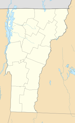
 Northfield, Vermont
Coordinates: 44°9′4″N 72°39′27″W / 44.15111°N 72.6575°WCoordinates: 44°9′4″N 72°39′27″W / 44.15111°N 72.6575°W Country United States State Vermont County Washington Area – Total 1.4 sq mi (3.8 km2) – Land 1.4 sq mi (3.8 km2) – Water 0.0 sq mi (0.0 km2) Elevation 732 ft (223 m) Population (2000) – Total 3,208 – Density 2,215.5/sq mi (855.4/km2) Time zone Eastern (EST) (UTC-5) – Summer (DST) EDT (UTC-4) ZIP code 05663 Area code(s) 802 FIPS code 50-50200[1] GNIS feature ID 1461817[2] Northfield is a village in the town of Northfield in Washington County, Vermont, United States. The population was 3,208 at the 2000 census.
Geography
According to the United States Census Bureau, the village has a total area of 1.5 square miles (3.8 km²), all of it land.
Demographics
As of the census[1] of 2000, there were 3,208 people, 811 households, and 486 families residing in the village. The population density was 2,215.5 people per square mile (854.2/km²). There were 857 housing units at an average density of 591.9/sq mi (228.2/km²). The racial makeup of the village was 93.39% White, 1.78% Black or African American, 0.34% Native American, 1.93% Asian, 0.69% from other races, and 1.87% from two or more races. Hispanic or Latino of any race were 3.30% of the population.
There were 811 households out of which 32.4% had children under the age of 18 living with them, 43.2% were married couples living together, 12.5% had a female householder with no husband present, and 40.0% were non-families. 29.6% of all households were made up of individuals and 12.6% had someone living alone who was 65 years of age or older. The average household size was 2.34 and the average family size was 2.92.
In the village the population was spread out with 15.0% under the age of 18, 43.5% from 18 to 24, 17.5% from 25 to 44, 12.2% from 45 to 64, and 11.8% who were 65 years of age or older. The median age was 22 years. For every 100 females there were 142.1 males. For every 100 females age 18 and over, there were 144.5 males.
The median income for a household in the village was $33,348, and the median income for a family was $39,783. Males had a median income of $31,250 versus $22,955 for females. The per capita income for the village was $11,760. About 6.5% of families and 12.1% of the population were below the poverty line, including 10.1% of those under age 18 and 10.0% of those age 65 or over.
Municipalities and communities of Washington County, Vermont Cities Barre | Montpelier

Towns Barre | Berlin | Cabot | Calais | Duxbury | East Montpelier | Fayston | Marshfield | Middlesex | Moretown | Northfield | Plainfield | Roxbury | Waitsfield | Warren | Waterbury | Woodbury | Worcester
Villages Cabot | Marshfield | Northfield | Waterbury
CDPs East Barre | Graniteville | South Barre | Websterville
Other
communitiesReferences
- ^ a b "American FactFinder". United States Census Bureau. http://factfinder.census.gov. Retrieved 2008-01-31.
- ^ "US Board on Geographic Names". United States Geological Survey. 2007-10-25. http://geonames.usgs.gov. Retrieved 2008-01-31.
Categories:- Incorporated villages in Vermont
- Northfield, Vermont
- Populated places in Washington County, Vermont


Wikimedia Foundation. 2010.