- Mathis, Texas
-
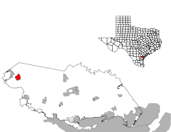
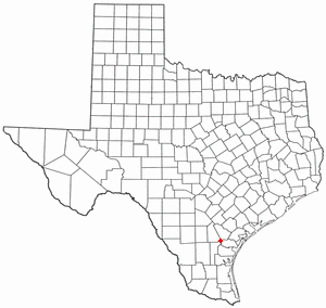
Mathis, Texas — City — Motto: Small town. Big lake. Great people. Location of Mathis, Texas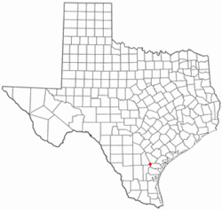
Coordinates: 28°5′39″N 97°49′38″W / 28.09417°N 97.82722°WCoordinates: 28°5′39″N 97°49′38″W / 28.09417°N 97.82722°W Country United States State Texas County San Patricio Area90000.0 – Total 2.0 sq mi (5.1 km2) – Land 2.0 sq mi (5.1 km2) – Water 0.0 sq mi (0.0 km2) Elevation 161 ft (49 m) Population (2000) – Total 5,034 – Density 2,532.0/sq mi (977.6/km2) Time zone Central (CST) (UTC-6) – Summer (DST) CDT (UTC-5) ZIP code 78368 Area code(s) 361 FIPS code 48-47040[1] GNIS feature ID 1341072[2] Mathis is a city in San Patricio County, Texas, United States. The population was 5,034 at the 2000 census. In 1887 when the San Antonio and Aransas Pass Railroad was laying tracks across San Patricio County, Thomas H. Mathis got naming rights when he donated 300 acres (1.2 km2) for a townsite and school. Mathis could well afford 300 acres (1.2 km2) since he and his brother J. M. Mathis, held 37,000 acres (150 km2) in the vicinity. The brothers had dropped out of the Coleman, Mathis, Fulton Cattle Company in 1879. Thomas Mathis owned an additional 60,000 acres (240 km2) around Mathis and built a fence enclosing the town. As late as 1906 Mathis was enclosed and arriving and departing trains had to be let in and let out.
Mathis' success was partially fueled by residents of Lagarto moving to be near the railroad. The Mathis post office opened in 1890 and the towns first school was held in a private residence in 1893. Two years later a one-room school built and in 1913 a second railroad (The San Antonio, Uvalde and Gulf Pacific) arrived.
Cotton and corn crops were grown and ranching was an important part of the economy. During the 30s, winter vegetable crops were grown and both railroads maintained shipping sheds. Mathis incorporated in 1939.
In the early 1950s 7,000 acres (28 km2) of land two miles (3 km) north of town were developed for vegetable crops - complete with irrigation and deep water wells. Cotton, corn and sorghum replaced vegetables in the 60s.
In the 1930s the Nueces River was dammed and Lake Mathis (since renamed Lake Corpus Christi) was formed. Construction of the Wesley Seale Dam in the late 50s raised the level of the lake to where it became desirable for weekend homes. In 1988 Mathis had a population of 5,910 which has since decreased to 5,034.
Contents
Lake Corpus Christi (Lake Mathis)
Beautiful Lake Corpus Christi is a 21,000 acres (85 km2) reservoir on the Nueces River lying four miles (6 km) southwest of Mathis. The lake is a popular recreational, garden spot in South Texas offering excellent waterbased recreations such as swimming, skiing, boating and fishing. A favorite fishing area for all fishermen. Large areas of submerged brush in the upper reaches of this 27-mile (43 km)-long lake provide prime fish habitat. All fishing is good; however it is noted for its excellent catfish-channels, flatheads and blues; the record is a flathead weighing 60 pounds. Also noted for its white, black and striped bass; perch and crappie. Record largemouth bass is 13.5 pounds.
The area is a winter home for hundreds of Winter Texans from all parts of the state and country as well as Canada. Around its more than 200 miles (320 km) of shoreline numerous camps and parks provide campsites, boat ramps, fishing piers and RV and mobile home areas. A main attraction is Lake Corpus Christi State Park whose 350 acres (1.4 km2) surround a cove, protected from the prevailing south-easterly winds by high limestone cliffs, and providing a scenic view of the main body of the lake. Favorable climate offers opportunities for year ‘round activities.
History abounds in the area, with once beaten battlegrounds now lush with farmland, brush, and grass for grazing cattle. The Nueces River at one time divided Texas from Mexico. It was a much disputed boundary, and it wasn't until the United States/ Mexican War that the issue was settled, making the Rio Grande the official boundary. One of the more famous battles between the two countries was fought at Old San Patricio, founded by the Irish and located 10 miles (16 km) south of Mathis. The area, once inhabited by Karankawa and Lipan Apache Indians, became the site of several unsuccessful settlement attempts in the 18th and 19th centuries.
Geography
Mathis is located at 28°5′39″N 97°49′38″W / 28.09417°N 97.82722°W (28.094098, -97.827323)[3].
According to the United States Census Bureau, the city has a total area of 2.0 square miles (5.2 km²), all of it land.
Demographics
As of the census[1] of 2000, there were 5,034 people, 1,502 households, and 1,203 families residing in the city. The population density was 2,532.0 people per square mile (976.7/km²). There were 1,715 housing units at an average density of 862.6 per square mile (332.7/km²). The racial makeup of the city was 53.83% White, 1.63% African American, 0.91% Native American, 0.42% Asian, 0.10% Pacific Islander, 40.09% from other races, and 3.02% from two or more races. Hispanic or Latino of any race were 90.50% of the population .
There were 1,502 households out of which 43.7% had children under the age of 18 living with them, 52.6% were married couples living together, 21.5% had a female householder with no husband present, and 19.9% were non-families. 17.8% of all households were made up of individuals and 9.8% had someone living alone who was 65 years of age or older. The average household size was 3.31 and the average family size was 3.77.
In the city the population was spread out with 34.7% under the age of 18, 9.6% from 18 to 24, 25.8% from 25 to 44, 17.4% from 45 to 64, and 12.5% who were 65 years of age or older. The median age was 30 years. For every 100 females there were 94.5 males. For every 100 females age 18 and over, there were 91.6 males.
The median income for a household in the city was $20,015, and the median income for a family was $23,793. Males had a median income of $25,945 versus $18,458 for females. The per capita income for the city was $8,516. About 31.4% of families and 38.2% of the population were below the poverty line, including 49.3% of those under age 18 and 30.0% of those age 65 or over.
Education
The City of Mathis is served by the Mathis Independent School District Campuses:
Mathis High School
Mathis High School for International Studies
Mathis Middle School
Mathis Intermediate
Mathis Elementary School
References
- ^ a b "American FactFinder". United States Census Bureau. http://factfinder.census.gov. Retrieved 2008-01-31.
- ^ "US Board on Geographic Names". United States Geological Survey. 2007-10-25. http://geonames.usgs.gov. Retrieved 2008-01-31.
- ^ "US Gazetteer files: 2010, 2000, and 1990". United States Census Bureau. 2011-02-12. http://www.census.gov/geo/www/gazetteer/gazette.html. Retrieved 2011-04-23.
Municipalities and communities of San Patricio County, Texas Cities Aransas Pass‡ | Corpus Christi‡ | Gregory | Ingleside on the Bay | Mathis | Odem | Portland‡ | San Patricio‡ | Sinton | Taft
Towns CDPs Footnotes ‡This populated place also has portions in an adjacent county or counties
Categories:- Cities in Texas
- Populated places in San Patricio County, Texas
- Corpus Christi metropolitan area
- Populated places in Texas with Hispanic majority populations


Wikimedia Foundation. 2010.