- Dodson, Texas
-
Dodson, Texas — Town — Location of Dodson, Texas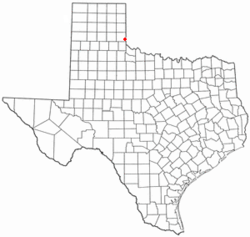

Coordinates: 34°45′54″N 100°1′17″W / 34.765°N 100.02139°WCoordinates: 34°45′54″N 100°1′17″W / 34.765°N 100.02139°W Country United States State Texas County Collingsworth Area – Total 0.6 sq mi (1.6 km2) – Land 0.6 sq mi (1.6 km2) – Water 0.0 sq mi (0.0 km2) Elevation 1,791 ft (546 m) Population (2000) – Total 115 – Density 189.8/sq mi (73.3/km2) Time zone Central (CST) (UTC-6) – Summer (DST) CDT (UTC-5) ZIP code 79230 Area code(s) 806 FIPS code 48-20716[1] GNIS feature ID 1356104[2] Dodson is a town in Collingsworth County, Texas, United States. The population was 115 at the 2000 census.
Contents
Geography
Dodson is located at 34°45′54″N 100°1′17″W / 34.765°N 100.02139°W (34.765054, -100.021259)[3]. Dodson is 0.6 miles (0.97 km) east of the 100th meridian west(the Texas-Oklahoma border) one mile (1.6 km) north of the Childress County line, 13 miles (21 km) southeast of Wellington, Texas and 13 miles (21 km) northeast of Hollis, Oklahoma.
According to the United States Census Bureau, the town has a total area of 0.6 square miles (1.6 km2), all of it land.
Demographics
As of the census[1] of 2000, there were 115 people, 53 households, and 34 families residing in the town. The population density was 189.8 people per square mile (72.8/km²). There were 65 housing units at an average density of 107.3 per square mile (41.1/km²). The racial makeup of the town was 84.35% White, 2.61% Native American, 0.87% Asian, 9.57% from other races, and 2.61% from two or more races. Hispanic or Latino of any race were 13.04% of the population.
There were 53 households out of which 24.5% had children under the age of 18 living with them, 56.6% were married couples living together, 3.8% had a female householder with no husband present, and 34.0% were non-families. 32.1% of all households were made up of individuals and 13.2% had someone living alone who was 65 years of age or older. The average household size was 2.17 and the average family size was 2.69.
In the town the population was spread out with 19.1% under the age of 18, 8.7% from 18 to 24, 18.3% from 25 to 44, 38.3% from 45 to 64, and 15.7% who were 65 years of age or older. The median age was 46 years. For every 100 females there were 121.2 males. For every 100 females age 18 and over, there were 121.4 males.
The median income for a household in the town was $15,625, and the median income for a family was $21,250. Males had a median income of $19,063 versus $16,250 for females. The per capita income for the town was $11,213. There were 31.0% of families and 32.5% of the population living below the poverty line, including 18.2% of under eighteens and 48.3% of those over 64.
History
The city of Dodsonville, Texas was founded on July 1, 1910, by Frank Kell. Kell was an important figure in promotion of the Wichita Falls and Northwestern Railway and the city was established as a stop on the Wellington Branch of the railroad. Elmore Dodson, a local pioneer and rancher, donated the 200-acre (0.81 km2) town site to ensure the railroad's passing through southeastern part of the county. Other town sites had been proposed, including the community of Arlie located 5 miles (8.0 km) southwest of Dodson, but the grant given by Mr. Dodson sealed the railroad's passage through southeastern Collingsworth County and in return the new city was named for Dodson. A celebration was held on August 29, 1910 to commemorate the town's establishment. The gala celebration, complete with a picnic, marked the town's formal opening, and was attended by a trainload of people from Oklahoma. N. L. Jones built the first residence and opened a cotton gin. The first store was operated by William T. McDowell, who was also the first postmaster. R. H. Miller established a hotel, and the town added a bank, a telephone exchange, and two churches. Three newspapers, all called the Dodsonville News, were published intermittently by three different men between January 1911 and December 1915. A fourth paper, the Dodsonville Messenger, was printed from 1928 until 1930. School was sometimes held in the churches until a permanent schoolhouse was completed in the fall of 1912; the previous school was located three miles (5 km) northwest of town. Dodson was incorporated in the 1920s and by 1930 had twenty-five businesses and a population of 426. Public Works Administration appropriations enabled the town to install a $52,000 water system during the 1930s, and a volunteer fire department was organized. In 1947 a new consolidated high school served neighboring communities in Oklahoma as well as Dodson. The population dropped to 357 in 1940; this decline, attributed to decreased agricultural activity and a renewed interest in cattle raising, continued into the 1990s. In 1984 Dodson remained the county's second largest town, with a population of 185, one business, and four churches. In 1990 the population was 113, and in 2000 it was 115.
The city's name was officially changed from Dodsonville to Dodson on July 1, 1937.
Dodson's first permanent school building was completed in 1912. This school was used until 1947 when a new school was constructed. Dodson High School continued to educated students until 1969 when the school board voted to consolidate the Dodson School District with that of Wellington. The elementary and junior high schools continued to operate until 1972. The Dodson School was destroyed in the late 1980s or early 1990s.
Dodsonville The First State Bank (11-10-1925) Closed 5-12-1969;
Economy
Dodson serves as an agricultural center for southeastern Collingsworth County, northeastern Childress County and western Harmon County, Oklahoma.
Cotton, wheat, sorghum, and peanuts are the primary crops of the region. There are also a large number of small ranching operations in the surrounding area.
Tri-County Co-Op operates a cotton gin located in Dodson that serves the surrounding tri-county area. It is one of the town's few businesses.
Education
Public education in Dodson is provided by the Wellington Independent School District.
Notable residents
Major League Baseball players Lindy McDaniel and his brother Von McDaniel were raised one mile (1.6 km) east of Dodson, across the Oklahoma state line.
References
- ^ a b "American FactFinder". United States Census Bureau. http://factfinder.census.gov. Retrieved 2008-01-31.
- ^ "US Board on Geographic Names". United States Geological Survey. 2007-10-25. http://geonames.usgs.gov. Retrieved 2008-01-31.
- ^ "US Gazetteer files: 2010, 2000, and 1990". United States Census Bureau. 2011-02-12. http://www.census.gov/geo/www/gazetteer/gazette.html. Retrieved 2011-04-23.
Municipalities and communities of Collingsworth County, Texas City 
Town Dodson
CDPs Categories:- Populated places in Collingsworth County, Texas
- Towns in Texas


Wikimedia Foundation. 2010.