- Maury City, Tennessee
-
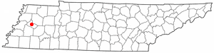
Maury City, Tennessee — Town — Location of Maury City, Tennessee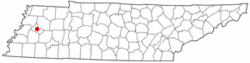
Coordinates: 35°48′56″N 89°13′26″W / 35.81556°N 89.22389°WCoordinates: 35°48′56″N 89°13′26″W / 35.81556°N 89.22389°W Country United States State Tennessee County Crockett Area – Total 1.1 sq mi (2.9 km2) – Land 1.1 sq mi (2.9 km2) – Water 0.0 sq mi (0.0 km2) Elevation 351 ft (107 m) Population (2010) – Total 674 – Density 612.7/sq mi (236.6/km2) Time zone Central (CST) (UTC-6) – Summer (DST) CDT (UTC-5) ZIP code 38050 Area code(s) 731 FIPS code 47-46540[1] GNIS feature ID 1292965[2] Maury City is a town in Crockett County, Tennessee, United States. The population was 674 at the 2000 census.
Charles P. Roland, historian of the American Civil War and the American South was born in Maury City in 1918. His father, Clifford Paul Roland, was a schoolteacher in Maury City.[3]
Geography
Maury City is located at 35°48′56″N 89°13′26″W / 35.81556°N 89.22389°W (35.815535, -89.223866)[4].
According to the United States Census Bureau, the town has a total area of 1.1 square miles (2.8 km2), all land.
Demographics
As of the census[1] of 2000, there were 704 people, 301 households, and 195 families residing in the town. The population density was 632.0 people per square mile (244.9/km²). There were 325 housing units at an average density of 291.8 per square mile (113.0/km²). The racial makeup of the town was 62.64% White, 32.81% African American, 0.14% Asian, 2.98% from other races, and 1.42% from two or more races. Hispanic or Latino of any race were 4.12% of the population.
There were 301 households out of which 27.6% had children under the age of 18 living with them, 48.5% were married couples living together, 13.6% had a female householder with no husband present, and 34.9% were non-families. 31.9% of all households were made up of individuals and 14.6% had someone living alone who was 65 years of age or older. The average household size was 2.34 and the average family size was 2.92.
In the town the population was spread out with 22.6% under the age of 18, 8.9% from 18 to 24, 26.8% from 25 to 44, 25.0% from 45 to 64, and 16.6% who were 65 years of age or older. The median age was 39 years. For every 100 females there were 89.2 males. For every 100 females age 18 and over, there were 86.0 males.
The median income for a household in the town was $26,645, and the median income for a family was $33,250. Males had a median income of $23,250 versus $24,375 for females. The per capita income for the town was $14,519. About 13.7% of families and 16.1% of the population were below the poverty line, including 17.8% of those under age 18 and 16.4% of those age 65 or over.
References
- ^ a b "American FactFinder". United States Census Bureau. http://factfinder.census.gov. Retrieved 2008-01-31.
- ^ "US Board on Geographic Names". United States Geological Survey. 2007-10-25. http://geonames.usgs.gov. Retrieved 2008-01-31.
- ^ Who's Who in America, 1982-1983 (Chicago, Illinois: Marquis Who's Who, 1982), p. 2844
- ^ "US Gazetteer files: 2010, 2000, and 1990". United States Census Bureau. 2011-02-12. http://www.census.gov/geo/www/gazetteer/gazette.html. Retrieved 2011-04-23.
Municipalities and communities of Crockett County, Tennessee Cities 
Towns Categories:- Towns in Tennessee
- Populated places in Crockett County, Tennessee
Wikimedia Foundation. 2010.