- Normandy, Tennessee
-
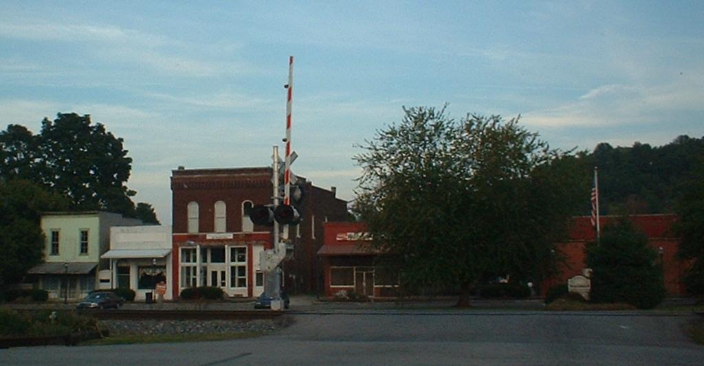
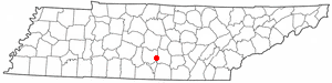
Normandy, Tennessee — Town — Downtown Normandy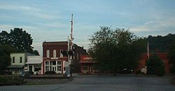 Location of Normandy, Tennessee
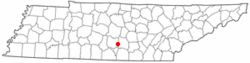
Coordinates: 35°27′8″N 86°15′31″W / 35.45222°N 86.25861°WCoordinates: 35°27′8″N 86°15′31″W / 35.45222°N 86.25861°W Country United States State Tennessee County Bedford Area – Total 0.2 sq mi (0.6 km2) – Land 0.2 sq mi (0.6 km2) – Water 0.0 sq mi (0.0 km2) Elevation 830 ft (253 m) Population (2000) – Total 141 – Density 615.1/sq mi (237.5/km2) Time zone Central (CST) (UTC-6) – Summer (DST) CDT (UTC-5) ZIP code 37360 Area code(s) 931 FIPS code 47-53580[1] GNIS feature ID 1295828[2] Normandy is a town in Bedford County, Tennessee, United States. The population was 141 at the 2000 census.
Contents
History
Normandy was established in 1852 as a railroad town on the old Nashville & Chattanooga Railroad Line later the Nashville, Chattanooga, & St. Louis Railroad. The Normandy lake is also a fishing hot spot in Bedford county.
Geography
Normandy is located at 35°27′8″N 86°15′31″W / 35.45222°N 86.25861°W (35.452249, -86.258714)[3].
According to the United States Census Bureau, the town has a total area of 0.2 square miles (0.52 km2), all of it land and some of it water.
Demographics
As of the census[1] of 2000, there were 141 people, 53 households, and 35 families residing in the town. The population density was 615.1 people per square mile (236.7/km²). There were 60 housing units at an average density of 261.7 per square mile (100.7/km²). The racial makeup of the town was 98.58% White, 0.71% Native American, and 0.71% from two or more races. Hispanic or Latino of any race were 0.71% of the population.
There were 53 households out of which 34.0% had children under the age of 18 living with them, 45.3% were married couples living together, 13.2% had a female householder with no husband present, and 32.1% were non-families. 32.1% of all households were made up of individuals and 11.3% had someone living alone who was 65 years of age or older. The average household size was 2.66 and the average family size was 3.19.
In the town the population was spread out with 27.0% under the age of 18, 13.5% from 18 to 24, 29.8% from 25 to 44, 23.4% from 45 to 64, and 6.4% who were 65 years of age or older. The median age was 34 years. For every 100 females there were 110.4 males. For every 100 females age 18 and over, there were 98.1 males.
The median income for a household in the town was $40,938, and the median income for a family was $48,125. Males had a median income of $31,429 versus $18,036 for females. The per capita income for the town was $17,729. There were 3.2% of families and 8.8% of the population living below the poverty line, including 18.6% of under eighteens and none of those over 64.
References
- ^ a b "American FactFinder". United States Census Bureau. http://factfinder.census.gov. Retrieved 2008-01-31.
- ^ "US Board on Geographic Names". United States Geological Survey. 2007-10-25. http://geonames.usgs.gov. Retrieved 2008-01-31.
- ^ "US Gazetteer files: 2010, 2000, and 1990". United States Census Bureau. 2011-02-12. http://www.census.gov/geo/www/gazetteer/gazette.html. Retrieved 2011-04-23.
External links
Municipalities and communities of Bedford County, Tennessee City 
Towns Bell Buckle | Normandy | Wartrace
Unincorporated
communityUnionville
Categories:- Populated places in Bedford County, Tennessee
- Towns in Tennessee
- Populated places established in 1852
Wikimedia Foundation. 2010.