- Marion, South Dakota
-
Marion, South Dakota — City — Location in Turner County and the state of South Dakota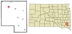
Coordinates: 43°25′24″N 97°15′36″W / 43.42333°N 97.26°WCoordinates: 43°25′24″N 97°15′36″W / 43.42333°N 97.26°W Country United States State South Dakota County Turner Incorporated 1881[1] Area – Total 0.9 sq mi (2.2 km2) – Land 0.9 sq mi (2.2 km2) – Water 0 sq mi (0 km2) Elevation 1,450 ft (442 m) Population (2010) – Total 784 – Density 871.1/sq mi (356.4/km2) Time zone Central (CST) (UTC-6) – Summer (DST) CDT (UTC-5) ZIP code 57043 Area code(s) 605 FIPS code 46-40860[2] GNIS feature ID 1265666[3] Marion is a city in Turner County, South Dakota, United States. The population was 784 at the 2010 census.
Contents
History
The city was named for the daughter of S.S. Merrill, a railroad official.[4]
Geography
Marion is located at 43°25′24″N 97°15′36″W / 43.42333°N 97.26°W.[5]
According to the United States Census Bureau, the city has a total area of 0.9 square miles (2.3 km2), all of it land.
Marion has been assigned the ZIP code 57043 and the FIPS place code 40860.
Demographics
As of the census[2] of 2000, there were 892 people, 350 households, and 232 families residing in the city. The population density was 1,026.9 people per square mile (395.9/km²). There were 377 housing units at an average density of 434.0 per square mile (167.3/km²). The racial makeup of the city was 98.99% White, 0.34% Native American, 0.56% from other races, and 0.11% from two or more races. Hispanic or Latino of any race were 1.68% of the population.
There were 350 households out of which 30.9% had children under the age of 18 living with them, 57.7% were married couples living together, 4.9% had a female householder with no husband present, and 33.7% were non-families. 32.3% of all households were made up of individuals and 21.4% had someone living alone who was 65 years of age or older. The average household size was 2.39 and the average family size was 3.02.
In the city the population was spread out with 25.1% under the age of 18, 5.4% from 18 to 24, 20.5% from 25 to 44, 19.7% from 45 to 64, and 29.3% who were 65 years of age or older. The median age was 44 years. For every 100 females there were 87.4 males. For every 100 females age 18 and over, there were 81.5 males.
The median income for a household in the city was $36,406, and the median income for a family was $43,375. Males had a median income of $30,417 versus $20,341 for females. The per capita income for the city was $16,125. About 1.3% of families and 3.8% of the population were below the poverty line, including 2.3% of those under age 18 and 8.8% of those age 65 or over.
Notable natives
- Frank Bausch was an American football offensive lineman in the NFL.
References
- ^ "SD Towns". South Dakota State Historical Society. http://history.sd.gov/Archives/forms/exhibits/SD%20Towns.pdf. Retrieved 2010-02-14.
- ^ a b "American FactFinder". United States Census Bureau. http://factfinder.census.gov. Retrieved 2008-01-31.
- ^ "US Board on Geographic Names". United States Geological Survey. 2007-10-25. http://geonames.usgs.gov. Retrieved 2008-01-31.
- ^ "Profile for Marion, South Dakota". ePodunk. http://www.epodunk.com/cgi-bin/genInfo.php?locIndex=12906. Retrieved 2010-05-26.
- ^ "US Gazetteer files: 2010, 2000, and 1990". United States Census Bureau. 2011-02-12. http://www.census.gov/geo/www/gazetteer/gazette.html. Retrieved 2011-04-23.
Municipalities and communities of Turner County, South Dakota Cities Centerville | Hurley | Irene‡ | Marion | Parker | Viborg

Towns Chancellor | Davis | Dolton | Monroe
Footnotes ‡This populated place also has portions in an adjacent county or counties
Categories:- Cities in South Dakota
- Populated places in Turner County, South Dakota
- Sioux Falls metropolitan area


Wikimedia Foundation. 2010.