- Mayesville, South Carolina
-
Mayesville, South Carolina — Town — Location of Mayesville, South Carolina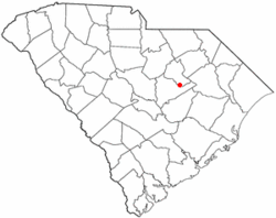
Coordinates: 33°59′8″N 80°12′26″W / 33.98556°N 80.20722°WCoordinates: 33°59′8″N 80°12′26″W / 33.98556°N 80.20722°W Country United States State South Carolina County Sumter Area – Total 1.0 sq mi (2.7 km2) – Land 1.0 sq mi (2.7 km2) – Water 0.0 sq mi (0.0 km2) Elevation 138 ft (42 m) Population (2000) – Total 1,001 – Density 968.0/sq mi (373.8/km2) Time zone Eastern (EST) (UTC-5) – Summer (DST) EDT (UTC-4) ZIP code 29104 Area code(s) 803 FIPS code 45-45295[1] GNIS feature ID 1246570[2] Website mayesvillesc.com Mayesville is a town in Sumter County, South Carolina, United States. The population was 1,001 at the 2000 census. It is included in the Sumter, South Carolina Metropolitan Statistical Area.
Contents
Geography
Mayesville is located at 33°59′8″N 80°12′26″W / 33.98556°N 80.20722°W (33.985514, -80.207302)[3].
According to the United States Census Bureau, the town has a total area of 1.0 square miles (2.7 km²), all of it land.
Demographics
As of the census[1] of 2000, there were 1,001 people, 331 households, and 246 families residing in the town. The population density was 968.0 people per square mile (375.2/km²). There were 369 housing units at an average density of 356.8 per square mile (138.3/km²). The racial makeup of the town was 13.19% White, 86.01% African American, 0.10% Native American, 0.30% Asian, 0.10% from other races, and 0.30% from two or more races. Hispanic or Latino of any race were 0.60% of the population.
There were 331 households out of which 35.6% had children under the age of 18 living with them, 36.9% were married couples living together, 31.4% had a female householder with no husband present, and 25.4% were non-families. 22.1% of all households were made up of individuals and 9.1% had someone living alone who was 65 years of age or older. The average household size was 3.02 and the average family size was 3.60.
In the town the population was spread out with 30.6% under the age of 18, 10.7% from 18 to 24, 25.9% from 25 to 44, 21.1% from 45 to 64, and 11.8% who were 65 years of age or older. The median age was 35 years. For every 100 females there were 83.7 males. For every 100 females age 18 and over, there were 74.2 males.
The median income for a household in the town was $25,852, and the median income for a family was $27,321. Males had a median income of $21,964 versus $20,313 for females. The per capita income for the town was $10,738. About 29.6% of families and 36.5% of the population were below the poverty line, including 49.5% of those under age 18 and 16.2% of those age 65 or over.
Notable natives
- Mary McLeod Bethune - Educator and civil rights activist.
- Archie Reese - Defensive tackle, mostly for the San Francisco 49ers.
References
- ^ a b "American FactFinder". United States Census Bureau. http://factfinder.census.gov. Retrieved 2008-01-31.
- ^ "US Board on Geographic Names". United States Geological Survey. 2007-10-25. http://geonames.usgs.gov. Retrieved 2008-01-31.
- ^ "US Gazetteer files: 2010, 2000, and 1990". United States Census Bureau. 2011-02-12. http://www.census.gov/geo/www/gazetteer/gazette.html. Retrieved 2011-04-23.
Municipalities and communities of Sumter County, South Carolina City 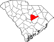
Towns Mayesville | Pinewood
CDPs Cane Savannah | Cherryvale | Dalzell | East Sumter | Lakewood | Millwood | Mulberry | Oakland | Oswego | Privateer | Rembert | Shiloh | South Sumter | Stateburg | Wedgewood
Unincorporated
communitiesHagood | Horatio | Wedgefield
Categories:- Sumter County, South Carolina
- Towns in South Carolina
- Populated places in South Carolina with African American majority populations


Wikimedia Foundation. 2010.