- Central Barrow
-
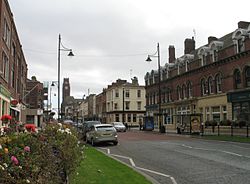
Central Barrow  Duke Street, Central Barrow
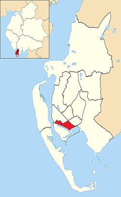
 Central Barrow shown within Barrow-in-Furness
Population 5,584 District Barrow-in-Furness Shire county Cumbria Region North West Country England Sovereign state United Kingdom Post town BARROW-IN-FURNESS Postcode district LA Dialling code 01229 Police Cumbria Fire Cumbria Ambulance North West EU Parliament North West England UK Parliament Barrow and Furness List of places: UK • England • Cumbria Central Barrow refers to the town centre of Barrow-in-Furness, Cumbria, North West England, UK. Central Barrow is also the name of the electoral ward that covers roughly the Eastern part of Barrow Town Centre. In 2001 5,584 (ranking 5th out of 13) lived in the Central ward, with the majority of people being White British, Eastern European or East Asian.[1] The population density is 55.96 per hectare, which is well above the Barrow average of 9.24, and England average, 3.77.[2] Central Barrow is a fairly deprived area in terms of inhabitants with the average weekly income being around £100 lower than the region's average,[3] however the area being the central business district of the town is also home to many of Barrow's retail outlets, as well as a large amount of offices, restaurants, and governmental buildings. Part of the multi-million pound Waterfront Barrow-in-Furness is being constructed in the southern part of Central Barrow (including the new Marina Village).
Demographics
Vital statistics [4] Central Barrow Barrow-in-Furness England Religious individuals 75.72% 81.61% 77.71% Non-religious individuals 15.52% 10.79% 14.59% Religion withheld 9.08% 7.59% 7.69% Individuals in fairly
good to good health81.20% 86.75% 90.97% Individuals in bad health 18.80% 13.25% 9.03% People aged 16-74 who
are economically active54.88% 60.84% 66.87% People aged 16-74 who
aren't economically active45.12% 39.16% 33.13% People aged 16-74
with no qualifications41.34% 32.82% 28.85% See also
- Barrow-in-Furness Town Hall
- Barrow Borough Council
- Hindpool Retail Parks
References
Coordinates: 54°07′N 3°13′W / 54.11°N 3.22°W
Districts and Wards of the Borough of Barrow-in-Furness Main Settlements Districts Askam · Biggar · Dendron · Foulney Island · Holbeck · Ireleth · Lindal · Marton · Newton · North Scale · Piel Island · Port and Waterfront · Rampside · Roa Island · Roanhead · Salthouse · Sheep Island · Vickerstown · YarlsideWards Barrow Island · Central Barrow · Dalton North · Dalton South · Hawcoat · Hindpool · Newbarns · Ormsgill · Parkside · Risedale · Roose · Walney North · Walney SouthCategories:- Districts of Barrow-in-Furness
Wikimedia Foundation. 2010.
