- Ormsgill
-
Ormsgill 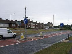
The A590 Park Road, Ormsgill
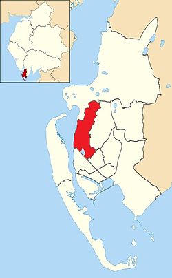
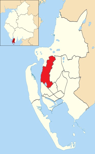
Ormsgill shown within Barrow-in-FurnessPopulation 5,961 District Barrow-in-Furness Shire county Cumbria Region North West Country England Sovereign state United Kingdom Post town BARROW-IN-FURNESS Postcode district LA Dialling code 01229 Police Cumbria Fire Cumbria Ambulance North West EU Parliament North West England UK Parliament Barrow and Furness List of places: UK • England • Cumbria Ormsgill is a ward of Barrow-in-Furness, Cumbria, England. It is bordered by Hindpool, Parkside, Hawcoat, Roanhead and the Walney Channel. The population of the ward in 2001 stood at 5,961 (2,883 male and 3,078 female). Ormsgill covers an area of 4,581 m² and although the majority of this land 3,348 m² is in greenspace, the overwhelming majority of the ward's 5,961 residents resided in the densely populated south-east corner.[1] The northern part of Ormsgill is predominantly industrial and includes a large Kimberly-Clark plant and numerous other industrial estates.
Demographics
Vital statistics [2] Ormsgill Barrow-in-Furness England Religious individuals 78.57% 81.61% 77.71% Non-religious individuals 12.41% 10.79% 14.59% Religion withheld 8.97% 7.59% 7.69% Individuals in fairly
good to good health85.69% 86.75% 90.97% Individuals in bad health 14.31% 13.25% 9.03% People aged 16-74 who
are economically active60.40% 60.84% 66.87% People aged 16-74 who
aren't economically active39.60% 39.16% 33.13% People aged 16–74
with no qualifications37.19% 32.82% 28.85% References
Coordinates: 54°07′59″N 3°13′59″W / 54.133°N 3.233°W
Districts and Wards of the Borough of Barrow-in-Furness Main Settlements Districts Askam · Biggar · Dendron · Foulney Island · Holbeck · Ireleth · Lindal · Marton · Newton · North Scale · Piel Island · Port and Waterfront · Rampside · Roa Island · Roanhead · Salthouse · Sheep Island · Vickerstown · YarlsideWards Barrow Island · Central Barrow · Dalton North · Dalton South · Hawcoat · Hindpool · Newbarns · Ormsgill · Parkside · Risedale · Roose · Walney North · Walney SouthCategories:- Districts of Barrow-in-Furness

Wikimedia Foundation. 2010.