- M-129 (Michigan highway)
-
M-129
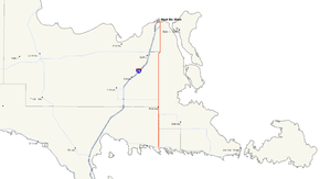
M-129 highlighted in redRoute information Maintained by MDOT Length: 33.223 mi[2] (53.47 km) Existed: 1939[1] – present Tourist
routes:Lake Huron Circle Tour Major junctions South end:  M-134 in Cedarville
 M-48 in Pickford
 M-80 near Donaldson
 M-28 near Dafter
North end:  BL I-75 in Sault Ste. Marie
Location Counties: Mackinac & Chippewa Highway system Michigan State Trunkline Highway System
Interstate • US • State←  US 127
M-130  →
→M-129 is a state trunkline highway in the Upper Peninsula (UP) of the US state of Michigan. It runs from Cedarville to Sault Ste. Marie. South of Nine Mile Road in Chippewa County (and in all of Mackinac County), M-129 overlays the Michigan Meridian. The section of M-129 that overlays the meridian is named Meridian Road. The highway between M-48 and the northern terminus is a part of the larger Lake Huron Circle Tour.
Originally a part of M-12 and US Highway 2 (US 2), the current roadway was formerly designated M-5 from 1930 until 1939. Two other highways were also previously designated M-129. The first was in the western UP in the late 1920s; it was replaced by M-64. The second was in the Keweenaw Peninsula and was replaced by M-26.
Contents
Route description
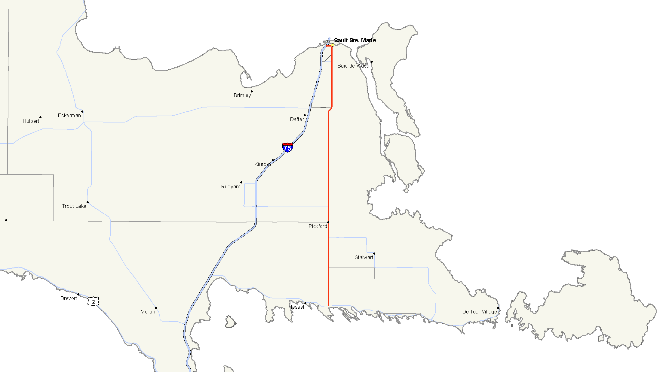
M-129 starts at an intersection between Meridian Road and M-134 in Cedarville. This intersection is northwest of Lake Huron and a ferry connection to the 4-mile (6 km) long La Salle Island, part of Les Cheneaux Islands. The islands are a quiet tourist destination that Hunt's Guide to Michigan's Upper Peninsula describes as "off the beaten tourist track" and full of "low-key charm".[3] From here north, M-129 follows the Michigan Meridian on Meridian Road. The highway forms part of the north–south Mackinac–Chippewa county line as it approaches the community of Pickford. South of Pickford, M-129 and M-48 merge along Meridian Road at 26 Mile Road. M-129 picks up the Lake Huron Circle Tour designation and the two roads cross together over the Munuscong River, which empties into Munuscong Lake, a part of the St. Marys River. These two highways run concurrently through Pickford to 22 Mile Road.[4]
At 22 Mile Road, M-48 turns westerly and M-129 continues north. This intersection is also the location of the Munscong Golf Club. M-129 meets the eastern termini of M-80 and M-28 at 17 Mile Road and 9 Mile Road, respectively. Just before meeting 9 Mile Road, M-129 jogs to the east, leaving Meridian Road to meet up with McKnight Road, which runs parallel to the Michigan Meridian. McKnight Road and I-75 run roughly parallel approaching Sault Ste. Marie from the south. At 3 Mile Road, M-129 enters the city of Sault Ste. Marie east of the southern terminus of BS I-75, and the roadway is renamed Ashmun Street. When BS I-75 meets Ashmun Street, M-129 ends and BS I-75 takes over the Ashmun Street name into downtown.[4] M-129 ends south of the Lake Superior State University campus, home of the annual Banished Words List.[5]
History
The modern M-129 was originally part of M-12 from 1919 until 1926 and US 2 from 1926 to 1933.[6][7][8]
Previous designations
The first usage of M-129 on a highway in Michigan was on a roadway connecting Lake Gogebic State Park to Marenisco and south to the Wisconsin state line;[9] this routing was designated M-64 in 1930.[10] The second usage was for a highway in the Keweenaw Peninsula connecting Phoenix with Eagle Harbor. This second designation was extended in 1933 to Copper Harbor and replaced by M-26 in 1935.[8][11]
Current designation
M-5 was used as the designation for the former US 2 in Mackinac and Chippewa counties until 1939, when it was redesignated as M-129 on maps.[1][12] The last gravel sections of roadway were paved in 1960 south of Sault Ste. Marie,[13] and the highway was truncated to end at M-134 in Cedarville in 1963.[14] Previous to this, the highway continued south into downtown Cedarville on Merdian Road. A small realignment moved the northern terminus to a new intersection with BS I-75 in Sault Ste. Marie in late 1967.[15][16]
Major intersections
County Location Mile[2] Destinations Notes Mackinac Cedarville 0.000 M-134 – Hessel, DeTour VillageChippewa Pickford Township 8.991  M-48 east / LHCT east (26 Mile Road) – Goetzville
Southern end of M-48/LHCT concurrency 12.991 M-48 east (22 Mile Road) – RudyardNorthern end of M-48 concurrency Bruce Township 17.991 M-80 west (17 Mile Road) – KinchloeEastern terminus of M-80 Dafter Township 25.991 M-28 west (9 Mile Road) – NewberryEastern terminus of M-28 Sault Ste. Marie 33.223  BS I-75 / LHCT (Ashmun Street)
Northern end of LHCT concurrency 1.000 mi = 1.609 km; 1.000 km = 0.621 mi
Concurrency terminus • Closed/Former • Incomplete access • UnopenedReferences
- ^ a b Michigan State Highway Department (December 1, 1939). 1939 Official Michigan Highway Map (Map). Cartography by Rand McNally (Winter ed.).
- ^ a b "Control Section/Physical Reference Atlas". Michigan Department of Transportation. 2001. http://mdotwas1.mdot.state.mi.us/public/maps/pr/. Retrieved June 7, 2008.
- ^ Hunt, Mary and Hunt, Don (2007). "Les Cheneaux Islands". Hunt's Guide to Michigan's Upper Peninsula. Albion, MI: Midwestern Guides. http://hunts-upguide.com/les_cheneaux_islands_detail.html. Retrieved June 7, 2008.
- ^ a b Google, Inc. Google Maps – Cedarville, MI to Sault Ste. Marie, MI (Map). Cartography by Google, Inc. http://maps.google.com/maps?f=d&saddr=W+M+134&daddr=46.148443,-84.368134+to:Sault+Ste.+Marie,+MI&hl=en&geocode=FdjkvQIdWLn4-g%3B%3B&mra=dpe&mrcr=0&mrsp=1&sz=10&via=1&sll=46.149394,-84.534302&sspn=0.605084,0.928345&ie=UTF8&ll=46.241602,-84.442291&spn=0.604069,0.928345&z=10. Retrieved October 20, 2008.
- ^ "History of Word Banishment". Banished Words List. Lake Superior State University. http://www.lssu.edu/banished/history.php. Retrieved June 7, 2008.
- ^ Michigan State Highway Department (July 1, 1919). State of Michigan: Upper Peninsula (Map). http://maps.lib.msu.edu/miroadmaps/1919_up.htm. Retrieved March 2, 2008.
- ^ Bureau of Public Roads (1926). United States System of Highways (Map). http://www.okladot.state.ok.us/hqdiv/p-r-div/maps/misc-maps/1926us.pdf. Retrieved May 10, 2008.
- ^ a b Michigan State Highway Department (July 1, 1933). Official Highway Service Map (Map). Cartography by H.M. Gousha.
- ^ Michigan State Highway Department (May 1, 1929). Official Highway Service Map (Map).
- ^ Michigan State Highway Department (July 1, 1930). Official Highway Service Map (Map). Cartography by H.M. Gousha.
- ^ Michigan State Highway Department (June 1, 1935). 1935 Official Michigan Highway Map (Map). Cartography by Rand McNally.
- ^ Michigan State Highway Department (April 15, 1939). 1939 Official Michigan Highway Map (Map). Cartography by Rand McNally (Summer ed.).
- ^ Michigan State Highway Department (1960). Official Highway Map (Map). (Includes all changes through July 1, 1960)
- ^ Michigan State Highway Department (1963). Official Highway Map (Map).
- ^ Michigan Department of State Highways (1967). Official Highway Map (Map).
- ^ Michigan Department of State Highways (1968). Official Highway Map (Map).
External links
Categories:- State highways in Michigan
- Upper Peninsula of Michigan
- Lake Huron Circle Tour

Wikimedia Foundation. 2010.