- Croydon, Pennsylvania
-
Croydon Census-designated place 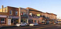 Downtown Croydon, Pennsylvania
Country United States State Pennsylvania County Bucks Township Bristol Elevation 20 ft (6.1 m) Coordinates 40°05′36″N 74°53′57″W / 40.09333°N 74.89917°W Area 2.5 sq mi (6.5 km2) - land 2.5 sq mi (6 km2) - water 0.0 sq mi (0 km2), 0% Population 9,950 (2010) Density 3,980.0 / sq mi (1,536.7 / km2) Timezone EST (UTC-5) - summer (DST) EDT (UTC-4) Area code 215 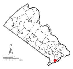 Location of Croydon in Bucks County
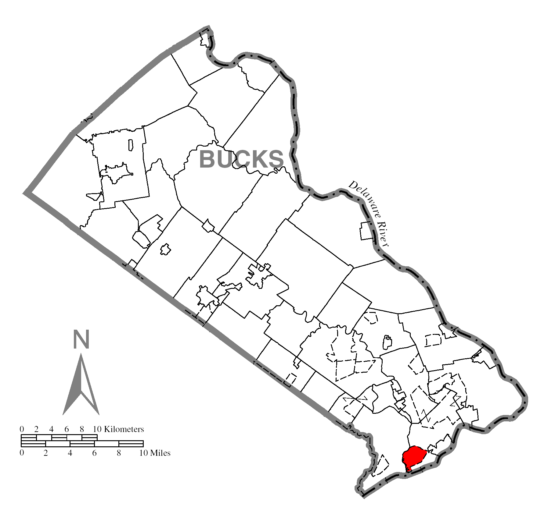
 Location of Croydon in Pennsylvania
 Location of Pennsylvania in the United States
Croydon is a census-designated place located in Bucks County, Pennsylvania. As of the 2010 census, the CDP had a total population of 9,950.[1]
Contents
Law and government
Croydon does not have a central government of its own. It is not organized or incorporated as a town or village. The area known as Croydon is located in Bristol Township. Croydon has an all-volunteer fire company which handles fire, medical, marine, and other calls servicing the community. Croydon uses zip code 19021.
Economy
Several notable mid-size businesses are headquartered in the business district of Croydon, including PAC Industries and Denaq Laptop Batteries.
Geography
Croydon is located at 40°5'36" North, 74°53'57" West (40.093443, -74.899128)[2].
According to the United States Census Bureau, the CDP has a total area of 6.4 km2 (2.5 sq mi), all of it land. Croydon is bordered to the south by Neshaminy Creek, which is tidal, and navigable by small vessels (about a 8 ft (2.4 m) to 6 ft (1.8 m) draft at high tide). There are several private marinas on the Neshaminy, and a Commonwealth of Pennsylvania marina (part of Neshaminy State Park) at the mouth of the creek. The Neshaminy empties into the Delaware River, which borders Croydon to the east, and forms the boundary between Pennsylvania and New Jersey. The Delaware is tidal in Croydon, and is navigable by ocean-going vessels (40 foot marked / maintained channel) as far upriver as Trenton, New Jersey.
Demographics
Historical populations Census Pop. %± 1990 9,967 — 2000 9,993 0.3% 2010 9,950 −0.4% www.dvrpc.org/data/databull/rdb/db82/appedixa.xls As of the 2010 census, Croydon was 82.9% White, 4.8% Black or African American, 0.2% Native American, 2.9% Asian, 0.1% some other race, and 1.6% were two or more races. 7.4% of the population was of Hispanic or Latino ancestry.[1]
As of the census[3] of 2000, there are 9,993 people, 3,735 households, and 2,577 families residing in the CDP. The population density is 4,029.9 people per square mile (1,555.8/km²). There are 3,875 housing units at an average density of 1,562.7/sq mi (603.3/km²). The racial makeup of the CDP is 93.30% White, 2.89% African American, 0.31% Native American, 1.28% Asian, 0.01% Pacific Islander, 1.18% from other races, and 1.03% from two or more races. 3.68% of the population are Hispanic or Latino of any race.
There are 3,735 households out of which 31.7% have children under the age of 18 living with them, 51.4% are married couples living together, 11.3% have a female householder with no husband present, and 31.0% are non-families. 25.3% of all households are made up of individuals and 8.0% have someone living alone who is 65 years of age or older. The average household size is 2.67 and the average family size is 3.24.
In the CDP the population is spread out with 24.6% under the age of 18, 9.5% from 18 to 24, 33.0% from 25 to 44, 22.0% from 45 to 64, and 10.9% who are 65 years of age or older. The median age is 36 years. For every 100 females there are 103.5 males. For every 100 females age 18 and over, there are 100.9 males.
The median income for a household in the CDP is $46,858, and the median income for a family is $55,660. Males have a median income of $37,574 versus $27,069 for females. The per capita income for the CDP is $19,751. 5.7% of the population and 3.9% of families are below the poverty line. Out of the total population, 8.9% of those under the age of 18 and 1.7% of those 65 and older are living below the poverty line.
References
- ^ "Race, Hispanic or Latino, Age, and Housing Occupancy: 2010 Census Redistricting Data (Public Law 94-171) Summary File (QT-PL), Croydon CDP, Pennsylvania". U.S. Census Bureau, American FactFinder 2. http://factfinder2.census.gov. Retrieved August 11, 2011.
- ^ "US Gazetteer files: 2010, 2000, and 1990". United States Census Bureau. 2011-02-12. http://www.census.gov/geo/www/gazetteer/gazette.html. Retrieved 2011-04-23.
- ^ "American FactFinder". United States Census Bureau. http://factfinder.census.gov. Retrieved 2008-01-31.
Categories:- Census-designated places in Bucks County, Pennsylvania


Wikimedia Foundation. 2010.