- Muldrow, Oklahoma
-
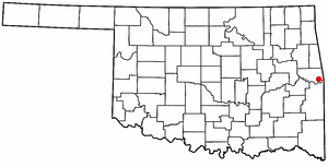
Muldrow, Oklahoma — Town — Location of Muldrow, Oklahoma
Coordinates: 35°24′16″N 94°36′4″W / 35.40444°N 94.60111°WCoordinates: 35°24′16″N 94°36′4″W / 35.40444°N 94.60111°W Country United States State Oklahoma County Sequoyah Area – Total 3.9 sq mi (10.0 km2) – Land 3.9 sq mi (10.0 km2) – Water 0.0 sq mi (0.0 km2) Elevation 505 ft (154 m) Population (2000) – Total 3,104 – Density 805.8/sq mi (311.1/km2) Time zone Central (CST) (UTC-6) – Summer (DST) CDT (UTC-5) ZIP code 74948 Area code(s) 539/918 FIPS code 40-49850[1] GNIS feature ID 1095696[2] Muldrow is a town in Sequoyah County, Oklahoma, United States. It is part of the Fort Smith, Arkansas-Oklahoma Metropolitan Statistical Area. The population was 3,104 at the 2000 census.
The town was named in honor of Henry Lowndes Muldrow, a Mississippi Congressman and personal friend of one of the town's founding fathers. H.L. Muldrow used his influence with the railroad to have a depot located at the townsite.
Contents
Geography
According to the United States Census Bureau, the town has a total area of 3.9 square miles (10 km2), of which 3.8 square miles (9.8 km2) is land and 0.04 square miles (0.10 km2) (0.52%) is water.
Demographics
As of the census[1] of 2000, there were 3,104 people, 1,204 households, and 846 families residing in the town. The population density was 805.8 people per square mile (311.3/km²). There were 1,313 housing units at an average density of 340.8 per square mile (131.7/km²). The racial makeup of the town was 69.59% White, 1.80% African American, 16.43% Native American, 0.29% Asian, 0.06% Pacific Islander, 1.32% from other races, and 10.50% from two or more races. Hispanic or Latino of any race were 3.70% of the population.
There were 1,204 households out of which 32.9% had children under the age of 18 living with them, 51.2% were married couples living together, 15.4% had a female householder with no husband present, and 29.7% were non-families. 26.2% of all households were made up of individuals and 11.7% had someone living alone who was 65 years of age or older. The average household size was 2.54 and the average family size was 3.08.
In the town the population was spread out with 28.1% under the age of 18, 9.1% from 18 to 24, 26.5% from 25 to 44, 22.7% from 45 to 64, and 13.7% who were 65 years of age or older. The median age was 35 years. For every 100 females there were 91.5 males. For every 100 females age 18 and over, there were 83.3 males.
The median income for a household in the town was $26,216, and the median income for a family was $32,083. Males had a median income of $26,603 versus $18,984 for females. The per capita income for the town was $11,918. About 14.1% of families and 18.2% of the population were below the poverty line, including 20.2% of those under age 18 and 21.7% of those age 65 or over.
Notable residents
- Charles Winchester Breedlove, Los Angeles City Council member, 1933–45
- Hometown of Shawntel Smith, Miss America 1996. The main street of the town, a stretch of U.S. Route 64, was re-named Shawntel Smith Boulevard in her honor.
- Hometown of Jordan Morgan, professional poker player. He took 2nd in the 2006 United States Poker Championship and has cashed for over 1.1 million in live tournaments.
References
- ^ a b "American FactFinder". United States Census Bureau. http://factfinder.census.gov. Retrieved 2008-01-31.
- ^ "US Board on Geographic Names". United States Geological Survey. 2007-10-25. http://geonames.usgs.gov. Retrieved 2008-01-31.
Municipalities and communities of Sequoyah County, Oklahoma City 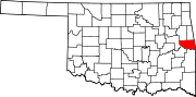
Towns Gans | Gore | Marble City | Moffett | Muldrow | Paradise Hill | Roland | Vian
CDPs Akins | Belfonte | Brent | Brushy | Carlile | Dwight Mission | Evening Shade | Flute Springs | Long | Marble City Community | McKey | Notchietown | Pinhook Corners | Redbird Smith | Remy | Short | Stony Point | Sycamore
Unincorporated
communitiesBaldridge | Blackgum | Blackjack | Box | Cherokee Chute | Cottonwood | Hanson | Harrison | Liberty | Lone Oak | Maple | Nicut | Paw Paw | Redland | Sadie | Seven Oaks | Shady Grove
Categories:- Populated places in Sequoyah County, Oklahoma
- Towns in Oklahoma
- Fort Smith metropolitan area

Wikimedia Foundation. 2010.