- Moffett, Oklahoma
-
Moffett, Oklahoma — Town — Location of Moffett, Oklahoma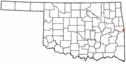
Coordinates: 35°23′23″N 94°26′47″W / 35.38972°N 94.44639°WCoordinates: 35°23′23″N 94°26′47″W / 35.38972°N 94.44639°W Country United States State Oklahoma County Sequoyah Area – Total 0.1 sq mi (0.3 km2) – Land 0.1 sq mi (0.3 km2) – Water 0.0 sq mi (0.0 km2) Elevation 413 ft (126 m) Population (2000) – Total 179 – Density 1,373.2/sq mi (530.2/km2) Time zone Central (CST) (UTC-6) – Summer (DST) CDT (UTC-5) ZIP code 74946 Area code(s) 539/918 FIPS code 40-49000[1] GNIS feature ID 1095465[2] Moffett is a town in Sequoyah County, Oklahoma, United States. It is part of the Fort Smith, Arkansas-Oklahoma Metropolitan Statistical Area. The population was 179 at the 2000 census.
Geography
Moffett is located at 35°23′23″N 94°26′47″W / 35.38972°N 94.44639°W (35.389791, -94.446286)[3].
According to the United States Census Bureau, the town has a total area of 0.1 square miles (0.26 km2), all of it land.
Demographics
As of the census[1] of 2000, there were 179 people, 61 households, and 40 families residing in the town. The population density was 1,373.2 people per square mile (531.6/km²). There were 68 housing units at an average density of 521.7 per square mile (202.0/km²). The racial makeup of the town was 58.10% White, 8.38% African American, 6.15% Native American, and 27.37% from two or more races. Hispanic or Latino of any race were 6.15% of the population.
There were 61 households out of which 34.4% had children under the age of 18 living with them, 37.7% were married couples living together, 14.8% had a female householder with no husband present, and 32.8% were non-families. 27.9% of all households were made up of individuals and 18.0% had someone living alone who was 65 years of age or older. The average household size was 2.93 and the average family size was 3.59.
In the town the population was spread out with 38.5% under the age of 18, 6.1% from 18 to 24, 26.8% from 25 to 44, 19.0% from 45 to 64, and 9.5% who were 65 years of age or older. The median age was 28 years. For every 100 females there were 98.9 males. For every 100 females age 18 and over, there were 107.5 males.
The median income for a household in the town was $16,875, and the median income for a family was $18,750. Males had a median income of $29,500 versus $18,125 for females. The per capita income for the town was $9,743. About 34.1% of families and 42.6% of the population were below the poverty line, including 49.1% of those under the age of eighteen and 39.1% of those sixty five or over.
Notes
- ^ a b "American FactFinder". United States Census Bureau. http://factfinder.census.gov. Retrieved 2008-01-31.
- ^ "US Board on Geographic Names". United States Geological Survey. 2007-10-25. http://geonames.usgs.gov. Retrieved 2008-01-31.
- ^ "US Gazetteer files: 2010, 2000, and 1990". United States Census Bureau. 2011-02-12. http://www.census.gov/geo/www/gazetteer/gazette.html. Retrieved 2011-04-23.
Municipalities and communities of Sequoyah County, Oklahoma City 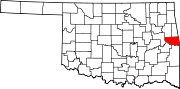
Towns Gans | Gore | Marble City | Moffett | Muldrow | Paradise Hill | Roland | Vian
CDPs Akins | Belfonte | Brent | Brushy | Carlile | Dwight Mission | Evening Shade | Flute Springs | Long | Marble City Community | McKey | Notchietown | Pinhook Corners | Redbird Smith | Remy | Short | Stony Point | Sycamore
Unincorporated
communitiesBaldridge | Blackgum | Blackjack | Box | Cherokee Chute | Cottonwood | Hanson | Harrison | Liberty | Lone Oak | Maple | Nicut | Paw Paw | Redland | Sadie | Seven Oaks | Shady Grove
Categories:- Populated places in Sequoyah County, Oklahoma
- Towns in Oklahoma
- Fort Smith metropolitan area
- Government units that have filed for Chapter 9 bankruptcy

Wikimedia Foundation. 2010.