- Dewar, Oklahoma
-
Dewar, Oklahoma — Town — Location of Dewar, Oklahoma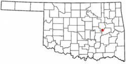
Coordinates: 35°27′32″N 95°56′46″W / 35.45889°N 95.94611°WCoordinates: 35°27′32″N 95°56′46″W / 35.45889°N 95.94611°W Country United States State Oklahoma County Okmulgee Area – Total 0.9 sq mi (2.4 km2) – Land 0.9 sq mi (2.4 km2) – Water 0.0 sq mi (0.0 km2) Elevation 669 ft (204 m) Population (2000) – Total 919 – Density 999.2/sq mi (385.8/km2) Time zone Central (CST) (UTC-6) – Summer (DST) CDT (UTC-5) ZIP code 74431 Area code(s) 539/918 FIPS code 40-20500[1] GNIS feature ID 1092066[2] Dewar is a town in Okmulgee County, Oklahoma, United States. The population was 919 at the 2000 census.
Contents
Geography
Dewar is located at 35°27′32″N 95°56′46″W / 35.45889°N 95.94611°W (35.458946, -95.945973)[3].
According to the United States Census Bureau, the town has a total area of 0.9 square miles (2.3 km2), of which, 0.9 square miles (2.3 km2) of it is land and 1.08% is water.
Demographics
As of the census[1] of 2000, there were 919 people, 344 households, and 261 families residing in the town. The population density was 999.2 people per square mile (385.7/km²). There were 386 housing units at an average density of 419.7 per square mile (162.0/km²). The racial makeup of the town was 71.49% White, 0.33% African American, 19.80% Native American, 0.54% from other races, and 7.83% from two or more races. Hispanic or Latino of any race were 2.07% of the population.
There were 344 households out of which 34.3% had children under the age of 18 living with them, 58.4% were married couples living together, 12.8% had a female householder with no husband present, and 24.1% were non-families. 23.0% of all households were made up of individuals and 14.0% had someone living alone who was 65 years of age or older. The average household size was 2.67 and the average family size was 3.12.
In the town the population was spread out with 27.3% under the age of 18, 10.0% from 18 to 24, 24.8% from 25 to 44, 24.5% from 45 to 64, and 13.4% who were 65 years of age or older. The median age was 35 years. For every 100 females there were 93.9 males. For every 100 females age 18 and over, there were 92.0 males.
The median income for a household in the town was $30,000, and the median income for a family was $35,417. Males had a median income of $27,625 versus $18,036 for females. The per capita income for the town was $12,188. About 11.5% of families and 15.2% of the population were below the poverty line, including 22.6% of those under age 18 and 17.4% of those age 65 or over.
References
- ^ a b "American FactFinder". United States Census Bureau. http://factfinder.census.gov. Retrieved 2008-01-31.
- ^ "US Board on Geographic Names". United States Geological Survey. 2007-10-25. http://geonames.usgs.gov. Retrieved 2008-01-31.
- ^ "US Gazetteer files: 2010, 2000, and 1990". United States Census Bureau. 2011-02-12. http://www.census.gov/geo/www/gazetteer/gazette.html. Retrieved 2011-04-23.
External links
Municipalities and communities of Okmulgee County, Oklahoma Cities 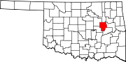
Towns Dewar | Grayson | Hoffman | Liberty‡ | Schulter | Winchester
Unincorporated
communitiesBaldhill | Bartlett | Bryant | Coalton | Dighton | Eram | Four Corners | Gulftown | Kusa | Natura | Nuyaka | Preston | Pumpkin Center | Spelter City | Wilson
Footnotes ‡This populated place also has portions in an adjacent county or counties
Categories:- Populated places in Okmulgee County, Oklahoma
- Towns in Oklahoma


Wikimedia Foundation. 2010.