- Smithfield, Ohio
Infobox Settlement
official_name = Smithfield, Ohio
settlement_type = Village
nickname =
motto =
imagesize =
image_caption =
image_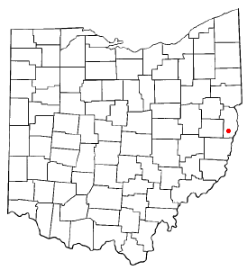
mapsize = 250px
map_caption = Location of Smithfield, Ohio
mapsize1 =
map_caption1 =subdivision_type = Country
subdivision_name =United States
subdivision_type1 = State
subdivision_name1 =Ohio
subdivision_type2 = County
subdivision_name2 = Jeffersongovernment_footnotes =
government_type =
leader_title =
leader_name =
leader_title1 =
leader_name1 =
established_title =
established_date =unit_pref = Imperial
area_footnotes =area_magnitude =
area_total_km2 = 2.5
area_land_km2 = 2.5
area_water_km2 = 0.0
area_total_sq_mi = 1.0
area_land_sq_mi = 1.0
area_water_sq_mi = 0.0population_as_of = 2000
population_footnotes =
population_total = 867
population_density_km2 = 349.2
population_density_sq_mi = 904.5timezone = Eastern (EST)
utc_offset = -5
timezone_DST = EDT
utc_offset_DST = -4
elevation_footnotes = GR|3
elevation_m = 380
elevation_ft = 1247
latd = 40 |latm = 16 |lats = 15 |latNS = N
longd = 80 |longm = 46 |longs = 50 |longEW = Wpostal_code_type =
ZIP code
postal_code = 43948
area_code = 740
blank_name = FIPS code
blank_info = 39-72760GR|2
blank1_name = GNIS feature ID
blank1_info = 1065337GR|3
website =
footnotes =Smithfield is a village in Jefferson County,
Ohio ,United States . The population was 867 at the 2000 census.During
Morgan's Raid , a decisive Union victory in the Civil War in 1863, Confederate Brid. Gen.John Hunt Morgan traveled through the Moorefield, Harrisville, New Athens,
Smithfield, New Alexandria, Wintersville, Two Ridge, Richmond, East Springfield, Bergholz, and Monroeville on his way to defeat at theBattle of Salineville .United States Senator William Sharon fromNevada was born in Smithfield onJanuary 9 ,1821 .Geography
Smithfield is located at coor dms|40|16|15|N|80|46|50|W|city (40.270853, -80.780493)GR|1.
According to the
United States Census Bureau , the village has a total area of 1.0square mile s (2.5km² ), all of it land.Demographics
As of the
census GR|2 of 2000, there were 867 people, 358 households, and 230 families residing in the village. Thepopulation density was 904.5 people per square mile (348.7/km²). There were 405 housing units at an average density of 422.5/sq mi (162.9/km²). The racial makeup of the village was 86.97% White, 9.80% African American, 0.12% Native American, 0.35% from other races, and 2.77% from two or more races. Hispanic or Latino of any race were 0.23% of the population.There were 358 households out of which 27.4% had children under the age of 18 living with them, 48.9% were married couples living together, 11.5% had a female householder with no husband present, and 35.5% were non-families. 32.1% of all households were made up of individuals and 15.6% had someone living alone who was 65 years of age or older. The average household size was 2.34 and the average family size was 2.90.
In the village the population was spread out with 24.1% under the age of 18, 6.0% from 18 to 24, 26.1% from 25 to 44, 24.0% from 45 to 64, and 19.8% who were 65 years of age or older. The median age was 40 years. For every 100 females there were 90.5 males. For every 100 females age 18 and over, there were 82.8 males.
The median income for a household in the village was $25,179, and the median income for a family was $30,833. Males had a median income of $33,500 versus $17,813 for females. The
per capita income for the village was $13,734. About 21.4% of families and 28.8% of the population were below thepoverty line , including 37.0% of those under age 18 and 19.1% of those age 65 or over.References
External links
Wikimedia Foundation. 2010.