- Churchs Ferry, North Dakota
-
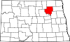
Churchs Ferry, North Dakota — City — Location of Churchs Ferry, North Dakota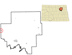
Coordinates: 48°16′8″N 99°11′47″W / 48.26889°N 99.19639°WCoordinates: 48°16′8″N 99°11′47″W / 48.26889°N 99.19639°W Country United States State North Dakota County Ramsey Area – Total 0.4 sq mi (1.1 km2) – Land 0.4 sq mi (1.1 km2) – Water 0.0 sq mi (0.0 km2) Elevation 1,450 ft (442 m) Population (2010)[1] – Total 12 – Density 178.2/sq mi (68.8/km2) Time zone Central (CST) (UTC-6) – Summer (DST) CDT (UTC-5) ZIP code 58325 Area code(s) 701 FIPS code 38-14140[2] GNIS feature ID 1028374[3] Churchs Ferry is a city in Ramsey County, North Dakota, in the United States that has been swallowed up by the expansion of nearby Devils Lake. The population was 12 at the 2010 census.[1] Churchs Ferry was founded in 1886.
Contents
Geography
Churchs Ferry is located at 48°16′8″N 99°11′47″W / 48.26889°N 99.19639°W (48.268898, -99.196487)[4].
According to the United States Census Bureau, the city has a total area of 0.4 square miles (1.0 km2), all of it land.
Demographics
As of the census[2] of 2000, there were 77 people, 33 households, and 26 families residing in the city. The population density was 178.2 people per square mile (69.1/km²). There were 46 housing units at an average density of 106.5 per square mile (41.3/km²). The racial makeup of the city was 100.00% White.
There were 33 households out of which 21.2% had children under the age of 18 living with them, 63.6% were married couples living together, 9.1% had a female householder with no husband present, and 21.2% were non-families. 21.2% of all households were made up of individuals and 12.1% had someone living alone who was 65 years of age or older. The average household size was 2.33 and the average family size was 2.50.
In the city the population was spread out with 19.5% under the age of 18, 3.9% from 18 to 24, 23.4% from 25 to 44, 36.4% from 45 to 64, and 16.9% who were 65 years of age or older. The median age was 48 years. For every 100 females there were 102.6 males. For every 100 females age 18 and over, there were 106.7 males.
The median income for a household in the city was $33,438, and the median income for a family was $60,313. Males had a median income of $30,625 versus $33,750 for females. The per capita income for the city was $18,327. None of the population and none of the families were below the poverty line.
Historical populations Census Pop. %± 1900 264 — 1910 457 73.1% 1920 353 −22.8% 1930 295 −16.4% 1940 244 −17.3% 1950 223 −8.6% 1960 161 −27.8% 1970 139 −13.7% 1980 139 0% 1990 118 −15.1% 2000 77 −34.7% 2010 12 −84.4% U.S. Decennial Census History
The waters level in Devils Lake began rising in the early 1990s, and more than 400 homes around the lake have been relocated or destroyed. This includes the city of Churchs Ferry, one of two municipalities that have been bought out by government agencies. The other is Penn, although some people remain in both communities.
Devils Lake keeps getting larger because it has no natural river or stream to carry away excess rain and snowmelt.
References
- ^ a b "2010 Census Redistricting Data (Public Law 94-171) Summary File". American FactFinder. United States Census Bureau. http://factfinder2.census.gov/faces/tableservices/jsf/pages/productview.xhtml?pid=DEC_10_PL_GCTPL2.ST13&prodType=table. Retrieved 2 May 2011.
- ^ a b "American FactFinder". United States Census Bureau. http://factfinder.census.gov. Retrieved 2008-01-31.
- ^ "US Board on Geographic Names". United States Geological Survey. 2007-10-25. http://geonames.usgs.gov. Retrieved 2008-01-31.
- ^ "US Gazetteer files: 2010, 2000, and 1990". United States Census Bureau. 2011-02-12. http://www.census.gov/geo/www/gazetteer/gazette.html. Retrieved 2011-04-23.
Municipalities and communities of Ramsey County, North Dakota Cities Brocket | Churchs Ferry | Crary | Devils Lake | Edmore | Hampden | Lawton | Starkweather
Townships Bartlett | Cato | Chain Lakes | Coulee | Creel | De Groat | Dry Lake | Fancher | Freshwater | Grand Harbor | Hammer | Harding | Highland Center | Hope | Klingstrup | Lawton | Lillehoff | Minnewaukan | Morris | Newbre | Newland | Noonan | North Creel | Northfield | Odessa | Ontario | Overland | Pelican | Poplar Grove | Prospect | Royal | South Minnewaukan | Stevens | Sullivan | Triumph | Webster
Unincorporated
communitiesCategories:- Cities in North Dakota
- Populated places in Ramsey County, North Dakota
- Populated places established in 1886


Wikimedia Foundation. 2010.