- McHenry, North Dakota
-
This article is about the city of McHenry. For the county, see McHenry County, North Dakota.
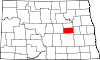
McHenry, North Dakota — City — Location of McHenry, North Dakota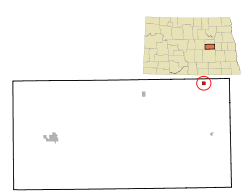
Coordinates: 47°34′33″N 98°35′22″W / 47.57583°N 98.58944°WCoordinates: 47°34′33″N 98°35′22″W / 47.57583°N 98.58944°W Country United States State North Dakota County Foster Area – Total 0.3 sq mi (0.7 km2) – Land 0.3 sq mi (0.7 km2) – Water 0.0 sq mi (0.0 km2) Elevation 1,509 ft (460 m) Population (2010)[1] – Total 56 – Density 276.0/sq mi (106.6/km2) Time zone Central (CST) (UTC-6) – Summer (DST) CDT (UTC-5) ZIP code 58464 Area code(s) 701 FIPS code 38-49260[2] GNIS feature ID 1030147[3] McHenry is a city in Foster County, North Dakota in the United States. The population was 56 at the 2010 census.[1] McHenry was founded in 1899.
Geography
McHenry is located at 47°34′33″N 98°35′22″W / 47.57583°N 98.58944°W (47.575845, -98.589541)[4].
According to the United States Census Bureau, the city has a total area of 0.3 square miles (0.78 km2), all of it land.
Demographics
Historical populations Census Pop. %± 1910 398 — 1920 299 −24.9% 1930 219 −26.8% 1940 250 14.2% 1950 189 −24.4% 1960 155 −18.0% 1970 152 −1.9% 1980 113 −25.7% 1990 85 −24.8% 2000 71 −16.5% 2010 56 −21.1% U.S. Decennial Census As of the census[2] of 2000, there were 71 people, 36 households, and 27 families residing in the city. The population density was 276.0 people per square mile (105.4/km²). There were 45 housing units at an average density of 174.9 per square mile (66.8/km²). The racial makeup of the city was 98.59% White, and 1.41% from two or more races. Hispanic or Latino of any race were 1.41% of the population.
There were 36 households out of which 11.1% had children under the age of 18 living with them, 66.7% were married couples living together, 5.6% had a female householder with no husband present, and 25.0% were non-families. 22.2% of all households were made up of individuals and 19.4% had someone living alone who was 65 years of age or older. The average household size was 1.97 and the average family size was 2.22.
In the city the population was spread out with 8.5% under the age of 18, 4.2% from 18 to 24, 12.7% from 25 to 44, 26.8% from 45 to 64, and 47.9% who were 65 years of age or older. The median age was 64 years. For every 100 females there were 91.9 males. For every 100 females age 18 and over, there were 85.7 males.
The median income for a household in the city was $26,250, and the median income for a family was $27,813. Males had a median income of $57,917 versus $27,917 for females. The per capita income for the city was $14,702. There were 4.3% of families and 16.7% of the population living below the poverty line, including 100.0% of under eighteens and 5.4% of those over 64.
References
- ^ a b "2010 Census Redistricting Data (Public Law 94-171) Summary File". American FactFinder. United States Census Bureau. http://factfinder2.census.gov/faces/tableservices/jsf/pages/productview.xhtml?pid=DEC_10_PL_GCTPL2.ST13&prodType=table. Retrieved 2 May 2011.
- ^ a b "American FactFinder". United States Census Bureau. http://factfinder.census.gov. Retrieved 2008-01-31.
- ^ "US Board on Geographic Names". United States Geological Survey. 2007-10-25. http://geonames.usgs.gov. Retrieved 2008-01-31.
- ^ "US Gazetteer files: 2010, 2000, and 1990". United States Census Bureau. 2011-02-12. http://www.census.gov/geo/www/gazetteer/gazette.html. Retrieved 2011-04-23.
Municipalities and communities of Foster County, North Dakota Cities Carrington | Glenfield | Grace City | McHenry
Townships Birtsell | Bordulac | Bucephalia | Carrington | Eastman | Estabrook | Florance | Glenfield | Haven | Larrabee | Longview | McHenry | McKinnon | Melville | Nordmore | Rolling Prairie | Rose Hill | Wyard
Unincorporated
communitiesBarlow | Bordulac | Guptill | Juanita | Lemert | Melville
Categories:- Cities in North Dakota
- Populated places in Foster County, North Dakota
- Populated places established in 1899


Wikimedia Foundation. 2010.