- Clayrack Drainage Mill
-
Clayrack Drainage Windmill Windmill 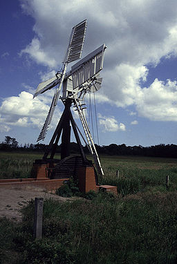 Clayrack Drainage Windmill
Country England State Norfolk Region East of England District North Norfolk Municipality Ludham Location On the east bank of the River Ant 
 Clayrack Drainage Windmill within Norfolk
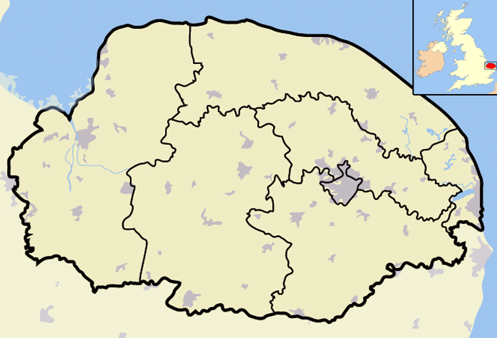
grid reference TG369193 Clayrack Drainage Windmill is located at How Hill in the English county of Norfolk [1] . It is on the east bank of the River Ant close to How Hill House, a large Edwardian building which houses the Norfolk Broads Study Centre[2] . The Drainage mill is 1¾ miles west of the village of Ludham.
Description
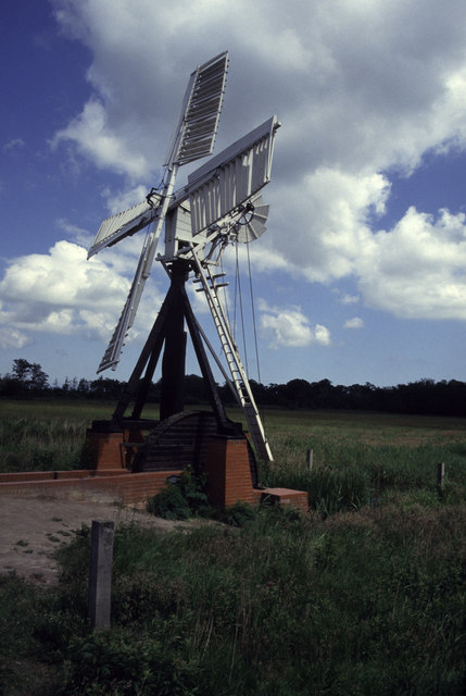
Clayrack Drainage Windmill is of an interesting design being one of only two ‘Hollow Post’ drainage mills left on the broads and the only one fitted with a scoop wheel. The mill has a miniature cap, sails and fantail based on its more traditional big brother tower drainage mills which can be seen on other parts of the Norfolk Broads.Just to the south of this windmill on the same side of the river Ant is another small interesting drainage windmill called Boardman’s Windmill. Clayrack takes its name from the Fen it stands on.
History
Clayrack drainage windmill is not on its original position. It was moved in 1981 from its previous site on Ranworth Marshes 2¾ miles away on the other bank of the River Ant. The mill was in a terrible state of repair and was in danger of being lost for ever. It was decided that it was worth saving and a restoration program was set up. As Ranworth marsh hosted many nesting birds who would have been vulnerable to any disturbance caused by the work the decision was taken to move Clayrack windpump to its present position at How Hilll. Now fully restored the mill can sometimes be seen operating in its original capacity as a drainage pump.
References
- ^ OS Explorer Map OL40” – The Broads. ISBN 0-319-23769-9 .
- ^ The Norfolk Windmill Trust, Windmills to Visit Guide. 3rd Edition 1982. Page 16, The Morris Printing Co Ltd 57-61 Pitt Street Norwich, Description & Location Details
Coordinates: 52°43′10″N 1°30′23″E / 52.71944°N 1.50635°E

This article about a Norfolk building or structure is a stub. You can help Wikipedia by expanding it.