- Mount Pleasant, North Carolina
-
Mount Pleasant, North Carolina — Town — Location of MountPleasant, North Carolina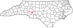
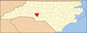
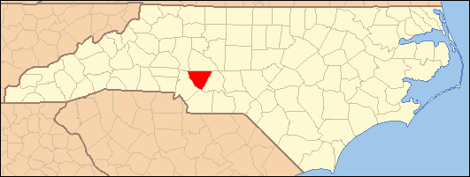
Coordinates: 35°24′13″N 80°26′8″W / 35.40361°N 80.43556°WCoordinates: 35°24′13″N 80°26′8″W / 35.40361°N 80.43556°W Country United States State North Carolina County Cabarrus Area - Total 1.4 sq mi (3.6 km2) - Land 1.4 sq mi (3.6 km2) - Water 0.0 sq mi (0.0 km2) Elevation 650 ft (198 m) Population (2000) - Total 1,259 - Density 900.7/sq mi (347.7/km2) Time zone Eastern (EST) (UTC-5) - Summer (DST) EDT (UTC-4) ZIP code 28124 Area code(s) 704 FIPS code 37-45140[1] GNIS feature ID 0990517[2] Website www.townofmountpleasantnc.org Mount Pleasant is a town located in eastern Cabarrus County, North Carolina, in the United States. As of the 2000 census, the town population was 1,259. The town center is located at the crossroads of Mount Pleasant Road and NC Hwy. 73. NC Hwy. 49 also skirts the town to the north on its way from Charlotte to Asheboro. The town is an important reference point along the road from Charlotte, the largest city in the Carolinas and Raleigh, the North Carolina state capital. The town is also an important point on NC Hwy. 73 between Concord and Albemarle. The town was once the site of North Carolina College, a Lutheran College for men which closed in 1902 and later became Mt. Pleasant Collegiate Institute, and the Mount Amoena Seminary, a Lutheran finishing school for women (1859–1927). The Eastern Cabarrus Historical Museum is located in the old Administration building of the NC College. The town is home to Mount Pleasant Elementary, Middle, and High Schools, which serve most of the families of eastern Cabarrus County.
Contents
Geography
Mount Pleasant is located at 35°24′13″N 80°26′8″W / 35.40361°N 80.43556°W (35.403734, -80.435478).[3]
According to the United States Census Bureau, the town has a total area of 1.4 square miles (3.6 km²), all of it land.
Demographics
As of the census[1] of 2000, there were 1,259 people, 473 households, and 353 families residing in the town. The population density was 900.7 people per square mile (347.2/km²). There were 521 housing units at an average density of 372.7 per square mile (143.7/km²). The racial makeup of the town was 93.09% White, 5.88% African American, 0.32% Asian, and 0.71% from two or more races. Hispanic or Latino of any race were 0.24% of the population.
There were 473 households out of which 35.3% had children under the age of 18 living with them, 61.3% were married couples living together, 10.4% had a female householder with no husband present, and 25.2% were non-families. 21.6% of all households were made up of individuals and 9.3% had someone living alone who was 65 years of age or older. The average household size was 2.55 and the average family size was 3.00.
In the town the population was spread out with 25.2% under the age of 18, 6.3% from 18 to 24, 30.7% from 25 to 44, 21.5% from 45 to 64, and 16.3% who were 65 years of age or older. The median age was 38 years. For every 100 females there were 88.2 males. For every 100 females age 18 and over, there were 80.5 males.
The median income for a household in the town was $48,207, and the median income for a family was $55,568. Males had a median income of $36,900 versus $25,357 for females. The per capita income for the town was $21,556. About 2.3% of families and 6.7% of the population were below the poverty line, including 1.9% of those under age 18 and 21.0% of those age 65 or over.
References
- ^ a b "American FactFinder". United States Census Bureau. http://factfinder.census.gov. Retrieved 2008-01-31.
- ^ "US Board on Geographic Names". United States Geological Survey. 2007-10-25. http://geonames.usgs.gov. Retrieved 2008-01-31.
- ^ "US Gazetteer files: 2010, 2000, and 1990". United States Census Bureau. 2011-02-12. http://www.census.gov/geo/www/gazetteer/gazette.html. Retrieved 2011-04-23.
External links
Municipalities and communities of Cabarrus County, North Carolina County seat: Concord Cities Concord | Locust‡ | Kannapolis‡
Towns Harrisburg | Midland‡ | Mount Pleasant
Unincorporated
communityOdell School | Rimertown
Footnotes ‡This populated place also has portions in an adjacent county or counties
Categories:- Populated places in Cabarrus County, North Carolina
- Towns in North Carolina

Wikimedia Foundation. 2010.