- Shire of Mansfield (former)
Infobox Australian Place | type = lga
name = Shire of Mansfield
state = vic
region =
area = 3919.10
est = 1865
seat = Mansfield
pop = 6100 (1992) [cite book|title=Victorian Year Book|author=Australian Bureau of Statistics, Victoria Office|year=1994|page=52|id=ISSN 0067-1223]
logosize =
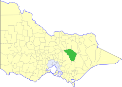
caption = Location in Victoria
county = Anglesey, Delatite, Tanjil, Wonnangatta
near-nw = Euroa
near-n = Benalla
near-ne = Oxley
near-w = Alexandra
near-e = Maffra
near-sw = Upper Yarra
near-s = Narracan
near-se = Maffra
_noautocat = yesThe Shire of Mansfield was a Local Government Area located about convert|185|km|mi|0 northeast of
Melbourne , the state capital of Victoria,Australia . The shire covered an area of convert|3919.10|km2|sqmi|1, and existed from 1865 until 1994.History
Mansfield was first incorporated as a district on 6 January 1865, and became a shire on 31 December 1866. On 30 May 1919, it annexed part of the Shire of Howqua as the Howqua Riding.cite book|title=Victorian Municipal Directory|year=1992|publisher=Arnall & Jackson|location=Brunswick|pages=753-754 Accessed at
State Library of Victoria , La Trobe Reading Room.]On 18 November 1994, the Shire was abolished, and merged with the City and
Shire of Benalla and the Warrenbayne district of Violet Town into theShire of Delatite . [cite book|url=http://www.ausstats.abs.gov.au/ausstats/free.nsf/0/76E601D6DB55E88ACA25722500049195/$File/12570_1994-95.pdf|title=Victorian local government amalgamations 1994-1995: Changes to the Australian Standard Geographical Classification|author=Australian Bureau of Statistics |date=1 August 1995|publisher=Commonwealth of Australia|page=5|isbn=0-642-23117-6|accessdate=2008-01-05]Wards
Mansfield was divided into four ridings in 1990, each of which elected three councillors:
* Central Riding
* Alpine Riding
* Delatite Riding
* Midland RidingTowns and Localities
* Mansfield
* Ancona
* Bonnie Doon
* Gaffneys Creek
* Goughs Bay
* Jamieson
* Kevington
* Maindample
* Matlock
* Merrijig
* Merton
* Mount Buller
* Tolmie
* Woodfield
* Woods PointPopulation
* Estimate in the 1958 Victorian Year Book.
References
Wikimedia Foundation. 2010.