- Shire of Alexandra
Infobox Australian Place | type = lga
name = Shire of Alexandra
state = vic
region =
area = 2197.31
est = 1868
seat = Alexandra
pop = 6,120 (1992) [cite book|title=Victorian Year Book|author=Australian Bureau of Statistics, Victoria Office|year=1994|page=52|id=ISSN 0067-1223]
logosize =
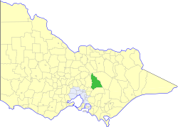
caption = Location in Victoria
county = Anglesey, Evelyn
near-nw = Euroa
near-n = Euroa
near-ne = Mansfield
near-w = Yea
near-e = Mansfield
near-sw = Healesville
near-s = Upper Yarra
near-se = Upper Yarra
_noautocat = yesThe Shire of Alexandra was a Local Government Area located about convert|130|km|mi|0 northeast of
Melbourne , the state capital of Victoria,Australia . The shire covered an area of convert|2197.31|km2|sqmi|1, and existed from 1868 until 1994.History
Alexandra was first incorporated as a district on 30 June 1868, and became a shire on 3 September 1869. Its boundaries changed a number of times throughout its existence:cite book|title=Victorian Municipal Directory|year=1992|publisher=Arnall & Jackson|location=Brunswick|pages=562-563 Accessed at
State Library of Victoria , La Trobe Reading Room.]
* 20 May 1914 - Annexed part of the North Riding of theShire of Yea .
* 1 October 1963 - Lost part toShire of Euroa .
* 1 October 1963 - Annexed part ofShire of Healesville around Buxton.
* 1 October 1984 - Annexed the East Riding of the Shire of Healesville.On 18 November 1994, the Shire was abolished, and merged with Yea and parts of Eltham, Broadford, Euroa, Healesville and Whittlesea into the new
Shire of Murrindindi . [cite book|url=http://www.ausstats.abs.gov.au/ausstats/free.nsf/0/76E601D6DB55E88ACA25722500049195/$File/12570_1994-95.pdf|title=Victorian local government amalgamations 1994-1995: Changes to the Australian Standard Geographical Classification|author=Australian Bureau of Statistics |date=1 August 1995|publisher=Commonwealth of Australia|page=10|isbn=0-642-23117-6|accessdate=2008-01-05]Wards
Alexandra was divided into three ridings on 3 August 1985, each of which elected three councillors. Prior to this, it was divided into five ridings in May 1957.
* Central Riding
* North East Riding
* South RidingTowns and Localities
* Alexandra
* Acheron
* Buxton (transferred from Healesville 1963)
* Cathkin
* Eildon
* Fawcett
* Gobur
* Kanumbra
* Koriella
* Marysville
* Narbethong
* Rubicon
* St Filians
* Snobs Creek
* Taggerty
* Thornton
* YarckPopulation
* Estimate in the 1958 Victorian Year Book.
References
External links
* [http://web.archive.org/web/20030424085858/www.arts.monash.edu.au/ncas/multimedia/gazetteer/list/alexandra.html Australian Places - Alexandra]
Wikimedia Foundation. 2010.