- Oppenheim, New York
-
Oppenheim, New York — Town — Location within the state of New York
 Oppenheim, New York
Coordinates: 43°4′54″N 74°42′3″W / 43.08167°N 74.70083°W Country United States State New York County Fulton Government - Type Town Council - Town Supervisor George E. Capek (R) - Town Council Members' ListArea - Total 56.5 sq mi (146.2 km2) - Land 56.3 sq mi (145.7 km2) - Water 0.2 sq mi (0.5 km2) Elevation 1,115 ft (340 m) Population (2000) - Total 1,774 - Density 31.5/sq mi (12.2/km2) Time zone Eastern (EST) (UTC-5) - Summer (DST) EDT (UTC-4) FIPS code 36-55101 GNIS feature ID 0979314 Oppenheim is a town in Fulton County, New York, United States. The town is at the western border of the county and is east of Utica. The population was 1,774 at the 2000 census.
Contents
History
The town was first settled around 1791 by Palatine Germans from Oppenheim, Germany.
Oppenheim was established in 1808 from the Town of Palatine in Montgomery County before the formation of Fulton County. When Fulton County was formed in 1838, the south part of Oppenheim was used to form the Town of St. Johnsville, which remained in Montgomery County.
The early occupations of townspeople were associated with dairy and cheese-making activities.
Geography
According to the United States Census Bureau, the town has a total area of 56.5 square miles (146 km2), of which, 56.3 square miles (146 km2) of it is land and 0.2 square miles (0.52 km2) of it (0.32%) is water.
The northern part of the town is in the Adirondack Park. The west town line is the border of Herkimer County and the south town line is the border of Montgomery County.
East Canada Creek is A stream defining the west town line.
New York State Route 29 is an east-west highway across Oppenheim. New York State Route 331, a north-south highway, intersects NY-29 at Oppenheim village.
Demographics
As of the census[1] of 2000, there were 1,774 people, 685 households, and 493 families residing in the town. The population density was 31.5 people per square mile (12.2/km²). There were 858 housing units at an average density of 15.2 per square mile (5.9/km²). The racial makeup of the town was 98.31% White, 0.73% African American, 0.17% Native American, 0.23% Asian, 0.11% from other races, and 0.45% from two or more races. Hispanic or Latino of any race were 0.68% of the population.
There were 685 households out of which 32.6% had children under the age of 18 living with them, 54.0% were married couples living together, 8.8% had a female householder with no husband present, and 28.0% were non-families. 23.1% of all households were made up of individuals and 8.9% had someone living alone who was 65 years of age or older. The average household size was 2.54 and the average family size was 2.94.
In the town the population was spread out with 25.0% under the age of 18, 7.3% from 18 to 24, 29.6% from 25 to 44, 25.0% from 45 to 64, and 13.1% who were 65 years of age or older. The median age was 38 years. For every 100 females there were 106.0 males. For every 100 females age 18 and over, there were 102.6 males.
The median income for a household in the town was $31,284, and the median income for a family was $34,306. Males had a median income of $26,289 versus $19,427 for females. The per capita income for the town was $13,504. About 9.7% of families and 12.4% of the population were below the poverty line, including 14.8% of those under age 18 and 6.3% of those age 65 or over.
Communities and locations in Oppenheim
- Crum Creek – (1) A hamlet near the south town line on NY-331 and Crum Creek; and (2) A stream that flows through the town southward through the town. The former Crum Creek Evangelical Lutheran Church was listed on the National Register of Historic Places in 2010.[2]
- Doxtater Corner – A hamlet in the northwest part of the town, northeast of Rasbach Corners.
- Dolgeville (formerly "Brocketts Bridge") – Part of the Village of Dolgeville is at the western town line at East Canada Creek and NY-29.
- Ingham Mills – A hamlet on the west town line on County Road 108.
- Kringsbush – A hamlet by the south town line in the southwest part of the town.
- Kyser Lake – A wide part of the East Canada Creek, north of Ingham Mills.
- Lotville – A hamlet in the north part of the town, located between Doxtater Corners and Phipps Corners.
- Middle Sprite – A hamlet by the north town line, inside the Adirondack Park.
- Oppenheim – The hamlet of Oppenheim at the junction of Routes NY-29 and NY-331, west of Crum Creek.
- Phipps Corners – A location east of Lotville and north of Oppenheim hamlet.
- Rasbach Corners – A hamlet in the northwest part of the town, east of Dolgeville.
References
- ^ "American FactFinder". United States Census Bureau. http://factfinder.census.gov. Retrieved 2008-01-31.
- ^ "National Register of Historic Places". WEEKLY LIST OF ACTIONS TAKEN ON PROPERTIES: 7/19/10 THROUGH 7/23/10. National Park Service. 2010-07-30. http://www.nps.gov/history/nr/listings/20100730.htm.
External links
Coordinates: 43°04′20″N 74°41′34″W / 43.07222°N 74.69278°W
Municipalities and communities of Fulton County, New York County seat: Johnstown Cities 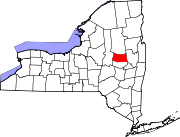
Towns Bleecker | Broadalbin | Caroga | Ephratah | Johnstown | Mayfield | Northampton | Oppenheim | Perth | Stratford
Villages Broadalbin | Dolgeville‡ | Mayfield | Northville
Footnotes ‡This populated place also has portions in an adjacent county or counties
Categories:- Towns in New York
- Populated places in Fulton County, New York


Wikimedia Foundation. 2010.