- Manzano, New Mexico
-
Manzano, New Mexico — CDP — Location of Manzano, New Mexico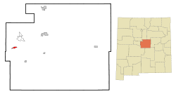
Coordinates: 34°39′2″N 106°20′54″W / 34.65056°N 106.34833°WCoordinates: 34°39′2″N 106°20′54″W / 34.65056°N 106.34833°W Country United States State New Mexico County Torrance Area – Total 1.7 sq mi (4.4 km2) – Land 1.7 sq mi (4.4 km2) – Water 0.0 sq mi (0.0 km2) Elevation 6,860 ft (2,091 m) Population (2000) – Total 54 – Density 32.0/sq mi (12.4/km2) Time zone Mountain (MST) (UTC-7) – Summer (DST) MDT (UTC-6) Area code(s) 505 FIPS code 35-46730 GNIS feature ID 0918244 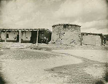 Adobe homes with torreon (defensive tower), Manzano, circa 1900
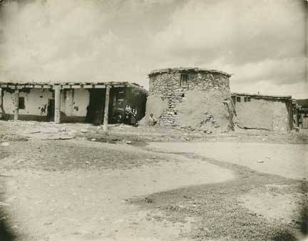
Manzano is a census-designated place (CDP) in Torrance County, New Mexico, United States. The population was 54 at the 2000 census. The Quarai Ruins of Salinas Pueblo Missions National Monument are located near the town. The center of population of New Mexico is located in Manzano [1].
Manzano is part of the Albuquerque Metropolitan Statistical Area. Manzano in spanish language mean Apple tree.
Contents
Geography
Manzano is located at 34°39′2″N 106°20′54″W / 34.65056°N 106.34833°W (34.650510, -106.348236)[1].
According to the United States Census Bureau, the CDP has a total area of 1.7 square miles (4.4 km2), all of it land.
Demographics
As of the census[2] of 2000, there were 54 people, 17 households, and 12 families residing in the CDP. The population density was 32.0 people per square mile (12.3/km²). There were 22 housing units at an average density of 13.1 per square mile (5.0/km²). The racial makeup of the CDP was 55.56% White, 31.48% Native American, 11.11% from other races, and 1.85% from two or more races. Hispanic or Latino of any race were 87.04% of the population.
There were 17 households out of which 41.2% had children under the age of 18 living with them, 41.2% were married couples living together, 11.8% had a female householder with no husband present, and 29.4% were non-families. 23.5% of all households were made up of individuals and 5.9% had someone living alone who was 65 years of age or older. The average household size was 3.18 and the average family size was 3.75.
In the CDP the population was spread out with 31.5% under the age of 18, 7.4% from 18 to 24, 22.2% from 25 to 44, 18.5% from 45 to 64, and 20.4% who were 65 years of age or older. The median age was 40 years. For every 100 females there were 170.0 males. For every 100 females age 18 and over, there were 105.6 males.
The median income for a household in the CDP was $13,750, and the median income for a family was $19,375. Males had a median income of $33,750 versus $0 for females. The per capita income for the CDP was $5,935. There were 35.0% of families and 37.7% of the population living below the poverty line, including 38.5% of under eighteens and 50.0% of those over 64.
References
- ^ "US Gazetteer files: 2010, 2000, and 1990". United States Census Bureau. 2011-02-12. http://www.census.gov/geo/www/gazetteer/gazette.html. Retrieved 2011-04-23.
- ^ "American FactFinder". United States Census Bureau. http://factfinder.census.gov. Retrieved 2008-01-31.
See also
- Torreon, Torrance County, New Mexico was named for the torreons at Manzano.
Municipalities and communities of Torrance County, New Mexico City 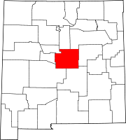
Towns Village CDPs Unincorporated
communitiesCategories:- Census-designated places in New Mexico
- Populated places in Torrance County, New Mexico
- Albuquerque metropolitan area
- Populated places in New Mexico with Hispanic majority populations


Wikimedia Foundation. 2010.