- Willard, New Mexico
Infobox Settlement
official_name = Willard, New Mexico
settlement_type = Village
nickname =
motto =
imagesize =
image_caption =
image_
imagesize =
image_caption =
image_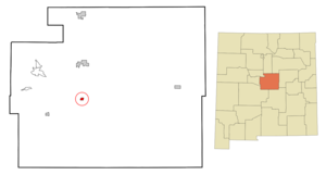
mapsize = 250px
map_caption = Location of Willard, New Mexico
mapsize1 =
map_caption1 =subdivision_type = Country
subdivision_name =United States
subdivision_type1 = State
subdivision_name1 =New Mexico
subdivision_type2 = County
subdivision_name2 = Torrance
government_footnotes =
government_type =
leader_title =
leader_name =
leader_title1 =
leader_name1 =
established_title =
established_date =unit_pref = Imperial
area_footnotes =area_magnitude =
area_total_km2 = 2.0
area_land_km2 = 2.0
area_water_km2 = 0.0
area_total_sq_mi = 0.8
area_land_sq_mi = 0.8
area_water_sq_mi = 0.0population_as_of = 2000
population_footnotes =
population_total = 240
population_density_km2 = 119.9
population_density_sq_mi = 310.5timezone = Mountain (MST)
utc_offset = -7
timezone_DST = MDT
utc_offset_DST = -6
elevation_footnotes =
elevation_m = 1859
elevation_ft = 6099
latd = 34 |latm = 35 |lats = 47 |latNS = N
longd = 106 |longm = 1 |longs = 59 |longEW = Wpostal_code_type =
ZIP code
postal_code = 87063
area_code = 505
blank_name = FIPS code
blank_info = 35-85160
blank1_name = GNIS feature ID
blank1_info = 0896618
website =
footnotes =Willard is a village in Torrance County,
New Mexico ,United States . The population was 240 at the 2000 census. It is part of the Albuquerque Metropolitan Statistical Area. The village is not experiencing the same extreme growth that towns farther north in the state are.Geography
Willard is located at coor dms|34|35|47|N|106|1|59|W|city (34.596497, -106.033108)GR|1.
According to the
United States Census Bureau , the village has a total area of 0.8square mile s (2.0km² ), all of it land.Demographics
As of the
census GR|2 of 2000, there were 240 people, 96 households, and 60 families residing in the village. Thepopulation density was 310.5 people per square mile (120.3/km²). There were 115 housing units at an average density of 148.8/sq mi (57.7/km²). The racial makeup of the village was 50.42% White, 0.83% African American, 1.25% Native American, 45.83% from other races, and 1.67% from two or more races. Hispanic or Latino of any race were 83.33% of the population.There were 96 households out of which 33.3% had children under the age of 18 living with them, 47.9% were married couples living together, 8.3% had a female householder with no husband present, and 36.5% were non-families. 35.4% of all households were made up of individuals and 16.7% had someone living alone who was 65 years of age or older. The average household size was 2.50 and the average family size was 3.28.
In the village the population was spread out with 28.8% under the age of 18, 9.6% from 18 to 24, 23.8% from 25 to 44, 21.3% from 45 to 64, and 16.7% who were 65 years of age or older. The median age was 36 years. For every 100 females there were 110.5 males. For every 100 females age 18 and over, there were 106.0 males.
The median income for a household in the village was $20,833, and the median income for a family was $28,333. Males had a median income of $30,313 versus $21,000 for females. The
per capita income for the village was $9,343. About 19.4% of families and 27.6% of the population were below thepoverty line , including 31.0% of those under the age of eighteen and 35.6% of those sixty five or over.References
External links
Wikimedia Foundation. 2010.