- Torreon, Torrance County, New Mexico
Infobox Settlement
official_name = Torreon, New Mexico
settlement_type = CDP
nickname =
motto =
imagesize =
image_caption =
image_
imagesize =
image_caption =
image_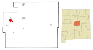
mapsize = 250px
map_caption = Location of Torreon in Torrance County, New Mexico
mapsize1 =
map_caption1 =subdivision_type = Country
subdivision_name =United States
subdivision_type1 = State
subdivision_name1 =New Mexico
subdivision_type2 = County
subdivision_name2 =
government_footnotes =
government_type =
leader_title =
leader_name =
leader_title1 =
leader_name1 =
established_title =
established_date =unit_pref = Imperial
area_footnotes =area_magnitude =
area_total_km2 =
area_land_km2 =
area_water_km2 =
area_total_sq_mi =
area_land_sq_mi =
area_water_sq_mi =population_as_of =
population_footnotes =
population_total =
population_density_km2 =
population_density_sq_mi =timezone = Mountain (MST)
utc_offset =
timezone_DST =
utc_offset_DST =
elevation_footnotes =
elevation_m =
elevation_ft =
latd = |latm = |lats = |latNS =
longd = |longm = |longs = |longEW =postal_code_type =
postal_code =
area_code =
blank_name =
blank_info =
blank1_name =
blank1_info =
website =
footnotes =Torreon is a farming communityPearce, T. M. (1965) "Torreon" "New Mexico place names; a geographical dictionary" University of New Mexico Press, Albuquerque, NM, p. 168, [http://worldcat.org/oclc/420847 OCLC 420847] ] and
census-designated place (CDP) in Torrance County,New Mexico ,United States . The population was 244 at the 2000 census. It is part of the Albuquerque Metropolitan Statistical Area.Geography
Torreon is located on NM State Route 55 on the eastern slopes of the
Manzano Mountains at coor dms|34|43|27|N|106|17|50|W|city (34.724240, -106.297148)GR|1.According to the
United States Census Bureau , the CDP has a total area of 8.3square mile s (21.5km² ), all of it land.History
Torreon is built on the site of an old Piro
pueblo one of the more northern of the Salinas pueblos. The Piro site was occupied prior to the arrival of the Spanish in the 1500s, but became part of the Salinas District, a group of mission towns on the east side of theManzano Mountains . As theApache moved south along the edge of theRocky Mountains in the mid-1600s these missions had to become more defensible. However, by 1677 the Torreon site had been abandoned.Torreon was resettled in the Spring of 1841 by Nino Antonio Montoya and twenty-six other farmers under a grant from the Prefect of the Central District of New Mexico. The Torreon Grant was named after the defensive towers [ [http://books.google.com/books?id=ukQOAAAAIAAJ&pg=PA496 Twitchell, Ralph Emerson (1911) "The Leading Facts of New Mexican History" Torch Press, Cedar Rapids, Iowa, p. 496] [http://worldcat.org/oclc/3828708 OCLC 3828708] ] built at Manzano 6.6 miles to the south, and consisted of an area approximately three miles east-west by six miles north-south. Apache raids remained a serious problem until after the Civil War and the appointment of
Edward Hatch as New Mexico Military District commander.Demographics
As of the
census GR|2 of 2000, there were 244 people, 93 households, and 66 families residing in the CDP. Thepopulation density was 29.3 people per square mile (11.3/km²). There were 139 housing units at an average density of 16.7/sq mi (6.5/km²). The racial makeup of the CDP was 73.77% White, 0.41% Native American, 0.82% Asian, 1.23% Pacific Islander, 18.85% from other races, and 4.92% from two or more races. Hispanic or Latino of any race were 68.85% of the population.There were 93 households out of which 30.1% had children under the age of 18 living with them, 55.9% were married couples living together, 7.5% had a female householder with no husband present, and 29.0% were non-families. 26.9% of all households were made up of individuals and 10.8% had someone living alone who was 65 years of age or older. The average household size was 2.62 and the average family size was 3.23.
In the CDP the population was spread out with 25.0% under the age of 18, 9.0% from 18 to 24, 20.1% from 25 to 44, 32.0% from 45 to 64, and 13.9% who were 65 years of age or older. The median age was 40 years. For every 100 females there were 106.8 males. For every 100 females age 18 and over, there were 101.1 males.
The median income for a household in the CDP was $36,250, and the median income for a family was $45,750. Males had a median income of $35,375 versus $12,188 for females. The
per capita income for the CDP was $12,349. About 12.9% of families and 10.9% of the population were below thepoverty line , including 13.4% of those under the age of eighteen and none of those sixty five or over.Notes
External links
Wikimedia Foundation. 2010.