- Tajique, New Mexico
Infobox Settlement
official_name = Tajique, New Mexico
settlement_type = CDP
nickname =
motto =
imagesize =
image_caption =
image_
imagesize =
image_caption =
image_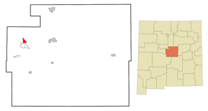
mapsize = 250px
map_caption = Location of Tajique, New Mexico
mapsize1 =
map_caption1 =subdivision_type = Country
subdivision_name =United States
subdivision_type1 = State
subdivision_name1 =New Mexico
subdivision_type2 = County
subdivision_name2 = Torrance
government_footnotes =
government_type =
leader_title =
leader_name =
leader_title1 =
leader_name1 =
established_title =
established_date =unit_pref = Imperial
area_footnotes =area_magnitude =
area_total_km2 = 7.0
area_land_km2 = 7.0
area_water_km2 = 0.0
area_total_sq_mi = 2.7
area_land_sq_mi = 2.7
area_water_sq_mi = 0.0population_as_of = 2000
population_footnotes =
population_total = 148
population_density_km2 = 21.1
population_density_sq_mi = 54.7timezone = Mountain (MST)
utc_offset = -7
timezone_DST = MDT
utc_offset_DST = -6
elevation_footnotes =
elevation_m = 2043
elevation_ft = 6703
latd = 34 |latm = 45 |lats = 22 |latNS = N
longd = 106 |longm = 17 |longs = 17 |longEW = Wpostal_code_type =
ZIP code
postal_code = 87016
area_code = 505
blank_name = FIPS code
blank_info = 35-76060
blank1_name = GNIS feature ID
blank1_info = 0928822
website =
footnotes =Tajique is a
census-designated place (CDP) in Torrance County,New Mexico ,United States . The population was 148 at the 2000 census. It is part of the Albuquerque Metropolitan Statistical Area.Geography
Tajique is located at coor dms|34|45|22|N|106|17|17|W|city (34.756005, -106.288042)GR|1.
According to the
United States Census Bureau , the CDP has a total area of 2.7square mile s (7.0km² ), all of it land.History
Tajique was originally a Tigua pueblo. The name Tajique may have been derived from the the
Tiwa name Tush-yit-yay. The original date of settlement is unknown. In the early 1600's, Tajique served as the seat of theSan Miguel Mission . After anApache raid in 1674, the inhabitants of theQuarai pueblo joined the Tajique pueblo, doubling the population to over 600 residents. In 1675, a subsequent Apache raid forced the abandonment of the Tajique pueblo. [Hodge, Fredrick Webb: "Handbook of American Indians North of Mexico", Vol 4 page 673. Digital Scanning Inc, 2003.]The
Trigo Fire of 2007 forced the evacuation of Tajique, destroying several structures north and west of the town. In June of 2008, the town was once again evacuated due to fire.Demographics
As of the
census GR|2 of 2000, there were 148 people, 48 households, and 39 families residing in the CDP. Thepopulation density was 54.7 people per square mile (21.1/km²). There were 63 housing units at an average density of 23.3/sq mi (9.0/km²). The racial makeup of the CDP was 58.78% White, 2.03% Native American, 37.84% from other races, and 1.35% from two or more races. Hispanic or Latino of any race were 79.05% of the population.There were 48 households out of which 41.7% had children under the age of 18 living with them, 56.3% were married couples living together, 20.8% had a female householder with no husband present, and 16.7% were non-families. 12.5% of all households were made up of individuals and 4.2% had someone living alone who was 65 years of age or older. The average household size was 3.08 and the average family size was 3.28.
In the CDP the population was spread out with 35.8% under the age of 18, 8.1% from 18 to 24, 28.4% from 25 to 44, 17.6% from 45 to 64, and 10.1% who were 65 years of age or older. The median age was 31 years. For every 100 females there were 92.2 males. For every 100 females age 18 and over, there were 90.0 males.
The median income for a household in the CDP was $27,969, and the median income for a family was $27,969. Males had a median income of $33,000 versus $32,500 for females. The
per capita income for the CDP was $7,645. There were 34.0% of families and 30.1% of the population living below thepoverty line , including 34.3% of under eighteens and none of those over 64.References
External links
Wikimedia Foundation. 2010.