- Raritan Township, New Jersey
:"see also: Raritan,
New Jersey ; both Hazlet and Edison,New Jersey were formerly called Raritan Township"Infobox Settlement
official_name = Raritan Township, New Jersey
settlement_type = Township
nickname =
motto =
imagesize =
image_caption =
image_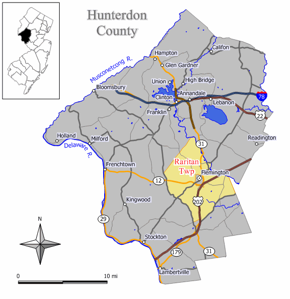
mapsize = 250x200px
map_caption = Map of Raritan Township in Hunterdon County. Inset: Location of Hunterdon County highlighted in the State of New Jersey.
mapsize1 = 250x200px
map_caption1 = Census Bureau map of Raritan Township, New Jerseysubdivision_type = Country
subdivision_name =United States
subdivision_type1 = State
subdivision_name1 =New Jersey
subdivision_type2 = County
subdivision_name2 = Hunterdon
government_footnotes =
government_type =Township (New Jersey)
leader_title =Mayor
leader_name = John W. King
leader_title1 = Administrator
leader_name1 = Allan Pietrefesa [ [http://www.raritan-township.com/department.html Departments and Department Heads] , Raritan Township. AccessedJuly 31 ,2008 .]
established_title = Incorporated
established_date =April 2 ,1838 unit_pref = Imperial
area_footnotes =
area_magnitude =
area_total_km2 = 98.2
area_land_km2 = 98.0
area_water_km2 = 0.2
area_total_sq_mi = 37.9
area_land_sq_mi = 37.8
area_water_sq_mi = 0.1population_as_of = 2006
population_footnotes =
population_total = 22720
population_density_km2 = 202.1
population_density_sq_mi = 523.5timezone = Eastern (EST)
utc_offset = -5
timezone_DST = EDT
utc_offset_DST = -4
elevation_footnotes = [Gnis|882179|Township of Raritan,Geographic Names Information System . AccessedJune 13 ,2008 .]
elevation_m = 55
elevation_ft = 180
latd = 40 |latm = 30 |lats = 33 |latNS = N
longd = 74 |longm = 51 |longs = 5 |longEW = Wpostal_code_type =
ZIP code
postal_code = 08822 - Flemington
area_code = 908
blank_name = FIPS code
blank_info = 34-61920GR|2 [ [http://mcdc2.missouri.edu/webrepts/commoncodes/ccc_nj.html A Cure for the Common Codes: New Jersey] , Missouri Census Data Center. AccessedJuly 14 ,2008 .] [ [http://mcdc2.missouri.edu/webrepts/commoncodes/ccc_nj.html A Cure for the Common Codes: New Jersey] , Missouri Census Data Center. AccessedJuly 14 ,2008 .]
blank1_name = GNIS feature ID
blank1_info = 0882179GR|3
website = http://www.raritan-township.com
footnotes =Raritan Township is a Township in Hunterdon County,
New Jersey ,United States . As of theUnited States 2000 Census , the township population was 19,809.Raritan was incorporated as a township by an Act of the
New Jersey Legislature onApril 2 ,1838 , from portions of the now-defunct Amwell Township. Flemington town was formed within the township onMarch 14 ,1870 , and became an independent borough onApril 7 ,1910 . Portions of the township were ceded to East Amwell Township in 1854 and 1897."The Story of New Jersey's Civil Boundaries: 1606-1968", John P. Snyder, Bureau of Geology and Topography; Trenton, New Jersey; 1969. p. 157]"Raritan Township" was also the former name of a community in Middlesex County, now known as Edison Township.
Geography
According to the
United States Census Bureau , the township has a total area of 37.9square mile s (98.2km² ), of which, 37.8 square miles (98.0 km²) of it is land and 0.1 square miles (0.2 km²) of it (0.18%) is water.Raritan Township borders East Amwell Township, Delaware Township, Franklin Township, Clinton Township, Readington Township. Flemington Borough is an independent municipality located entirely within Raritan Township. Raritan Township also borders Somerset County.
Demographics
USCensusPop
1930= 1823
1940= 2158
1950= 2814
1960= 4545
1970= 6934
1980= 8292
1990= 15616
2000= 19809
estimate= 22720
estyear=2006
estref= [http://factfinder.census.gov/servlet/SAFFPopulation?_event=ChangeGeoContext&geo_id=06000US3401961920&_geoContext=01000US%7C04000US34%7C16000US3446260&_street=&_county=raritan&_cityTown=raritan&_state=04000US34&_zip=&_lang=en&_sse=on&ActiveGeoDiv=geoSelect&_useEV=&pctxt=fph&pgsl=010&_submenuId=population_0&ds_name=null&_ci_nbr=null&qr_name=null®=null%3Anull&_keyword=&_industry= Census data for Raritan township] ,United States Census Bureau . AccessedAugust 29 ,2007 .]
footnote=Population 1930 - 1990. [ [http://www.wnjpin.net/OneStopCareerCenter/LaborMarketInformation/lmi01/poptrd6.htm New Jersey Resident Population by Municipality: 1930 - 1990] , accessedMarch 1 ,2007 .] As of thecensus GR|2 of 2000, there were 19,809 people, 6,939 households, and 5,391 families residing in the township. Thepopulation density was 523.5 people per square mile (202.1/km²). There were 7,094 housing units at an average density of 187.5/sq mi (72.4/km²). The racial makeup of the township was 93.22% White, 1.23% African American, 0.09% Native American, 3.50% Asian, 0.01% Pacific Islander, 0.68% from other races, and 1.27% from two or more races. Hispanic or Latino of any race were 2.79% of the population.There were 6,939 households out of which 43.0% had children under the age of 18 living with them, 68.2% were married couples living together, 7.0% had a female householder with no husband present, and 22.3% were non-families. 18.2% of all households were made up of individuals and 5.6% had someone living alone who was 65 years of age or older. The average household size was 2.81 and the average family size was 3.24.
In the township the population was spread out with 29.3% under the age of 18, 4.6% from 18 to 24, 32.6% from 25 to 44, 24.7% from 45 to 64, and 8.9% who were 65 years of age or older. The median age was 37 years. For every 100 females there were 94.1 males. For every 100 females age 18 and over, there were 90.0 males.
The median income for a household in the township was $85,996, and the median income for a family was $96,336. Males had a median income of $69,485 versus $41,911 for females. The
per capita income for the township was $38,919. About 1.2% of families and 2.0% of the population were below thepoverty line , including 1.6% of those under age 18 and 2.9% of those age 65 or over.Government
Local government
Raritan Township is governed under the Township form of government with a five-member Township Committee. The Township Committee is elected directly by the voters in partisan elections to serve three-year terms of office on a staggered basis, with one or two seats coming up for election each year."2005 New Jersey Legislative District Data Book",
Rutgers University Edward J. Bloustein School of Planning and Public Policy , April 2005, p. 103.]At an annual reorganization meeting, the Township Committee selects one of its members to serve as Mayor and another as Deputy Mayor. The mayor presides at Township Committee meetings and votes as a member of the Committee, but has no other special powers under the township form of government law. All legislative and executive powers, including the power of appointments, are exercised by the committee as a whole. [ [http://www.raritan-township.com/government.html Raritan Township Form of Government] , Raritan Township. Accessed
July 31 ,2008 .]Members of the Raritan Township Committee are
Mayor John W. King,Deputy Mayor Richard O'Malley, Chris Harcar, John Kendzulak and Richard Kuhrt. [ [http://www.raritan-township.com/committee.html Committee] , Raritan Township. AccessedJuly 31 ,2008 .]Federal, state and county representation
Raritan Township is in the Seventh Congressional District and is part of New Jersey's 23rd Legislative District. [ [http://www.lwvnj.org/pubs/CG06.pdf 2006 New Jersey Citizen's Guide to Government] , New Jersey
League of Women Voters , p. 63. AccessedAugust 30 ,2006 .]Education
Children in public school for grades K through 8 attend the
Flemington-Raritan Regional School District , which also serves children from the neighboring community of Raritan Township. Schools in the district (with 2005-06 enrollment data from theNational Center for Education Statistics [ [http://nces.ed.gov/ccd/schoolsearch/school_list.asp?Search=1&DistrictID=3405190 Data for the Flemington-Raritan Regional School District] ,National Center for Education Statistics . AccessedApril 18 ,2008 .] are four K - 4 elementary schools — [http://www.frsd.k12.nj.us/barley/default.htm Barley Sheaf School] (562 students) - Flemington; [http://www.frsd.k12.nj.us/copper/ Copper Hill School] (705 students) - Ringoes; [http://www.frsd.k12.nj.us/desmares/ Francis A. Desmares School] (492 students) - Flemington; and [http://www.frsd.k12.nj.us/hunter Robert Hunter School] (556 students) - Flemington — [http://www.frsd.k12.nj.us/rfis Reading-Fleming Intermediate School] in Flemington for grades 5 - 6 and [http://www.frsd.k12.nj.us/jpcms/ J. P. Case Middle School] (1,248 students) - Flemington for grades 7 and 8.Public school students in grade 9 - 12 attend the
Hunterdon Central Regional High School , part of theHunterdon Central Regional High School District , which serves almost 2,800 students in central Hunterdon County. Students from Delaware Township, East Amwell Township, Flemington Borough, Raritan Township and Readington Township attend Hunterdon Central Regional High School. [ [http://education.state.nj.us/rc/rc07/narrative/19/2300/19-2300-000.html Hunterdon Central Regional High School 2007 Report card Narrative] ,New Jersey Department of Education . AccessedMarch 9 ,2008 . "Located in beautiful, historic Hunterdon County in central New Jersey, Hunterdon Central Regional High School serves the five municipalities of Delaware Township, East Amwell Township, Flemington Borough, Raritan Township, and Readington Township."]Notable residents
Notable current and former residents of Raritan Township include:
*Miles Ross (1827-1903), representedNew Jersey's 3rd congressional district in theUnited States House of Representatives from 1875 to 1883. [ [http://bioguide.congress.gov/scripts/biodisplay.pl?index=R000452 Miles Ross] , "Biographical Directory of the United States Congress ". AccessedAugust 29 ,2007 .]References
External links
* [http://www.raritan-township.com/ Raritan Township website]
* [http://www.co.hunterdon.nj.us/mun/raritan.htm Hunterdon County webpage for Raritan Township]
* [http://www.frsd.k12.nj.us/ Flemington-Raritan Regional School District]
*NJReportCard|19|1510|0|Flemington-Raritan Regional School District
* [http://nces.ed.gov/ccd/districtsearch/district_detail.asp?Search=2&details=1&ID2=3405190&DistrictID=3405190 data for the Flemington-Raritan Regional School District] ,National Center for Education Statistics
* [http://www.hcrhs.k12.nj.us/ Hunterdon Central Regional High School District]
*NJReportCard|19|2300|050|Hunterdon Central Regional High School
* [http://nces.ed.gov/ccd/schoolsearch/school_list.asp?Search=1&DistrictID=3407590 Data for the Hunterdon Central Regional High School] ,National Center for Education Statistics
* [http://www.hlta.org Hunterdon Land Trust Alliance]
Wikimedia Foundation. 2010.