- Mantachie, Mississippi
-
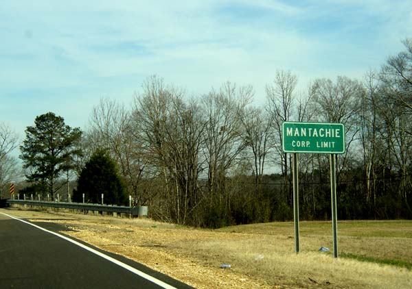
Mantachie, Mississippi — Town — Corporate limits on SR 371 Location of Mantachie, Mississippi
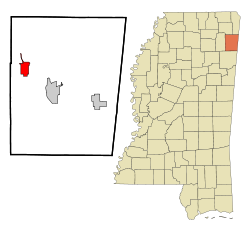
Coordinates: 34°19′51″N 88°29′36″W / 34.33083°N 88.49333°WCoordinates: 34°19′51″N 88°29′36″W / 34.33083°N 88.49333°W Country United States State Mississippi County Itawamba Area – Total 4.0 sq mi (10.2 km2) – Land 3.9 sq mi (10.2 km2) – Water 0.0 sq mi (0.0 km2) Elevation 344 ft (105 m) Population (2000) – Total 1,107 – Density 280.3/sq mi (108.2/km2) Time zone Central (CST) (UTC-6) – Summer (DST) CDT (UTC-5) ZIP code 38855 Area code(s) 662 FIPS code 28-44920 GNIS feature ID 0673115 Mantachie is a town in Itawamba County, Mississippi, United States. The population was 1,107 at the 2000 census.
Contents
Geography
Mantachie is located at 34°19′51″N 88°29′36″W / 34.330819°N 88.493453°W.[1]
According to the United States Census Bureau, the town has a total area of 4.0 square miles (10 km2), all land.
Demographics
As of the census[2] of 2000, there were 1,107 people, 448 households, and 321 families residing in the town. The population density was 280.3 people per square mile (108.2/km2). There were 477 housing units at an average density of 120.8 per square mile (46.6/km2). The racial makeup of the town was 97.56% White, 1.45% African American, 0.36% Native American, 0.09% Asian, 0.27% from other races, and 0.27% from two or more races. Hispanic or Latino of any race were 0.54% of the population.
There were 448 households out of which 34.6% had children under the age of 18 living with them, 57.6% were married couples living together, 10.7% had a female householder with no husband present, and 28.3% were non-families. 25.9% of all households were made up of individuals and 14.3% had someone living alone who was 65 years of age or older. The average household size was 2.47 and the average family size was 2.98.
In the town the population was spread out with 26.1% under the age of 18, 7.7% from 18 to 24, 28.5% from 25 to 44, 22.9% from 45 to 64, and 14.7% who were 65 years of age or older. The median age was 36 years. For every 100 females there were 95.6 males. For every 100 females age 18 and over, there were 90.7 males.
The median income for a household in the town was $29,224, and the median income for a family was $35,000. Males had a median income of $26,250 versus $22,232 for females. The per capita income for the town was $16,164. About 11.6% of families and 15.0% of the population were below the poverty line, including 16.3% of those under age 18 and 28.2% of those age 65 or over.
Education
The Town of Mantachie is served by the Itawamba County School District.
References
- ^ "US Gazetteer files: 2010, 2000, and 1990". United States Census Bureau. 2011-02-12. http://www.census.gov/geo/www/gazetteer/gazette.html. Retrieved 2011-04-23.
- ^ "American FactFinder". United States Census Bureau. http://factfinder.census.gov. Retrieved 2008-01-31.
Municipalities and communities of Itawamba County, Mississippi City 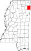
Towns Mantachie | Tremont
Unincorporated
communityDorsey
Ghost town Yale
Categories:- Towns in Mississippi
- Populated places in Itawamba County, Mississippi


Wikimedia Foundation. 2010.